
Trek Grade
Moderate to Difficult
Highest Altitude
13750 ft
Base Camp
Sonamarg
Best Time
July - Mid Sept
Trek Distance
72 Km
Not sure which trek is right for you? Trekup India’s Mountain Experts have you covered.
Not sure which trek is right for you? Trekup India’s Mountain Experts have you covered. From figuring out if a trek matches your fitness level to knowing who you’ll be trekking with, we’re here to answer all your questions. Reach out to our Mountain Experts and plan your trek with confidence.
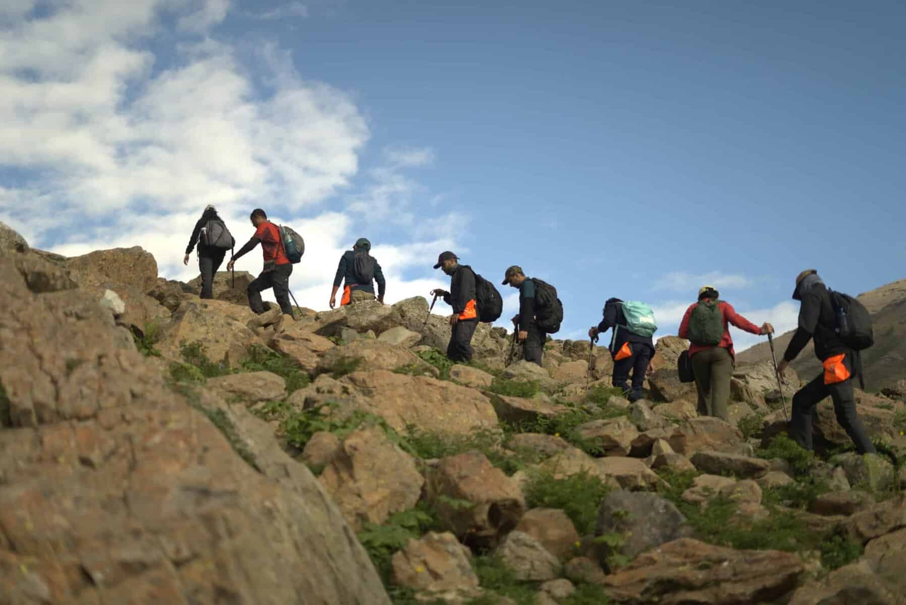
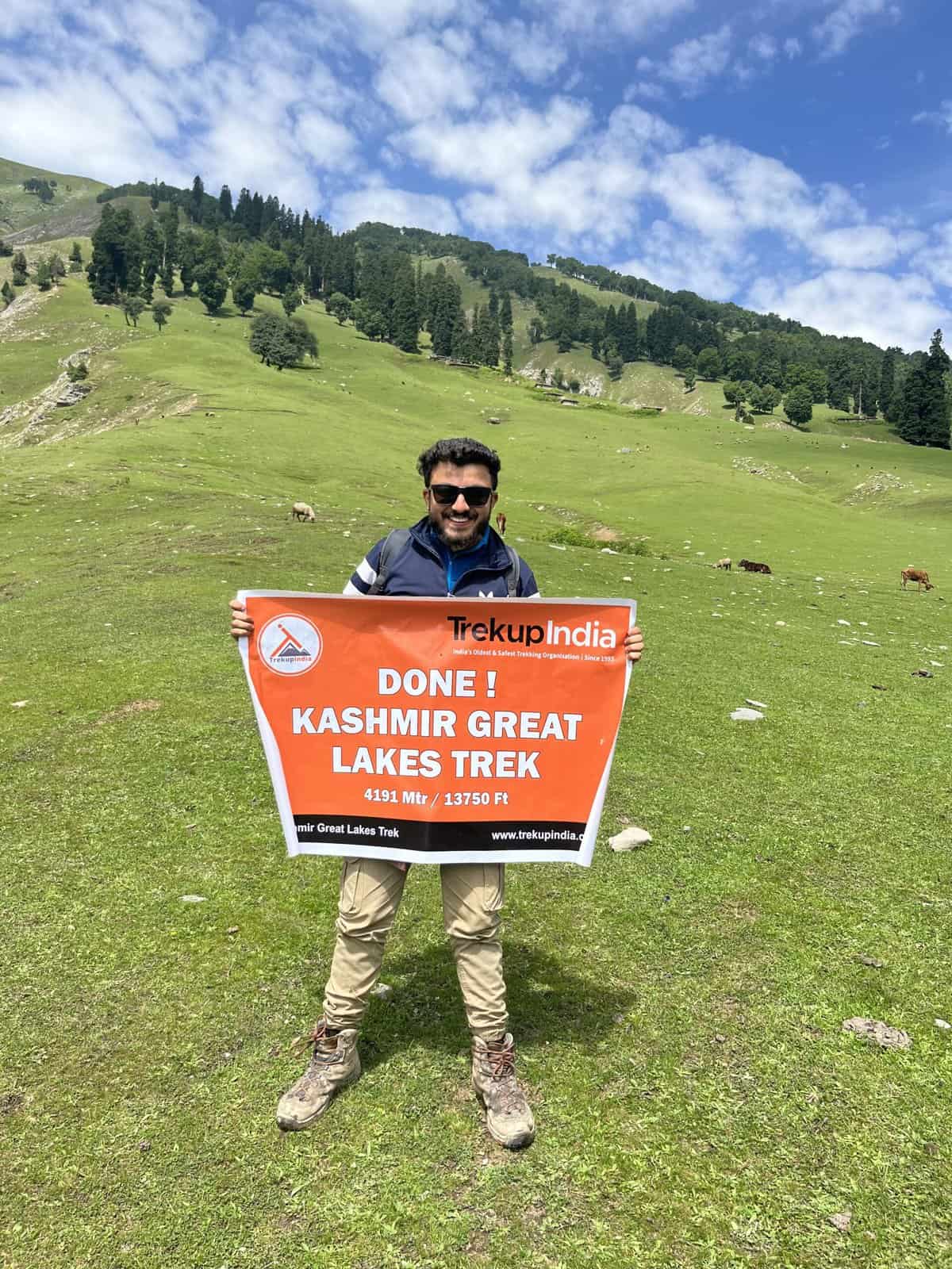
Kashmir Great Lakes Trek
Kashmir Great Lakes Trek , a journey that stands out for its unique features, is a trek that speaks for itself. Its name alone evokes images of breathtaking beauty and adventure. Nestled in the heart of the Himalayas, Kashmir is a haven for nature lovers and thrill-seekers alike. This trek offers a one-of-a-kind experience that will imprint unforgettable memories. The pristine lakes and snow-capped mountains are a sight to behold; their tranquillity and majesty will leave you in awe. The trek is an opportunity to immerse yourself in the natural beauty of Kashmir and create memories that will last a lifetime.
Kashmir, known as the earth’s paradise, is the location of this trek, which lasts around 7-9 days and is considered moderately challenging. The elevation reaches 13000 feet, and the distance covered is approximately 63 km. This trek provides an opportunity for self-discovery on multiple levels – physical, mental, and emotional. The experience of pushing one’s body to its limits and overcoming doubts about completing the trek is a challenge like no other. While the journey may be tough, the sense of accomplishment upon reaching the destination is unparalleled. This trek can be a happy and memorable experience for trekkers with proper preparation.
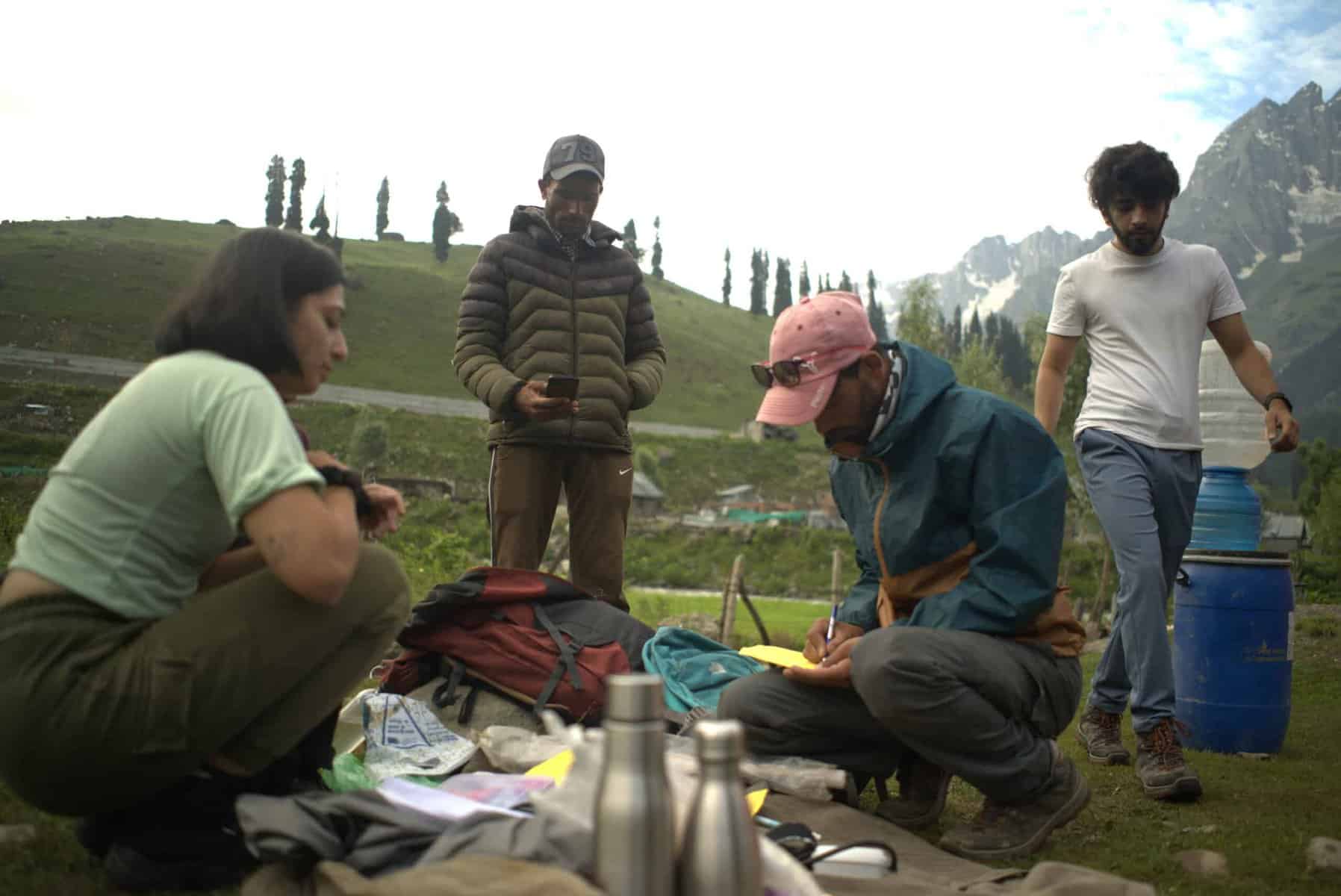
To embark on the challenging journey to the Kashmir Great Lakes Trek, it’s crucial to prioritize your health and well-being. Ensure you’re in top physical condition by engaging in regular gym sessions and incorporating activities like running, walking on an incline, cycling, cross-training, and stretching into your daily routine. Mental fitness is equally vital, so cultivate a positive mindset and practice stress-reducing techniques to help you cope with the demands of the trek. This preparation will not only make the trek more enjoyable but also increase your chances of successfully completing it.
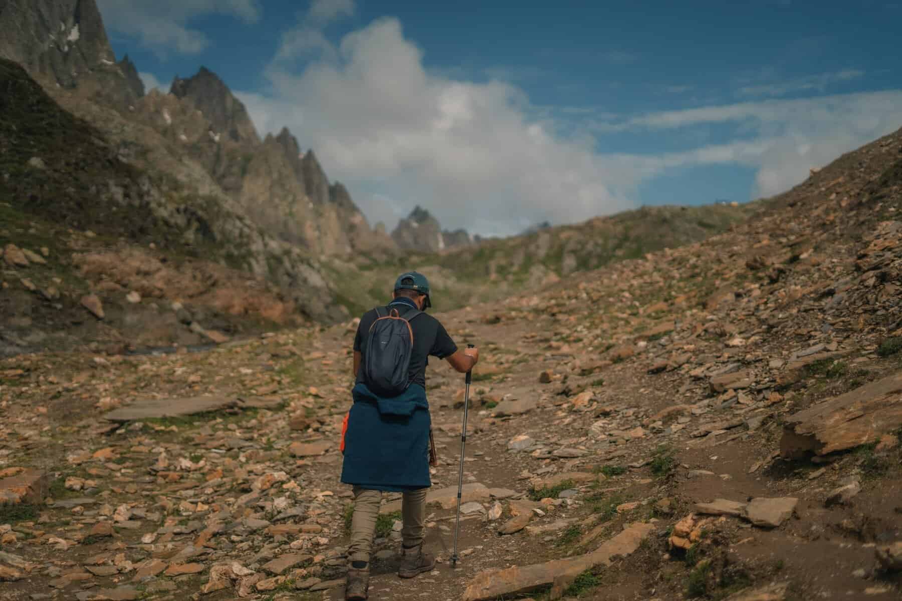
Along the Srinagar road, the trek begins approximately 3 kilometres outside Sonamarg. You’ll encounter a few roadside restaurants and dhabas where you can grab snacks or light meals. It’s recommended that trekkers stop here to stock up on provisions, as the next opportunity for food and shelter won’t be until Naranag, which marks the end of the trail.
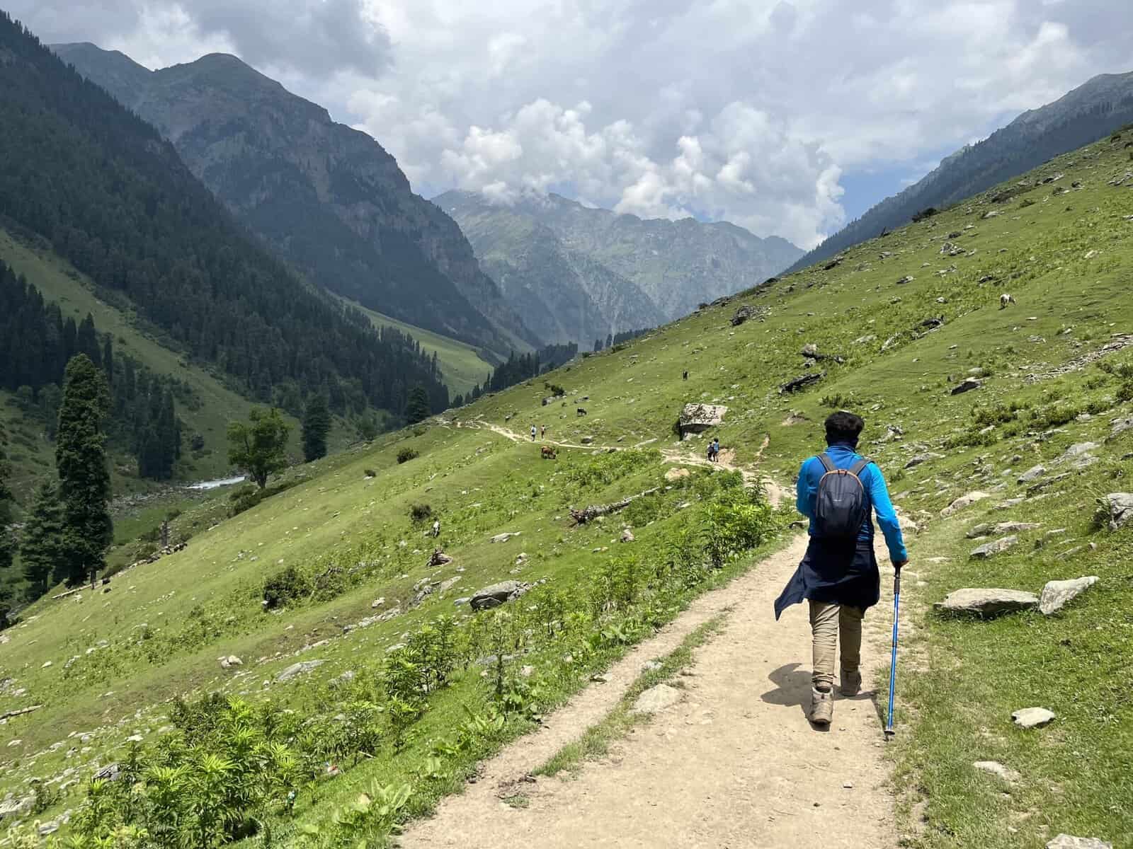
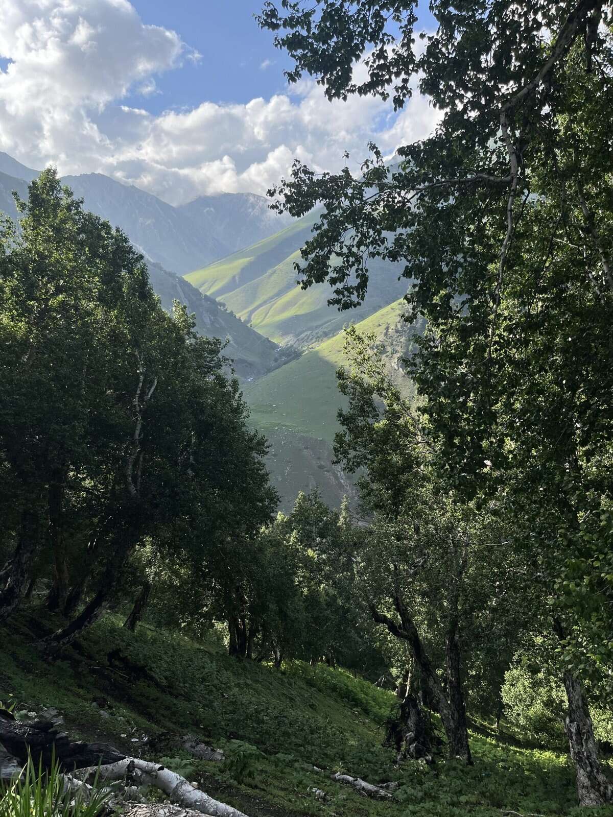
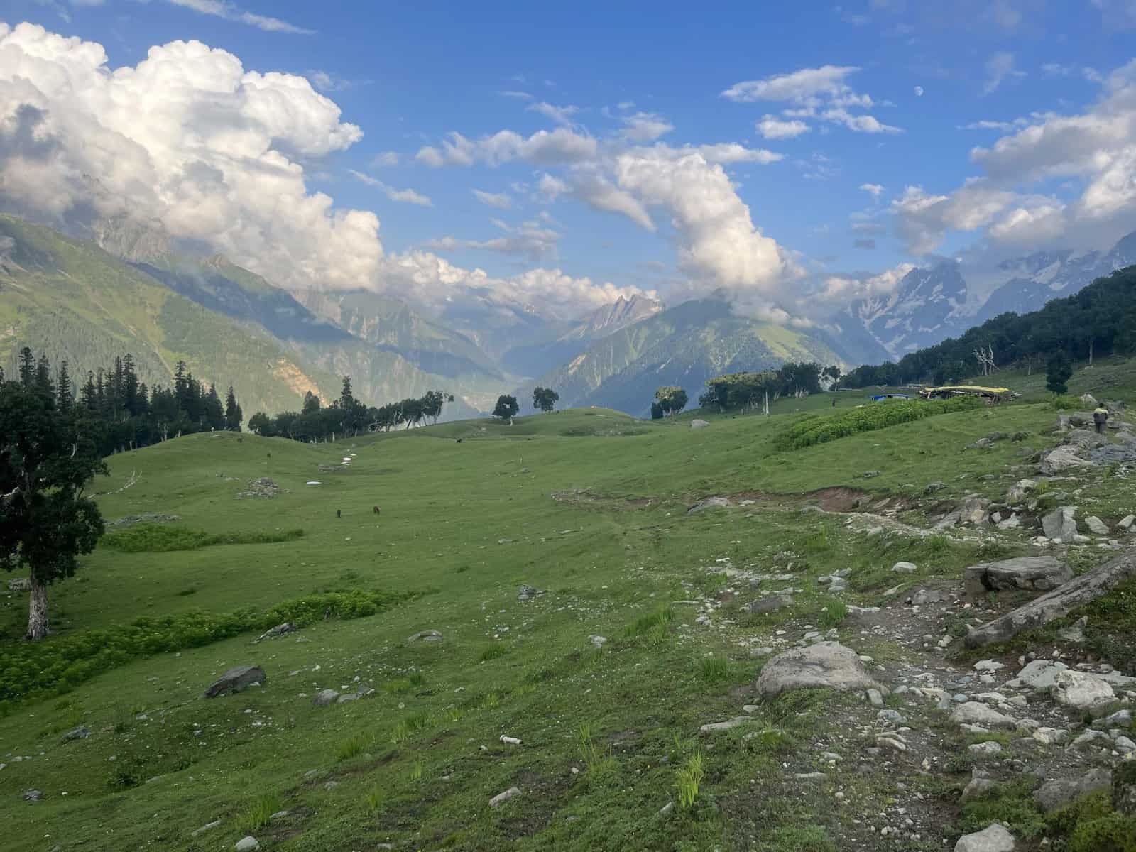
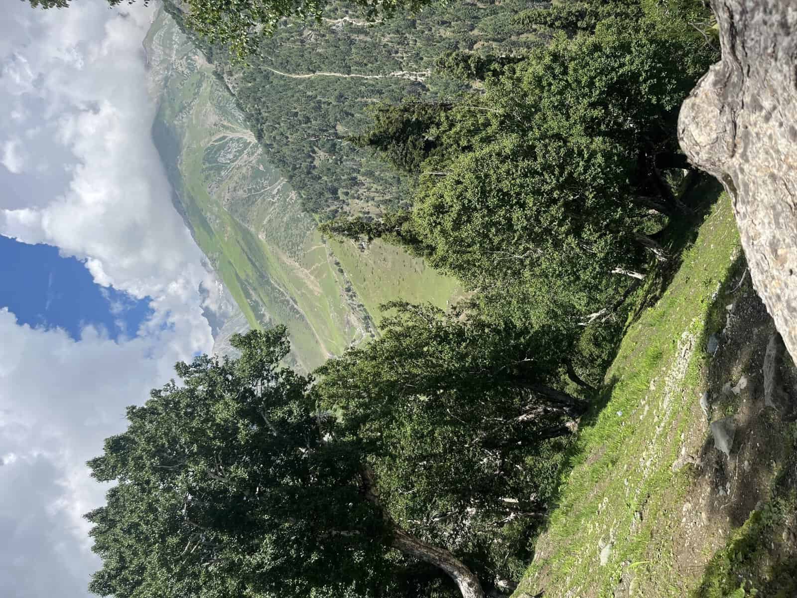
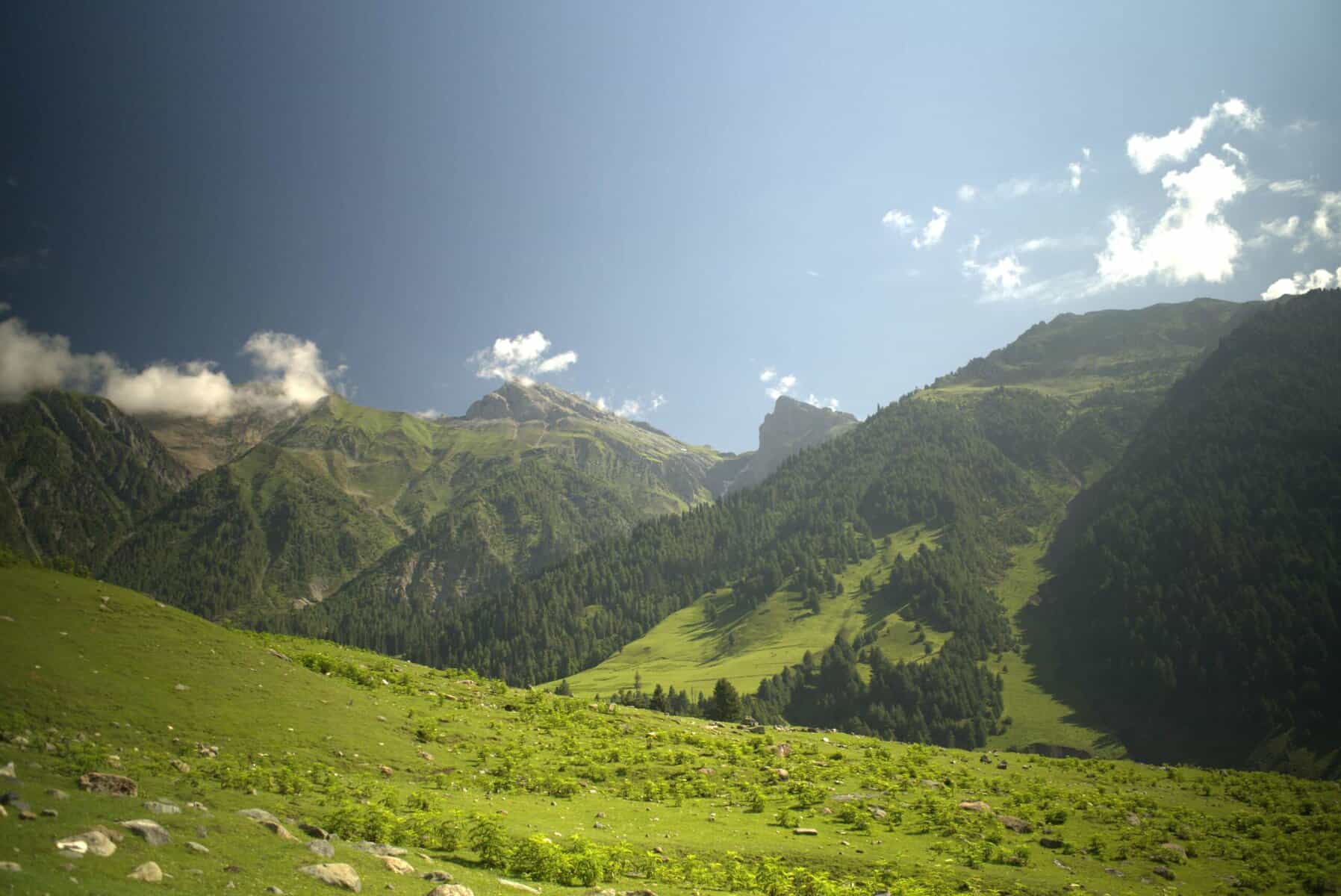
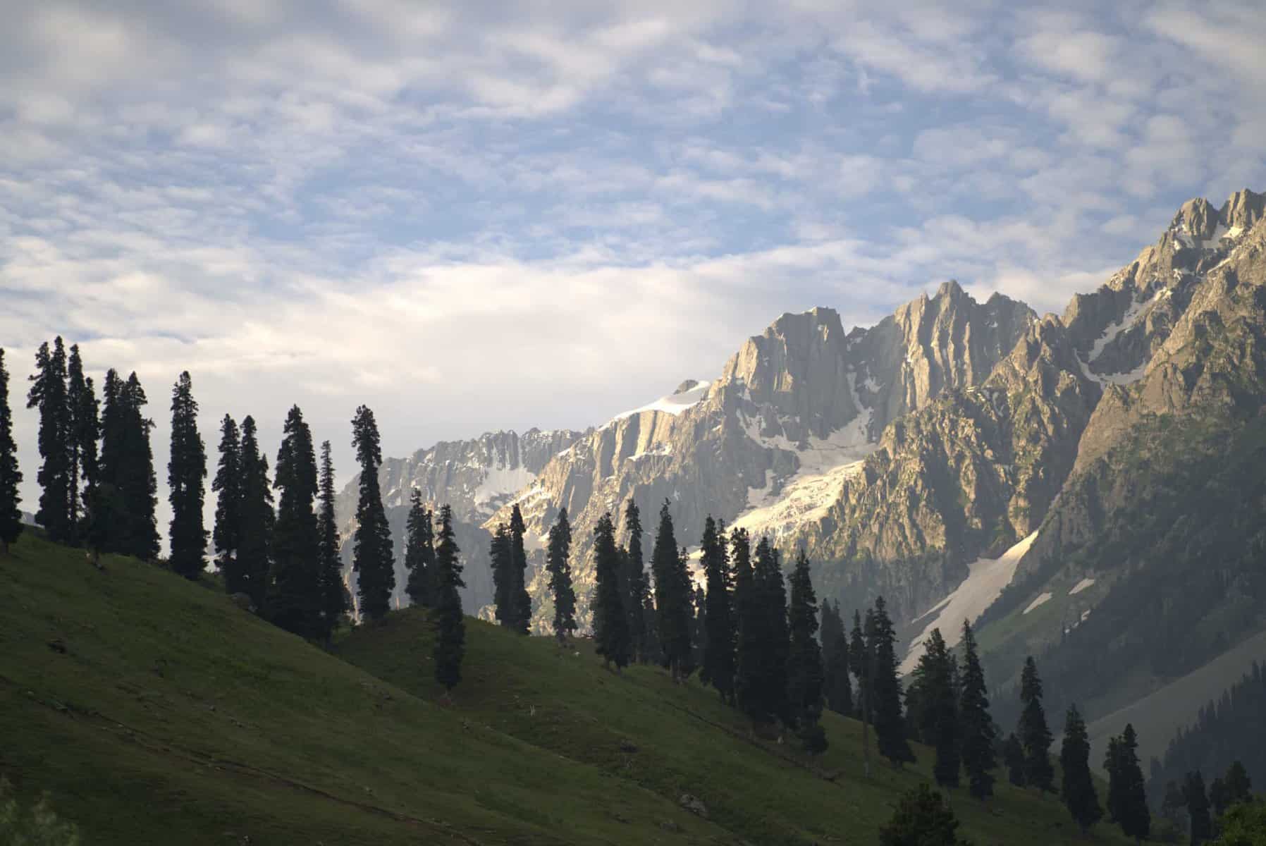
The path winds through a picturesque meadow with lush green grass, offering breathtaking views of the Sonamarg town below. As trekkers ascend, they reach the threshold of a dense forest, where towering Maple and Pine trees stand sentinel. The ensuing trail unfolds into a romantic paradise, with the dense canopy of Maple trees creating a dreamy, intimate atmosphere that is singular to this trek in India. This unique beauty of the trek is sure to intrigue and excite any adventure enthusiast.
Trek Cost
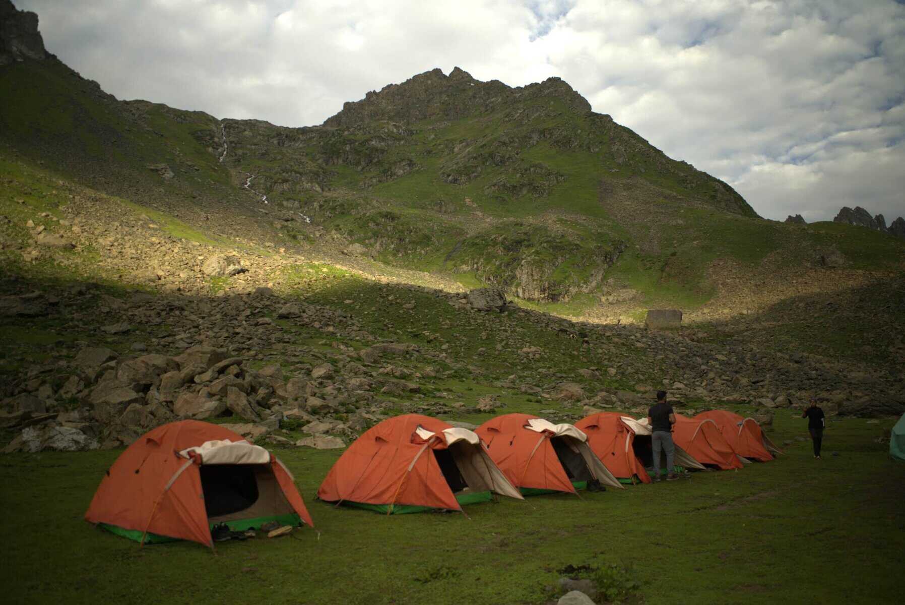
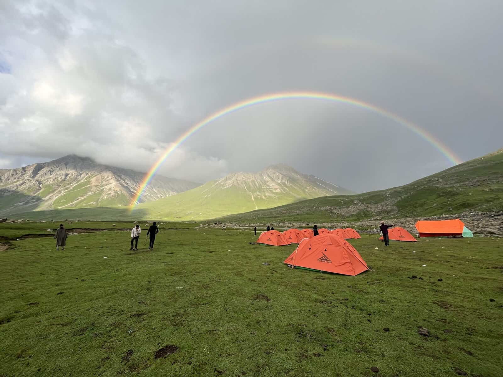
- Stay will be on a twin sharing basis in tents
- + 280 Trek Insurance (Mandatory)
- Discount Policy
- Transport Optional ( INR - 1,600 extra )
Pickup time 12 P.M from TRC Taxi Stand, Srinagar, in front of Tourism Office Building
Please Consult with our Mountain Experts Before Booking This Trek!!
Fix Departure Dates
Kashmir Great Lakes Trek Videos
Videos by experts watch these videos to prepare well for a Successful Trek

Want To Trek Like Pro?
Basically, watch these videos if you want to trek the same way professional trekkers do and make your skills better. These videos contain useful tips and techniques to further improve your trekking skills itself. These videos actually help both new and experienced trekkers improve their trekking skills. These videos definitely provide useful tips that make your trek better. We are seeing that these videos by Trekup India experts will only help you make your trekking skills better.


Know Everything About Acute Mountain Sickness
Acute Mountain Sickness occurs when people trek to high altitudes above 8,000 feet. This condition itself develops further due to reduced oxygen levels at such heights. Basically, as you go higher up, the air pressure and oxygen levels decrease, which causes the same problem. Acute Mountain Sickness surely causes headache, nausea, vomiting, and dizziness in affected persons. Moreover, peoples also experience difficulty in sleeping during this condition. To avoid mountain sickness, you should actually trek up slowly to higher altitudes. To learn further about this condition itself, watch the videos by Trekup India.


Day Wise Detailed Itinerary of Kashmir Great Lakes
Day 1: Arrive Srinagar and Drive to Sonamarg
- Altitude: 7800 feet
- Drive Distance: 90 Kms
- Drive Duration: 3 Hrs
- It takes approximately 3 hours to drive 90 km from Shrinagar
- TrekupIndia can arrange pickup from TRC at 12 pm if booked in advance
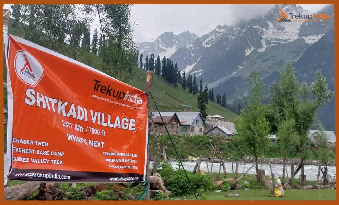
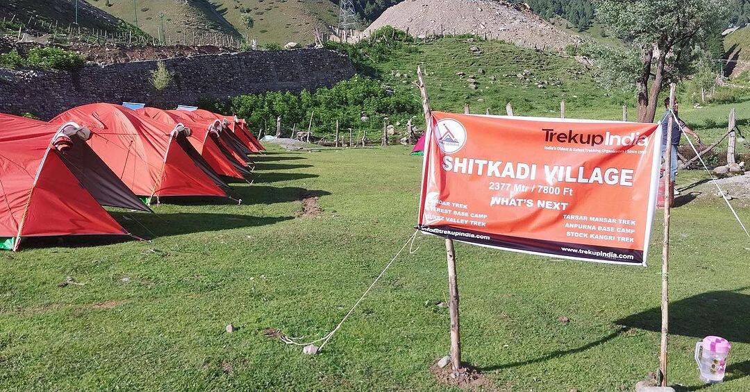
- The campsite is located near the Sindh River (Shitkadi Village).
- There are no shops nearby so make sure you have everything you need.
- Keep your ID proof with you in the original and two photocopies. We will need them to check at the Army Check Post.
In the afternoon, depart for Sonamarg. It takes 3 hours to reach Srinagar. The journey starts when you reach Srinagar, the capital city of Jammu and Kashmir. It is often described in the form of “Paradise on Earth.” When arriving at Srinagar International Airport or on the road, you’ll be welcomed by the tranquil natural beauty of the region.
When you arrive, greet the driver or trek leader to begin the scenic drive to Sonamarg, approximately 80-90 kilometres away (around 2.5-3 hours driving). Admire the beautiful panorama from the Sindh River, lush green meadows, and distant mountain peaks.
Sonamarg, which means “Meadow of Gold,” is a fantastic valley at an elevation of 2,800 m (9,200 feet). The driving is a visual delight, featuring winding roads, cascading waterfalls and snow-capped peaks looming in the distance. Sindh River: The river will be with you for much of your journey and offer stunning panoramas. Kangan Town: An unassuming town along the way to enjoy a brief time break.
Gagangear is a gorgeous place filled with lush green fields and tranquil ambience. Enjoy a relaxing evening while enjoying the peaceful nature of the valley. Overnight stay for the night in Sonamarg in tents on twin sharing amid the magnificent Himalayas and the tranquil sound of the Sindh River.
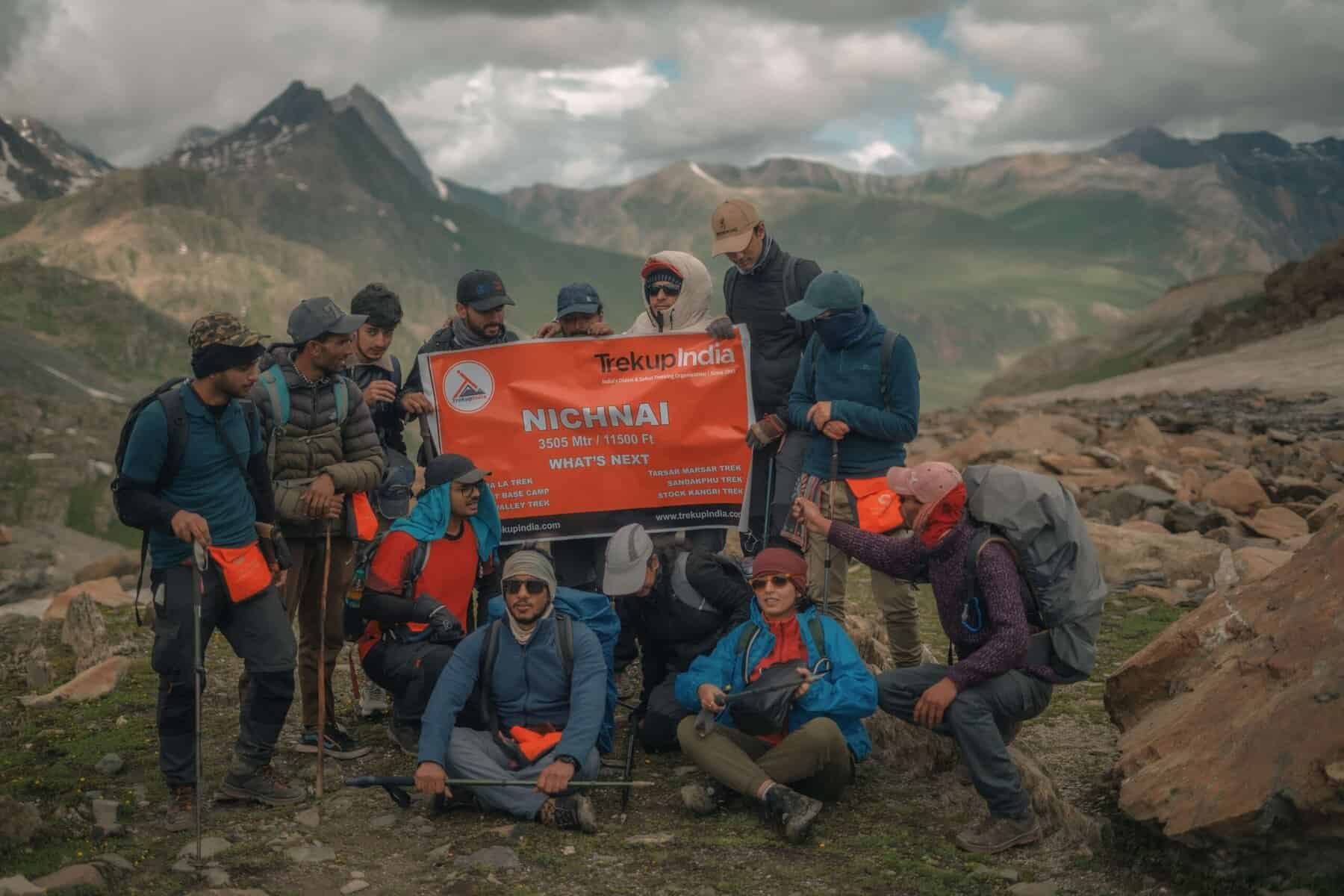
Day 02: Sonamarg (7.800ft) to Nichnai (11.1500ft), via Shekdur
- Altitude: 7,800 ft – 11,500 ft
- Trek Distance: 11 Kms
- Trek Duration: 8 Hrs
- 11kms Trek, approximately 8 Hours
- We trek to Nichnai via Shekdur after breakfast.
- You will find the trail through dense forests of Maple, Pine, and Bhoj trees.
- We are allowed to go through the army checkpoint after about half an hour. Here we must submit our ID proofs.
- You can also enjoy a spectacular view of the Sonmarg Valley and the Thajiwas Glacier while you’re at it.
- It takes approximately 2 and a half hours to trek from Shitkadi, Shekdur through dense pine forests.
- You can enjoy instant noodles or an omelette at Shekdur if you so desire.
- As we trek from Shekdur, to Nichnai, we follow the Nichnai Stream.
- After Shekdur, we have lunch at Nichnai.
The trek commences 3 kilometres from Sonamarg, along the Srinagar Road. After a brief 3-kilometer journey, you’ll encounter a solitary Dhaba offering snacks and refreshments. Naranag is the next settlement, located at the end of the trail. The jeep track diverges from the main road, veering right, and descends towards the Sindh River. The river flows parallel to the mud track and the main road. The trail follows a gentle curve to the left, traversing a picturesque meadow with breathtaking views of Sonamarg.
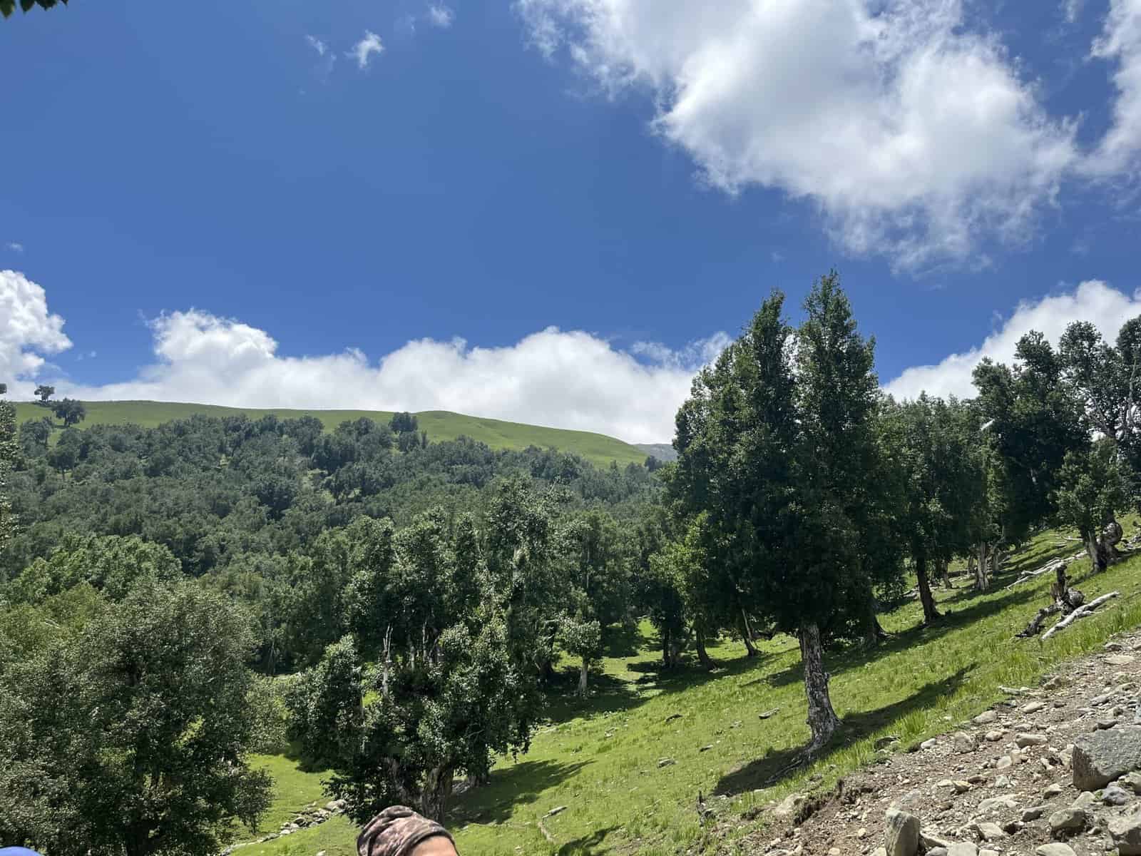
Within half an hour, you’ll reach the meadow’s summit, where Maple and Pine trees begin to dominate the landscape. The trail then descends to a small brook, only to ascend again, leading you through a dense forest of Maple trees. The experience of walking on the lush green grass amidst these Maples is truly unique.
The trail will lead you through a picturesque Maple tree forest for the next hour and a half. Stay on the uphill path; the downhill trail will take you to nearby villages. Enjoy the scenic views of the Sonamarg valley from the clearings between the trees. As you reach the top of the ridge, the Maple forest will give way to a meadow, offering stunning views of the valley below. Please take a moment to appreciate the scene’s beauty, with its streams, meadows, pines, and town nestled in the distance.
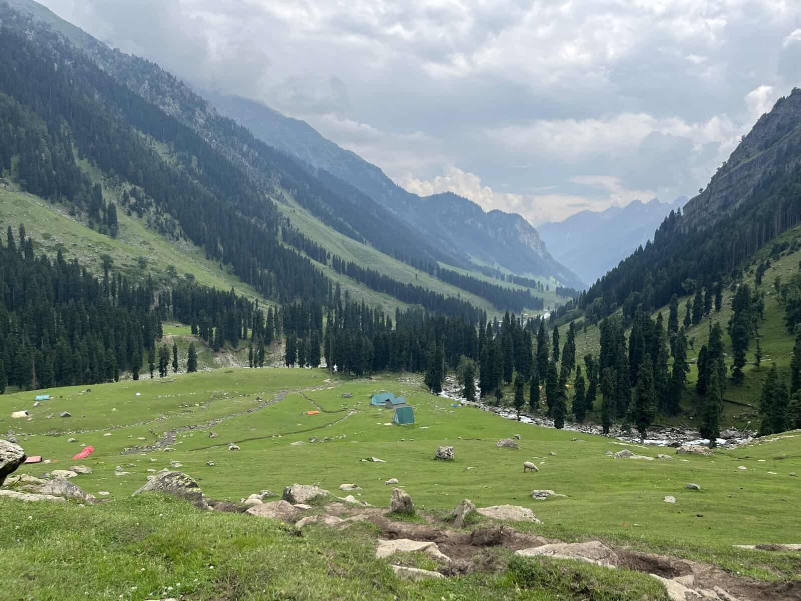
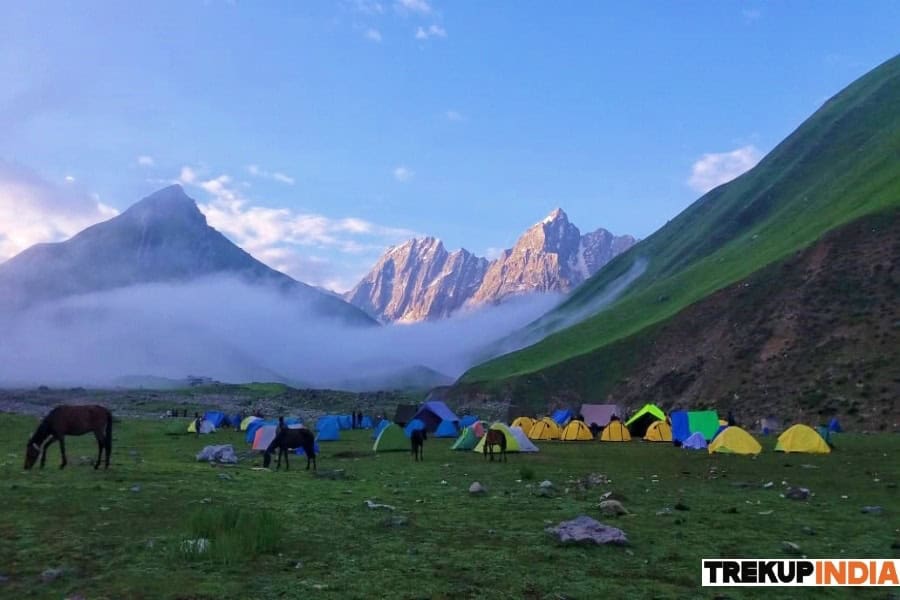
After a brief climb, the trail will descend into a verdant meadow lined with Silver Birch trees and dotted with small brooks. This is Shekdur, a lovely campsite surrounded by Bhojs. If you’re starting your trek from Srinagar at dawn, Shekdur is an ideal first campsite. However, if you’re starting from Sonamarg, it’s too early to set up camp here. Instead, take a break at the meadow before continuing to Nichnai, the next campsite.
The meadow lasts about half an hour before reaching a forest of Bhoj, or Silver Birch. Follow the trail through the forest and watch for the sun’s rays as they filter through the dense foliage, creating a dappled pattern of light and shadow.
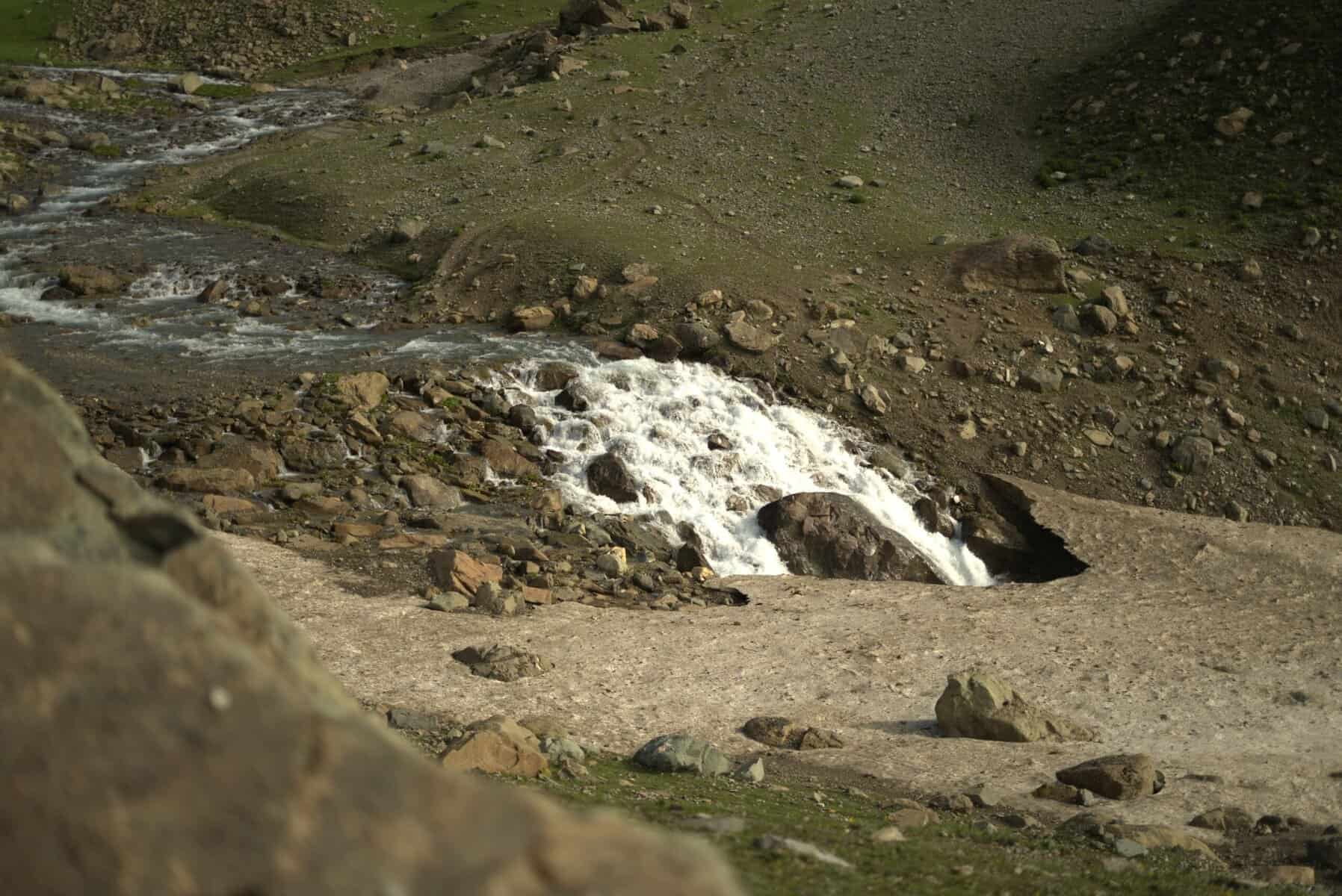
In approximately 45 minutes, you’ll reach the end of the birch tree line and begin your descent into the river valley, marking the beginning of Nichanai. The trail follows the right bank of the Nichanai River as it flows upstream, with the snow-capped peaks of Sonamarg Valley visible to your left.
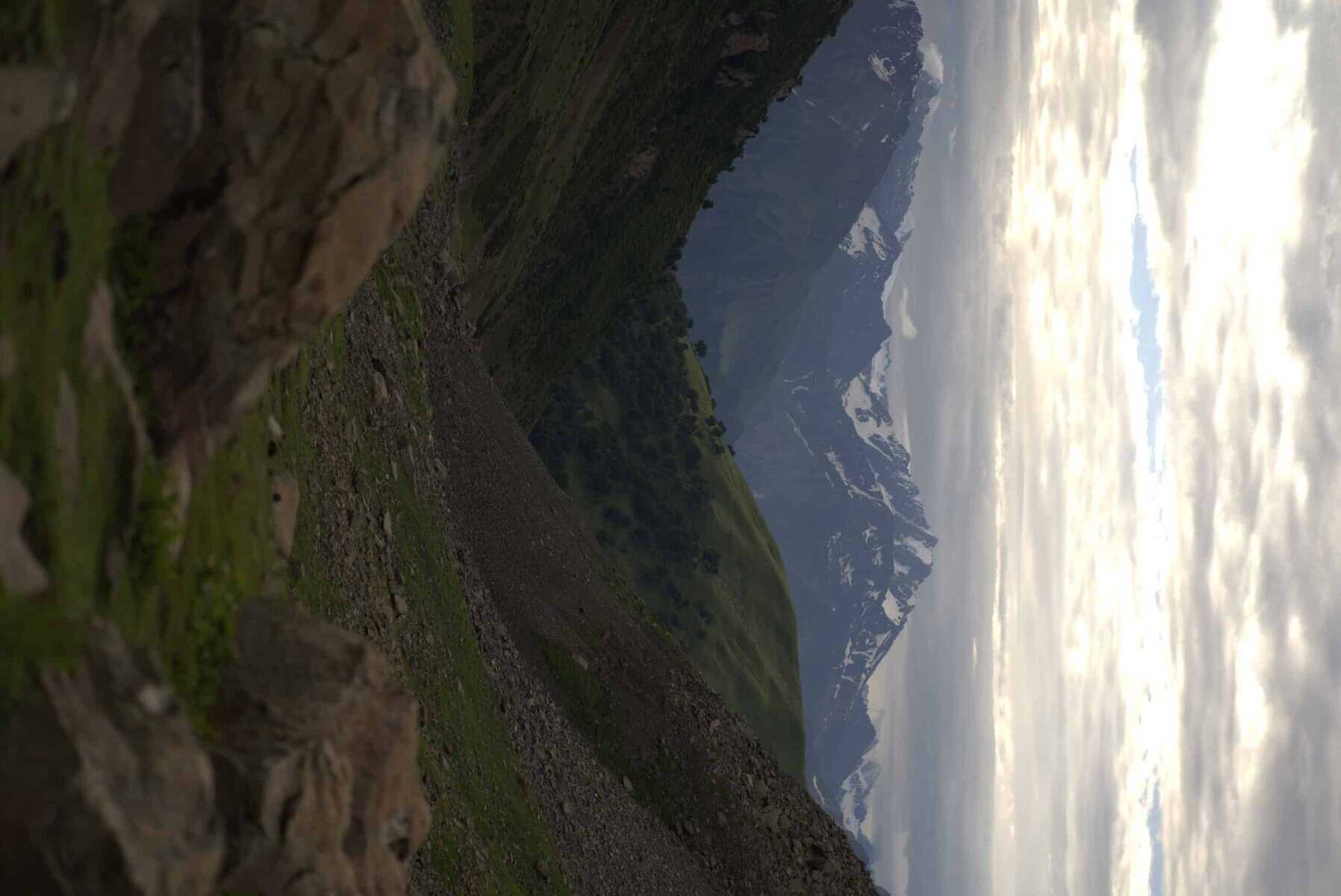
You’ll traverse a wide valley flanked by mountains, with the river Sindh flowing through it. The terrain will be rocky for the first 30 minutes, but eventually, the landscape will transform into a lush green meadow as the river valley narrows. Look ahead to spot the Triangular Twin Snow-capped Peaks in the distance.
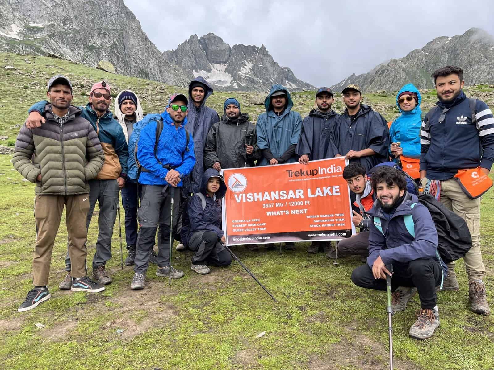
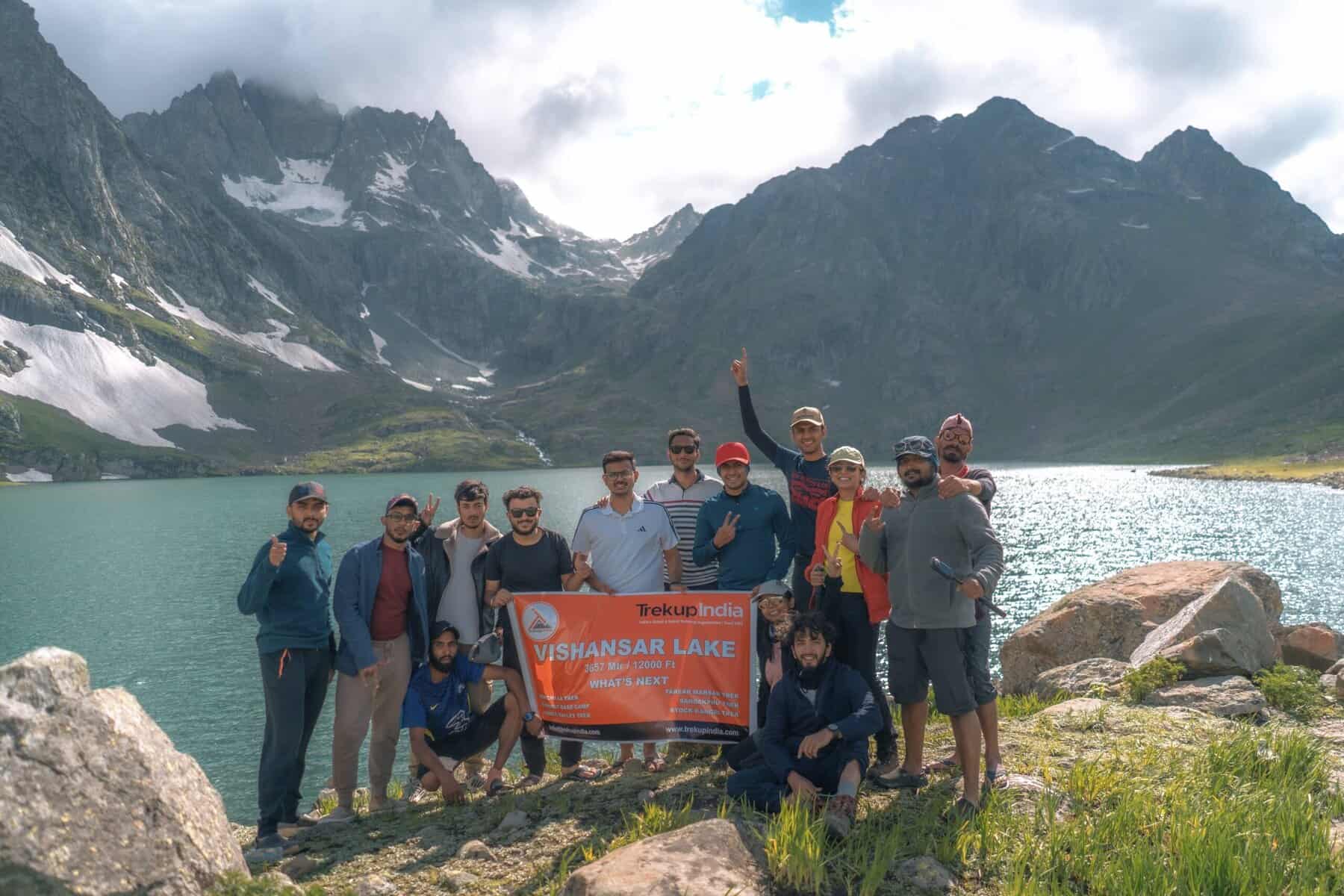
Day 03: Nichnai (1,500ft) to Vishansar lake (12,000.ft).
- Altitude: 11500 ft to 12,000ft through 13100 ft
- Trek Distance: 12 Kms
- Trek Duration: 7 Hrs
- 12 km Trek, approximately 7 hours
- The trek from Nichnai Pass to Nichnai Pass takes approximately 1 and 1/2 hours.
- You can access the B.S.N.L network at the top of Nichnai Pass, which is the final point in the mobile coverage area.
- There is a descent from Nichnai pass towards Vishansar.
- Lunch will be served at the campsite Vishansar
- You can also visit the Vishansar lake, which is only 15 minutes from the campsite.
- This is the first and most beautiful lake on the trek.
- The lake will freeze if the trek takes place in July. If we have permission from Srinagar Fishing Department, we can fish at the lake.
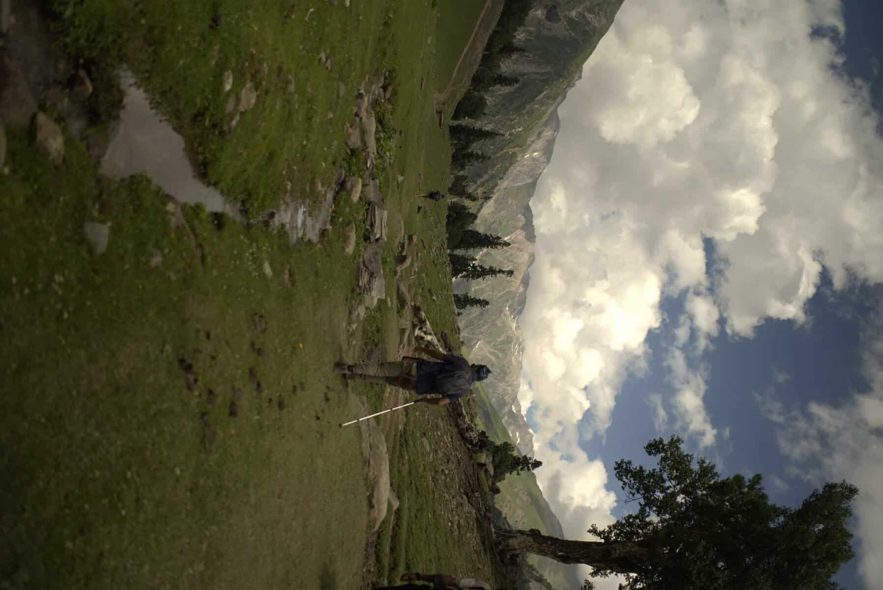
- Vishansar is frequented by flocks of sheep, and their shepherds are well-known for telling interesting stories.
- This campsite offers a great place to play volleyball, cricket and other sports.
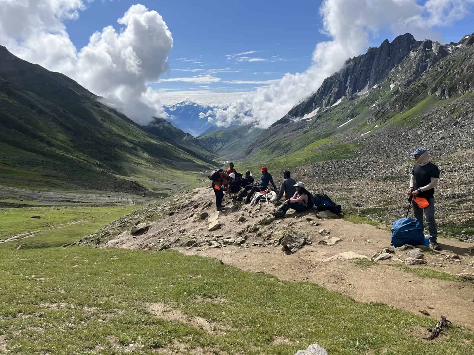
Embark on a picturesque journey across meadows, with the scenery continually improving. Begin your trek by 8:00 am to allow ample time to appreciate the surroundings. Your first destination for the day is the Nichnai pass or Vishnusar Berry, visible from the campsite. The pass is a striking landmark located just right of the twin snow-capped peaks. Following a half-hour river-side walk, cross the waterway to transition to its left bank. Observe the trail gradually ascending as you advance through the meadow for the next hour. The subsequent hour is dedicated to a moderate climb to Nichnai Pass, standing at 13,500 ft, succeeded by a minor descent and an extensive flat meadow walk, ultimately leading to Vishnusar Lake. As you ascend, take notice of a small lake nestled at the base of the mountains, its deep blue hue igniting excitement for the lake.
The pass is not immediately apparent from the meadow below, as the trail misleads with two inward turns before revealing the Nichnai pass. From this vantage point, take in the breathtaking views of the Sonamarg valley and the path you’ve traversed. This is a reliable spot to get a phone signal, courtesy of the BSNL network, which may not be available again until you reach beyond Gangabal.
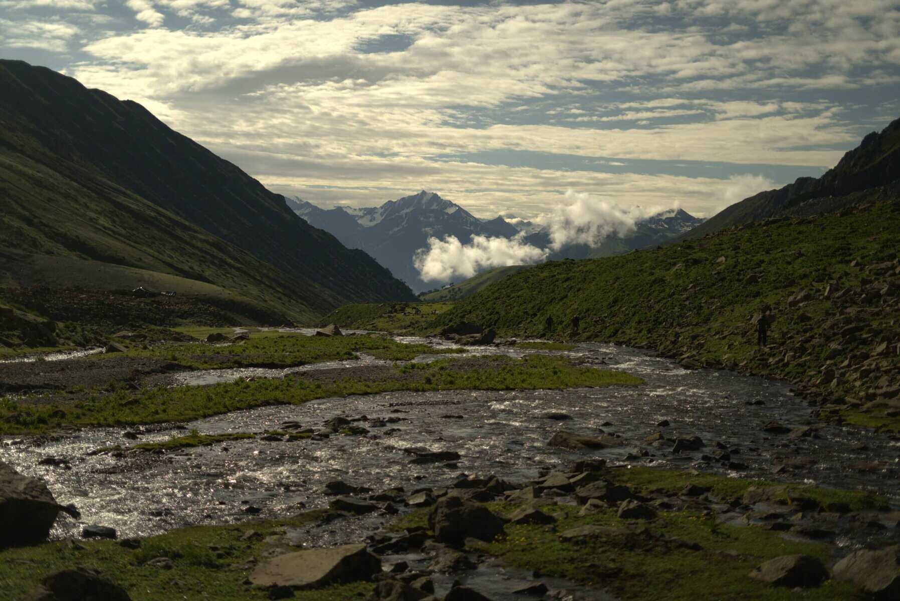
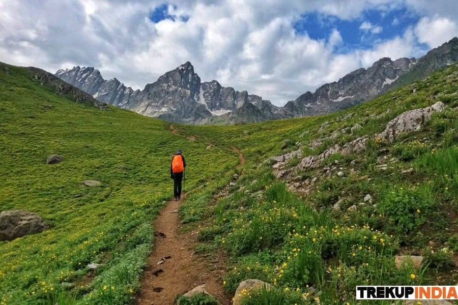
As you continue your journey, the path opens into a vast, snow-covered valley, with towering peaks rising up on your left. The landscape on the right side slopes upward, but no prominent peaks are in sight. You’re currently at an elevation of 13,229 feet, which is quite a feat, considering it’s only the second day of your trek. The high altitude can be challenging, but the good news is that the trail begins to descend from here, offering a welcome respite. The rugged terrain leads to a steep rocky path, eventually turning into lush green grass. Bright red flowers dot the landscape, adding colour to the otherwise muted tones. Ahead, a vast meadow stretches out for miles, flanked by towering mountains. A new river flows gently through the valley, providing a soothing soundtrack to your journey.
As you pause, take in the breathtaking panorama of rugged peaks, glistening rivers, and vibrant meadows. To your left, a magnificent waterfall cascades down the mountain slope, merging with the river below. Beyond the waterfall, the terrain flattens out, and you continue your journey through the expansive meadow. The iconic snow-capped Himalayas rise majestically to your left, while the barren, grey mountains on your right evoke the stark beauty of the Ladakh ranges.
Amble along the verdant valley, flanked by two towering ranges. Two prominent streams meander through the landscape, with the left-hand stream being your guide. Prepare for a refreshing stream crossing in a mere half hour, with crisp water leaving you invigorated.
Set up camp in the meadow for 90 minutes until you reach the valley’s end. A stream flows from the left towards the right, originating from Vishnusar Lake, located higher up on the left but cannot be seen from the campsite. Pitch your tents in an open area near the stream, leaving plenty of space for other campers.
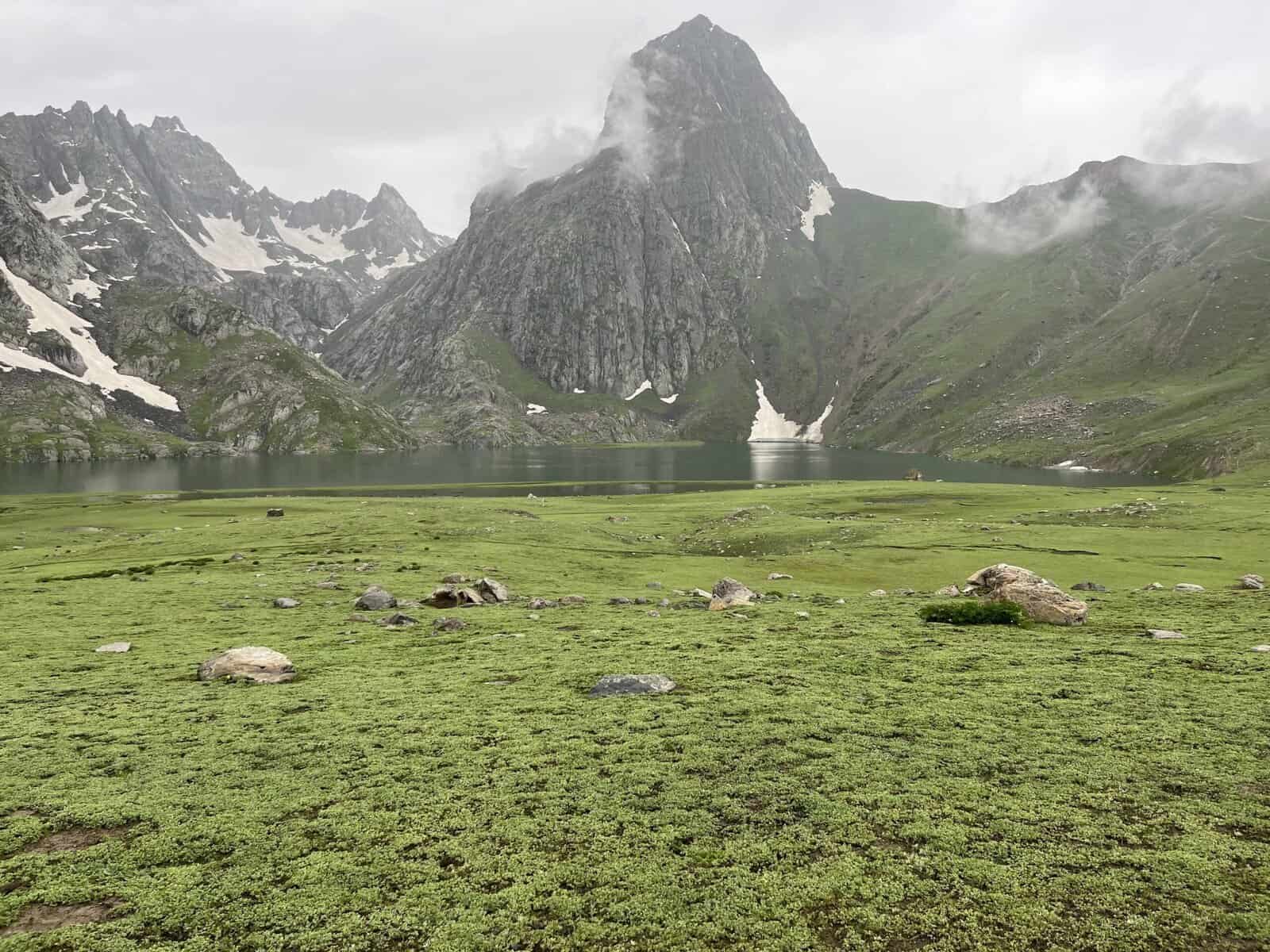
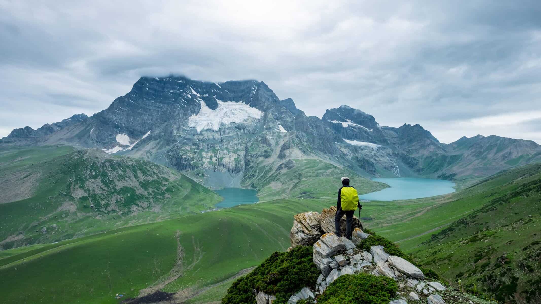
The Vishnusar lake is 0.5 km to the left and 100 feet above the campsite. Head left and follow the stream to reach the lake, keeping it to your right. It takes approximately 7 minutes to reach the lake between two mounds. The first thing you’ll notice about the Vishnusar Lake is its size and how four mountains surround it. The Kishansar peak, located 0.5 km away, is reflected in the lake’s calm waters, creating a stunning visual effect. The lake’s colour varies depending on the time of day and the clouds in the sky. In the early morning, the water is crystal clear, but the lake takes on a blue hue as the sun rises. When the sun is high in the sky, and the clouds are few, the water appears a deep blue. However, in the late afternoon, the lake turns greenish-blue, thanks to the combination of clouds and the setting sun. Regardless of the time of day, the Vishnusar Lake is truly breathtaking and worth seeing in its different colours.
Day 4: Day of Acclimatization and Rest/Buffer Day at Vishansar
Note: Kindly note in our Kashmir Great Lakes Trek Day 04 is rest day (which is optional) and will be used as a buffer day only incase of any weather condition, shutdown, political unrest, using Rest day / buffer day will completely depends on current weather condition of the region or Kashmir Situation. In all good situations the trek will continue and rest day / buffer day will not be used, making it a 6N 7D program. If the rest day / buffer day is used Trekup India will not charge for its logistics.
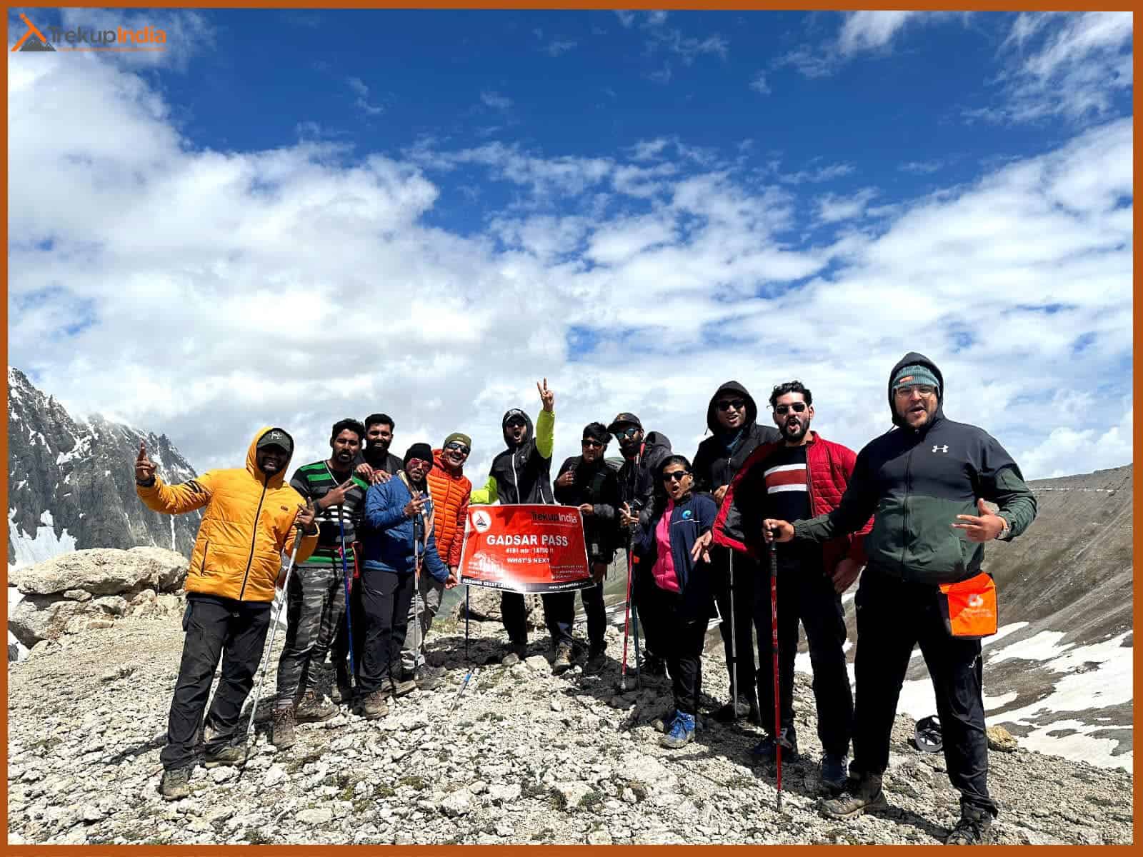
Day 05: Vishansar (12000ft) to Gadsar (12000ft), via Kishansar lake & Gadsar Pass (13,750ft).
- Altitude: (12,000ft to 12,000ft), via (13.750ft).
- Trek Distance: 14 Kms
- Trek Duration: 10 Hrs
- 14kms Trek, approximately 10 Hours
- The trek starts earlier than usual.
- The trek takes you from Vishansar up to Gadsar.
- The trail ascends steeply from Vishansar to Gadsar Pass.
- On the way, we can see Kishansar Lake.
- We descend slowly from the Gadsar pass to the campsite.
- En route, we can see Gadsar lake.
- The Glacier of Gadsar Lake might also be visible.
- We will arrive at the campsite after passing Gadsar lake. It takes us 2 hours.
- We will be stopped by another army checkpoint just a few minutes from our campsite. They will ask for our ID proofs.
- Lunch will be provided
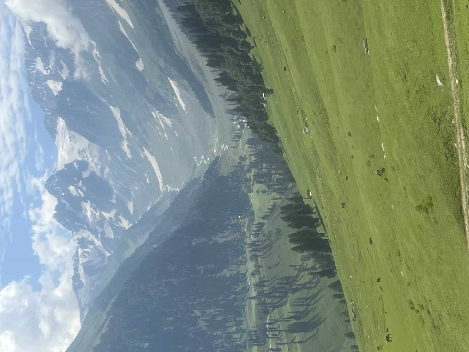
You’ll encounter a narrow trail that winds up the mountainside as you journey. This path will lead you to the summit, but be sure to follow the trail that ascends higher, as it will provide the most scenic route. The climb should take around an hour and a half at a moderate pace, and about 45 minutes into your ascent, you’ll be rewarded with a breathtaking view of both Kishansar and Vishnusar lakes, nestled in the mountains.
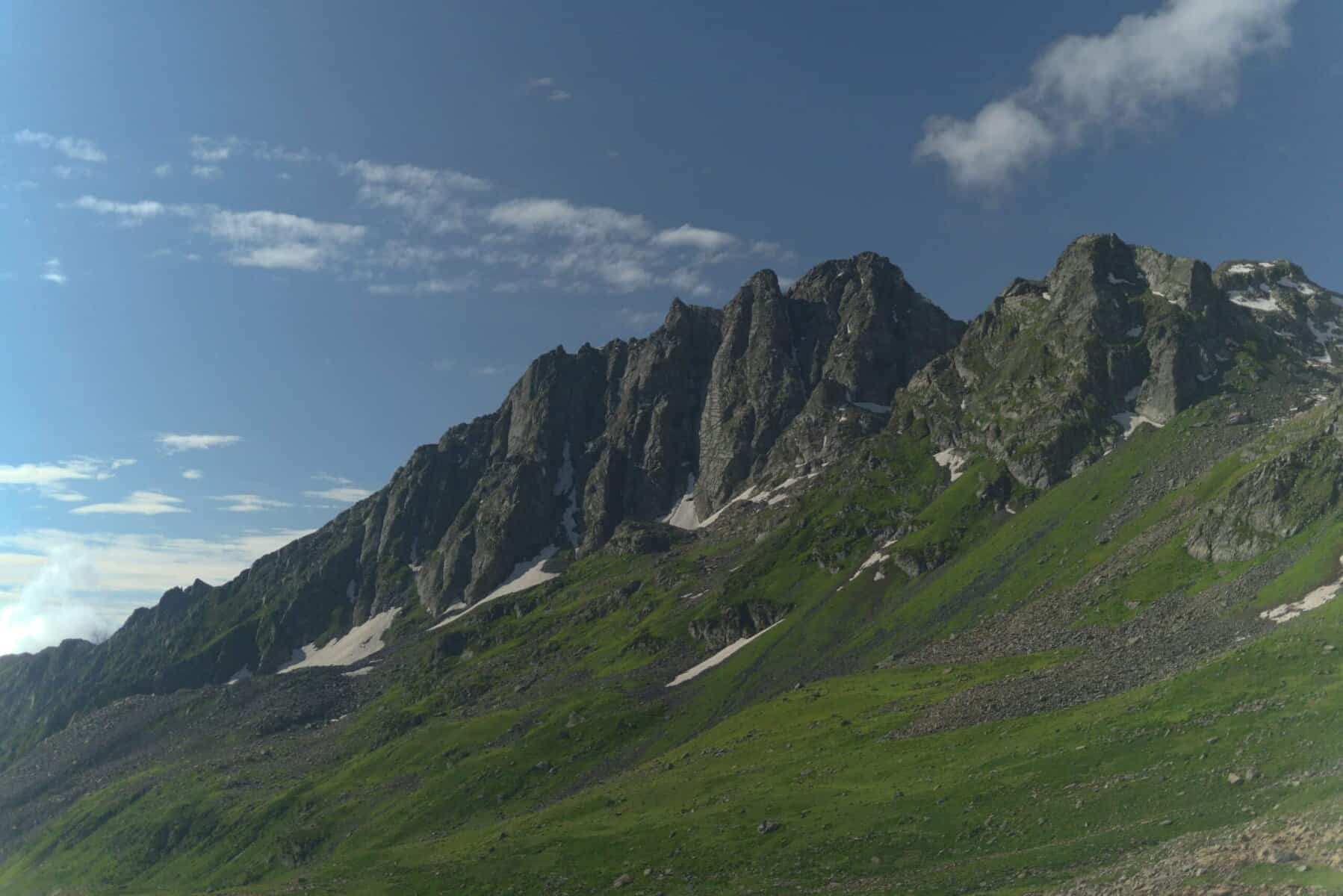
The scenic view of the twin lakes persists until you reach the ridge summit or the pass, known as the Gadsar pass, which stands at 13,800 feet, the highest point on this trek. The trek involves a strenuous 2-hour climb followed by a steep descent and a leisurely walk through the meadows. On the opposite side of the Gadsar pass, a long valley stretches out, with 2-3 small lakes visible in the distance. A series of snow-capped peaks can be seen on the far horizon, lying beyond our Line of Control. It is not unusual to encounter snow at the Gadsar pass and in the initial sections of the descent on the other side.
The path downward is uncomplicated. The initial minor lake on the left is Yamsar Lake, which the local population believes has a connection to Lord Yama. Following Yamsar is a second unnamed lake. A short descent of an hour brings you back to level meadows. This valley is more compact, with two mountain ranges running along its sides. Take note of the vibrant flowers growing out of the green grass, beginning with red and gradually shifting to blue and purple irises.
As you venture into the blue Iris area, you’re just a short distance from the breathtaking Gadsar lake, nestled at the foot of snow-capped peaks. Vibrant blue flowers bloom on one side, while snow slabs tumble into the lake from the mountain on the other. Ahead, the valley stretches out in a gentle green-blue slope. The Yamsar, the unnamed lake, and Gadsar are linked by a stream that flows from the higher lake to the lower, with Gadsar at an elevation of 12,500 feet.
Select Gadsar as your campsite for its breathtaking beauty, but only if you promise to leave the area as pristine as you found it. Gadsar is typically unoccupied, and a small, abandoned military shelter is nearby.
If you opt not to set up camp beside Gadsar, the next suitable location would be the army camp nearby. Following the downward trail from Gadsar, the valley expands after a half-hour walk, revealing a second blue lake on the left-hand side. The snow-capped mountains give way to rugged, barren peaks. You’ve descended a significant amount of altitude. Another half hour down the trail, a few shepherds’ huts come into view. Continue downhill for three and a half hours, and the army camp will be at the end of your journey. The Gadsar army camp comprises a small hut housing approximately 5-8 military personnel.
To proceed beyond the military camp, authorization from the central command is required. The command centre is located 4.8 kilometres further down, near a village, and is situated among the trees. The Gadsar camp maintains contact with the headquarters using handheld radios. The headquarters is also equipped with a satellite phone for military use. If you are near the Gadsar army camp, it is advisable to report to them promptly. Processing your documentation, which includes verifying original identification cards, takes approximately 2-3 hours.
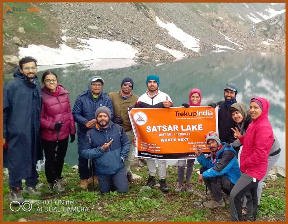
Day 06: Gadsar (12000ft) to Satsar (12000ft).
- Altitude: 12,000 ft – 12,000ft
- Trek Distance: 9 Kms
- Trek Duration: 6 Hrs
- 9kms Trek, approximately 6 hours.
- The trail is full of vibrant flowers from mid-July to mid-August.
- You will need to show your ID at another checkpoint of the army while you are on your way.
- We see two smaller lakes that are sometimes mistaken for Satsar Lakes.
- In the afternoon, we will visit the Satsar twin Lakes, which are approximately 1.3 h
- Mengen top is also known for Stasar twin lakes.
- These twin lakes can be found in the middle of the mountain.
After crossing the stream, follow the trail that ascends the mountain, reminiscent of a typical western ghats path. You’ll feel above the tree line, with the tree-covered valley stretching below. The 1.5-hour climb will take you up 1,100 feet, and the trail will eventually transition into a traverse. You’ll leave the river valley behind and find yourself walking on a flat trail surrounded by mountains, with deep craters to your right. This area is known as Maengandob.
The landscape ahead is breathtaking, with isolated mountains and a small ridge to your right. In between, you’ll find a flat green bed with a river flowing through it. Consider camping here if Gadsar Lake is your last stop. If you started at the army camp, it’s worth covering a bit more distance and setting up camp near the first of the Satsar lakes. Satsar consists of seven lakes, four or five containing water depending on the season. Located beyond the ridge on the right is the Satsar army check post, the third line of defence from the LOC.
Expect to go through the usual identity checks, collection, and questioning process. It’s best to take care of this today to ensure a smooth and enjoyable trekking experience tomorrow. Just ten minutes from the army camp is the first of the Satsar lakes, a picturesque body of water nestled in a green setting with mountains rising in front. Choose a suitable spot to set up camp for the day.
Day 07: Satsar (12,500ft) to Gangabal twin Lakes (11,500ft).
- Altitude: 12,000 ft – 11,500 ft 13000
- Trek Distance: 11 Kms
- Trek Duration: 6 Hrs
- 11kms Trek, approximately 6 Hours
- For approximately an hour, we walk on rocky trails and then ascend to Jazz Pass.
- The pass offers views of Mt. Harmukh with its glacier.
- We descend to the Gangbal lake, and then camp at Nandkol lake.
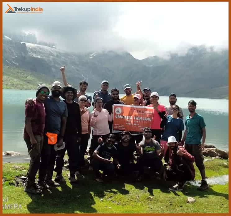
- We will visit Gangbal Lake, one of the largest lakes on the trek.
- After dinner, a group of Kashmiri staff members will perform traditional songs and dances.
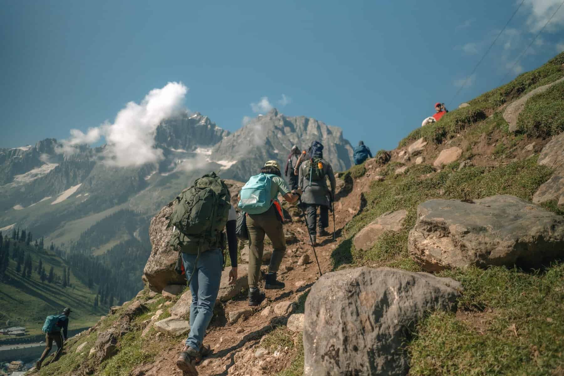
The terrain undulates throughout the day’s trek, alternating between gentle inclines and declines, followed by a steep ascent and descent. The path replicates this pattern, consistently rising and falling. Begin by trekking for half an hour to reach the largest Satsar lake, traversing bouldery terrain requiring more hopping than walking. Beyond the final lake, the trail descends, and after a 30-minute walk, the forest line comes into view on the left, while a ridge line lies to the right, standing 1,000 feet taller. It’s time to gain altitude again, starting from 11,800 feet at the base of the climb. Use the zig-zag pony track to ascend the first ridge, a 45-minute journey with limited breaks. From the summit, two additional ridges remain to be climbed. The barren and rocky trail offers a contrasting view of the adjacent mountains, where Gujjar huts are visible amidst tall pines. The disparity between the arid mountains and the lush greenery on the other side is striking.
After a two-hour ascent, you reach the summit of the third ridge, where you’re greeted with a breathtaking view. The altimeter shows an elevation of approximately 13,400 feet. The real treat, however, is the stunning panorama that unfolds before you. Two lakes sit side by side, with a stream flowing from the higher lake to the lower. Look closely and spot two more lakes in the distance, one on either side. The largest of the four lakes is Gangabal, and its companion is Nandkol. Your destination is now clearly visible, lying 1,400 feet below you. The path ahead involves a brief descent followed by a steep climb back to the lake. Take in the scenery and get ready for a challenging descent. Your final destination is either Gangabal or Nandkol. While the ascent is dry, you’ll cross a stream midway through the descent. Fill up your water bottles and press on. The steep descent takes about an hour and a half, after which you’ll find yourself in a lush green meadow. The meadow stretches from right to left, and a kilometre down the left, you’ll see the tree line again. Once you reach the base, the lake shore is still far off. Though the destination is now visible, it appears distant.
A short climb, a quick descent, and a stream crossing over a wooden log bridge lead you to the shores of Nandkol Lake. Observe that this lake isn’t as pristine as the others you saw on the trek. The area is littered with remnants of camping. Many people trek up from Naranag to Gangabal and return as a weekend getaway, leaving behind a trail of garbage. You can’t help but wish they had taken the time to clean up after themselves and appreciate the beauty of these lakes.
The picturesque Nandkol Lake is situated at the foot of the majestic Harmukh Peak, with the Harmukh Glacier gracefully descending the rocky slopes. Both Nandkol and Gangabal Lakes are renowned for their excellent trout fishing spots. While Gangabal Lake is a 20-minute trek away from Nandkol, a fiery stream flows between the two lakes, connecting them. To reach Gangabal from Nandkol, it’s essential to cross this stream using a sturdy artificial bridge on the right-hand side of the bank of Gangabal. The lake is vast, and a leisurely circumambulation of either lake will take around an hour.
Day 08: Gangabal (11,500ft) to Naranag (7.450ft). Drive to Srinagar
- Altitude: 11500 ft to 7450 ft
- Trek Distance: 15 Kms
- Trek Duration: 7 Hrs
- Drive Distance: 70 Kms
- Drive Duration: 2.5 Hrs
- 15kms Trek, approximately 7 hours
- You will be walking down the trail until you reach Naranag. Please take care of your ankles and knees.
- You will be passing through the pine forest.
- TrekupIndia can arrange transportation to Srinagar for a fee if you make an advance booking.
- You will arrive in Srinagar at 6:30 pm after driving 70kms.
- Prepaid sim cards are not valid in Kashmir. Carry Postpaid Sim Cards.
- You will reach Srinagar on Day 8 between 6:30 and 7:30 PM. After 8 PM, you can book your travel.
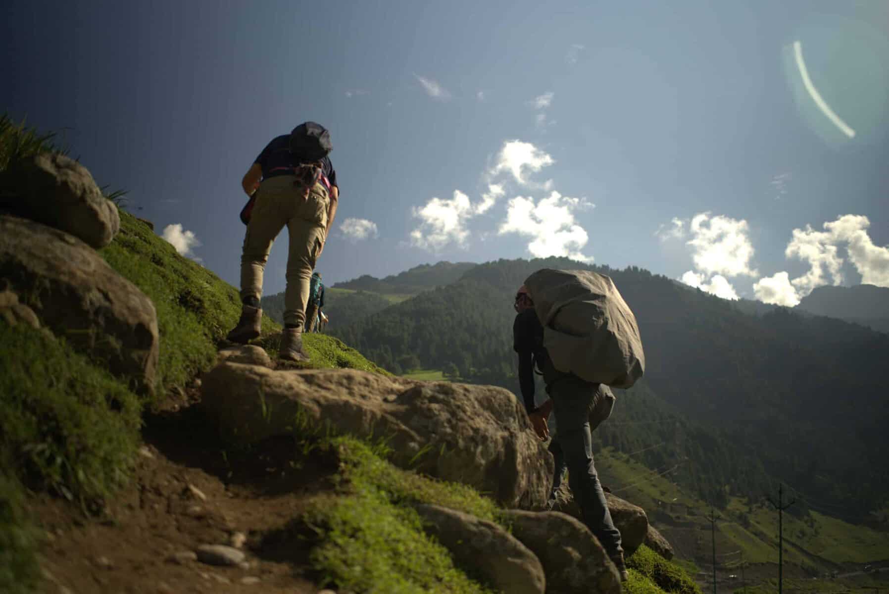
After a gentle downhill journey for 6 hours, Today’s journey may seem effortless as you descend downhill, but be mindful of the steep incline that may strain your knees.
Begin your trek from the Gangabal campsite, following the stream and ridgeline until you reach a grove of trees. After 30 minutes, you’ll start getting cell phone reception, so take a moment to let your loved ones know you’ve made it safely. As you continue, the ridge will give way to a picturesque meadow, offering a stunning view of Harmukh Peak in the distance.
As you continue your journey, you’ll notice the landscape shift, with the treeline coming into view. Most of the trees are pine, and you’ll begin to see signs of civilization, such as a log hut, as you make your way deeper into the forest. The trail takes you in and out of the woods for about 6 km without much change in altitude.
However, as you reach the two-thirds mark, the path begins to descend, which is quite steep. The trail is muddy and well-trodden, and the thick pine cover creates a canopy overhead. Over the final 4 km, you’ll experience a dramatic drop in altitude, losing over 3000 ft. You may see other trekkers on their way up from Naranang to Gangabal. As you continue down, Naranang comes into view, and the end of your trek is in sight.
The last portion can be challenging, as the path is quite steep, but a stone-paved path appears, and you’ll soon enter the village of Naranang. From there, you’ll drive to Srinagar, with an estimated arrival time of 6:30 pm. From this point, you can make further travel arrangements as needed.
We’ve prepared a comprehensive Trek Route Map for your upcoming adventure to Kashmir Great Lakes Trek, which outlines the entire journey including all stops and trails. This map provides detailed information on the terrain, distance between points of interest, and estimated travel time to help ensure a safe and enjoyable trek. We’ve carefully curated the map to ensure that you have all the necessary information at your fingertips. Please take a moment to review it thoroughly, and don’t hesitate to reach out if you have any questions or concerns.

The Kashmir Great Lakes Trek Altitude Chart is a useful tool for Trekkers to monitor their altitude changes during their rides, allowing them to plan their routes more efficiently and track their progress over time. This Kashmir Great Lakes Trek chart is beneficial for both casual and experienced Trekkers, helping them make the most out of their Trek experience.

Trek Cost Inclusions
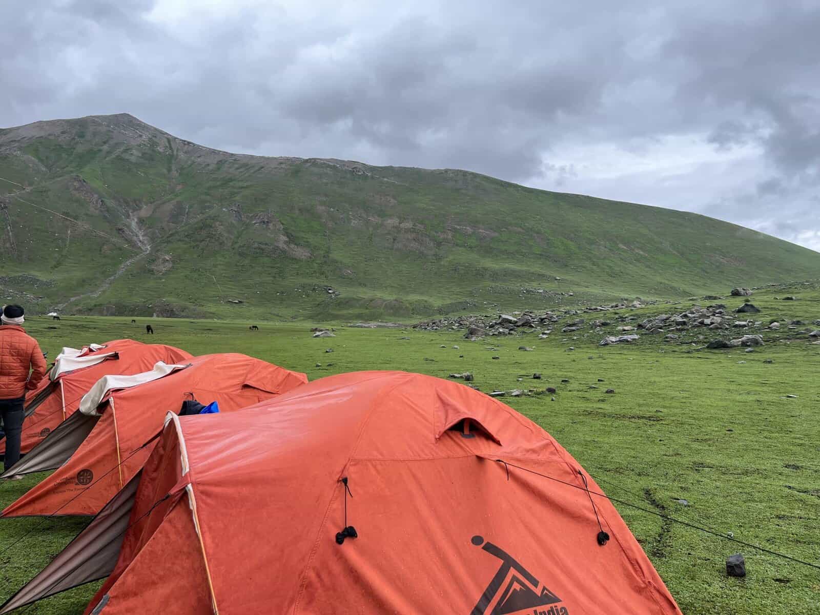
- Stay: 7 Nights of tented accommodation at individual campsites of Trekup India on twin sharing.
- Meals: Trekup India will provide freshly cooked meals during the trek starting with Dinner on Day 1 to tea, coffee on day 8 (Meals are simple, nutritious, and vegetarian)
- Trek Equipment: Sleeping bag, Sleeping tents, Kitchen tent, Dining tent, Toilet Tent.
- Amenities: All utensils, sleeping mattresses (Black foam mats), Crampons, and Gaiters for snow.
- Health & Safety: First Aid Box, Oxygen Cylinders, Stretchers, Oxi meters, BP Machines, health.
- Permits: Forest Permits and Camping Permission Fee
- Trek Crew: High Altitude Chef, Helpers, Trek Leader & Guides, and other support teams.
- Potters & Mules: Potters and Mules are to carry all trekking equipment, ration, and vegetables.
Trek Cost Exclusions
- GST 5% (it is Mandatory)
- Transport Optional: Srinagar to Sonmarg and return. ( 1600 extra )
- Trek Insurance Mandatory: (Trekup India recommends each trekker to get insurance) you can read more about What Is Trek Insurance, Why It Is Mandatory On Treks And What It Covers .
- Any Meals/accommodation beside the itinerary or not mentioned in the program.
- INR 2000 Extra for Forest Permits for Non Indian Nationals
- Any Bus / Airfare to/from trek start/end point
- Personal Medical expenses do carry your medication.
- Any personal services such as Laundry, phone calls, liquors, mineral water, etc.
- Any still / video camera fee
- Any Entrance fee Monuments, Monasteries, Museums, Temples – Pay directly on the spot.
- Backpack Offloading (Mule/Porter Charges)
- Offload Charges: ₹4305 per bag for the full trek if paid online in advance.
- On-spot Payment: Charges may increase by up to 30% if paid at the base camp.
- Weight Limit: Each bag must not exceed 10 kg.
- Note: Offloading is optional and is recommended for those who prefer to trek with a lighter daypack.
- Any emergency evacuation charges
- Any services that are not mentioned in the cost inclusion section.
What should you pack for the Kashmir Great Lakes Trek
Kashmir Great Lakes Trek is a high-altitude trek. The trekking gear you have to have for this particular trek differs from normal treks. Thus, read this whole segment. There is an important question that the trekker who is doing trek asks, like what all things to carry while trekking. Below, we have provided the details on everything you should take; an easy way to remember is by Head to foot or foot to head. We have prepared from Head to foot.


Head Gears
When trekking it's important to carry headgear to protect your head and face.
Heading out for a trek? Don’t forget to carry headgear to protect your beautiful face and head from the sun, wind, and dust! It’s an essential accessory that keeps you safe and comfortable throughout your adventurous journey. So, make sure you pack it before you step out into nature!
- Head Lamps are essential for the night, and most importantly, headtorchs keep your hands free while trekking.
- Hats or Cap– Cap will protect you from winds and sometimes freezing temperatures for the night. Hats protect you from the sun during the day and also ensure they have a strap so the hat doesn’t blow from the wind.
- Sunglasses– you will need specific sunglasses for trekking. The glasses should protect from UV rays, fit your face perfectly so it doesn’t fall while you climb, jump, or cross an obstacle, and be according to the weather conditions of the place; the glass should be made to fit different weather conditions.
- Buff / Balaclava– You must carry this to protect your mouth or neck from extreme temperatures and keep it warm.
Clothes
When trekking in high altitudes, prepare for cold weather by wearing layers. Layering traps heat, keeps you warm, and allows you to easily adjust your clothing as temperatures fluctuate.
Layering is important for different seasons when trekking. When planning a high-altitude trek, it is important to prepare for the cold weather. Wearing layers is the best approach as it provides both protection and flexibility when the weather changes frequently in the mountains. Layering helps to trap heat and keep your body warm, while at the same time allowing you to easily adjust your clothing as the temperature fluctuates. By wearing layers, you can enjoy your trek comfortably and stay safe in the unpredictable mountain weather
- For spring, summer, and monsoon treks, consider wearing three layers: a woollen sweater, a fleece, and a padded jacket.
- For autumn treks, add one more fleece layer to make it four layers.
- For winter treks, you may need five layers with thermals, a woollen sweater, two fleeces, and a padded jacket.
- T-shirt/sleeve shirt– Bring three T-shirts and two quick-dry trek pants, wearing one and carrying the others. Long sleeve shirts help to protect from sun UV rays. We recommend synthetic T-shirts as they get dry quickly when they get wet.
- Hiking / Trekking Jacket– down jackets (-5 to-10 C) or two-three-layer jackets.
- Thermals– at least two pairs of thermals help keep the body warm during cold weather.
- Undergarments– you can carry them according to your habitual and hygiene requirements.
- Gloves– 1 pair of gloves will keep your hand warm and nice.
- Trek Pants– Bring 2 to 3 comfortable trekking pants. Trekking pants play a significant role, as they are designed for comfort and mobility, making trekking easier. It should be Synthetic so that it gets dry quickly when wet.
- Rain Wear– you can carry a raincoat or Poncho. During long rains and snowfalls, the waterproof jackets start leaking. Still, the Poncho and raincoats keep you dry, so choose accordingly.
Tip: If you choose a raincoat on your trek, carry a small waterproof cover so things inside your backpack can’t get wet. If you carry a Poncho, you don’t need to worry. It protects both you and your backpack.
Foot Gears
When it comes to planning a trek, one of the most important aspects is to ensure that you have the right kind of foot gear.
- Trekking shoes whichare waterproof and have ankle support. Walking / Hiking sandals which can be used off the trek, i.e., in the morning and evening hours when you reach the campsite, basically to get your feet rest from heavy boots, sometimes used for crossing streams and rivers, it’s more comfortable and safer than crossing barefoot or wetting your shoes. Sneakers (Optional) can be worn for normal driving days or used around the camp.
- Socks– you should at least carry 3 to 4 pairs.
- Microspikes & Gaitorswill be provided by Trekup India when required. You don’t have to carry them.
Personal First Aid Kit
Don't forget to pack your personal first aid kit! It's always better to be safe. So, make sure you're prepared for any unforeseen circumstances.
Below are some common medicines generally required/used during your adventure trip; however, please consult your doctors prior.
- Antiseptic towel or water syringe (to clean the wound)
- Butterfly bandage for a small cut
- Cotton and elastic bandages and sterile gauze pad for larger wounds
- Latex gloves are used when the wound bleeds.
- Medicine for Diarrhea (Upset stomach)
- Medicine for cold, flue/fever, headache
- Some pain killers
- ORS pouches
- Quick pain relief spray (External use)
- Any personal medicine prescribed by your doctor
- Dimox / Similar for high altitude sickness
- Bug Repellent
- Carry some nutria/energy bars and drinks (non-alcoholic)
- Note: Kindly consult your doctor before purchasing or taking any medicine.
Gadgets and Other Items
You might also consider bringing a camera, binoculars, portable charger, and snacks. Be well-prepared and tackle any trail with confidence.
- Trekking Poles
- Mobile phone
- Camera
- Spare batteries for phone and camera, power bank
- Lightweight flashlight or headlight
- A waterproof bag made of plastic is used for the camera.
- Plug/converter for electrical items
- 1-litre water bottle
- A journal with a pen would be a good idea to keep your notes.
- Some book of your interest for the ideal time
- Get into the habit of maintaining a Map and guidebook of the region.
Hygiene & Personal toiletry
Remember to pack hygiene and personal toiletry items such as soap, shampoo, toothbrush, toothpaste, deodorant, and toilet paper.
- Sunscreen with UV protection
- 1 or 2 small quick-drying towels
- Toilet paper/tissues/wet wipes
- Toothbrush/toothpaste/ mouth freshener
- Deodorant / Talcum powder
- Shampoo
- Lip-gloss/salve
- Sanitary pads/tampons (For female trekkers)
- Bio gradable Soap
- Nail clipper
- Your other personal items that you use daily.
Compulsory Documents to Carry
There are certain documents that you should always carry with you. These documents are not only necessary for your safety and security, but they may also be required by local authorities.
These files must be submitted to the Forest Department before your trek. With none of these, you will not be permitted to trek—original and photocopy of government photo identity card. Carry IDs like Aadhaar, voter ID, etc.
How To Plan Your Trek & Reach Srinagar, Jammu?
By Air:- Most air carriers such as Air Indian Airlines, Indigo have regular flights to Srinagar. Getting to Srinagar by flight from New Delhi is considered the most conceivable.
By Train:- Jammu may be the closest railway station to Srinagar, which is at a distance of 290 km. Jammu railway station is nicely attached to other main towns in India by rail. Direct Rails are available from Delhi, Trivandrum, Bangalore and also Chennai.
By Bus:-Srinagar is connected through the National Highway 1A to all over the country. J & K transportation has regular comfy buses from Jammu. The Journey captures approximately ten hrs to arrive at Srinagar.
Fitness Required & Preparation Guide For Kgl Trek
If you’re preparing for a Kashmir great lakes trek, Trekup India recommends jogging as part of your fitness routine. Jogging helps work out the same muscle groups that you’ll use during trekking and can help you build endurance. You don’t need any special equipment to get started.

Fitness Target
Trekup India has put the Kashmir Great Lakes Trek into an moderaye-to-difficult-grade-level trek.
For Moderate – Difficult Level Treks – In order to be well-prepared for your trek, it is recommended that you focus on building your endurance by aiming to cover a distance of 4.5 kilometres in less than 40 minutes. This will help you to develop the necessary stamina and strength required to complete your journey successfully.
How to Achieve This Fitness Target?
To start preparing for your trek:
- Try jogging for at least five days every week.
- If you find 5 km too difficult at first, begin with 2 km and gradually increase over 2-3 weeks.
- Once you feel more comfortable running 5 km, focus on improving your speed gradually on a daily basis.
It is important to ensure that you can consistently complete 4.5 km in under 40 minutes for at least two weeks before your planned trek. Allow yourself 6-8 weeks to prepare physically for the journey.
Strength Training exercises that benefit Trekking
Trekking is an activity that demands a good level of strength.

Trekking is a demanding activity that requires good cardiovascular endurance, muscular strength, and overall fitness. To help you prepare for your trek, incorporating bodyweight exercises into your training routine can be an effective way to build strength, improve stability, and enhance endurance, all of which are crucial for a successful trek. In this regard, here’s a breakdown of body weight exercises categorized by the specific body parts they target and the benefits they offer during trekking.
1. Lower Body Exercises
Lower body exercises like squats and lunges are great for building lower body strength, essential for trekking.
a. Squats
Squats are an excellent exercise for building lower body strength, essential for trekking. They target the quadriceps, hamstrings, glutes, and calves. Solid quadriceps and glutes provide power for ascending and tackling uphill climbs, while vital hamstrings aid stability during descents. This is particularly helpful in navigating uneven terrain during trekking.
How to perform Squats Exercises:
- Stand with feet shoulder-width apart, toes pointing slightly outward.
- Lower your body by bending your knees and hips, keeping your back straight.
- Lower until your thighs are parallel to the ground or as low as comfortable.
- Push through your heels to return to the starting position.
b. Lunges
Lunges target the quadriceps, hamstrings, glutes, and calves. They improve lower body strength, balance, and stability, crucial for maintaining control on rocky trails and steep slopes. Additionally, they enhance flexibility, reducing the risk of injury while trekking.
How to Perform Lunge Exercises:
- Stand with feet hip-width apart, hands on hips or sides.
- Take a step forward with one foot, lowering your body until both knees are bent at 90-degree angles.
- Push through the heel of your front foot to return to the starting position.
- Repeat on the other side, alternating legs.
2. Upper Body Exercises
Upper body exercises such as push-ups and pull-ups effectively strengthen the upper body, especially the chest and shoulders, which are essential for carrying a backpack during treks.
a. Push-Ups
Targets: Chest, shoulders, triceps, and core.
Benefits for Trekking: Push-ups are an effective exercise to strengthen the upper body, especially the chest and shoulders, essential for carrying a backpack during treks. Improved upper body strength will also help maintain posture and stability while traversing challenging terrain.
How to Perform Push-Ups Exercises:
- Start in a plank position with hands shoulder-width apart and body in a straight line from head to heels.
- Lower your body by bending your elbows until your chest nearly touches the ground.
- Push through your palms to return to the starting position.
- Keep your core engaged throughout the movement.
b. Pull-Ups/Bodyweight Rows:
Targeting the back, biceps, and shoulders can significantly benefit trekking. You can strengthen these muscle groups by performing pull-ups or bodyweight rows and improve your posture and balance while carrying a backpack. Additionally, more muscular back muscles can help reduce the risk of back strain and fatigue during long treks, making your journey safer and more comfortable.
3. Core Exercises
Core exercises like planks and Russian twists can help strengthen the core muscles, which are crucial for maintaining stability and balance while trekking on uneven terrain.
a. Planks
Targets: Abdominals, obliques, and lower back.
Benefits for Trekking: Planks are an effective exercise that helps strengthen the core muscles. These muscles are crucial for maintaining stability and balance while trekking on uneven terrain. A strong core also helps improve posture, reducing the risk of back pain and fatigue during extended hikes.
How to Perform Planks Exercises:
- Start in a plank position with elbows directly under shoulders and body in a straight line from head to heels.
- Engage your core and hold the position, avoiding sagging or arching the back.
- Keep breathing steadily and hold for the desired duration.
b. Russian Twists
Targets: Obliques, abdominals, and lower back.
Benefits for Trekking: Russian twists engage the core muscles, particularly the obliques, improving rotational stability and balance. Enhanced core strength helps prevent injuries and improves overall performance during trekking.
How to Perform Russian Twist Exercises:
- Sit on the ground with knees bent and feet flat, leaning back slightly to engage the core.
- Clasp hands together and twist the torso to one side, bringing the hands towards the ground beside the hip.
- Return to the centre, then twist to the other side.
- Continue alternating sides for the desired number of repetitions.
4. Full Body/Cardiovascular Exercises
Full-body/cardiovascular exercises like burpees and mountain climbers are excellent for improving cardiovascular endurance, strength, and agility.
a.Burpees
Burpees are an excellent full-body exercise that targets your legs, chest, arms, and core. This exercise dramatically benefits trekking enthusiasts, improving cardiovascular endurance, strength, and agility. Regularly incorporating burpees into your workout routine can enhance your overall fitness level, which can help you endure long hikes and rugged terrains with ease.
How to Perform Burpees Exercises:
- Start in a standing position.
- Squat down and place hands on the ground.
- Jump feet back into a plank position.
- Perform a push-up.
- Jump feet back to the squat position.
- Explosively jump up into the air, reaching overhead.
- Land softly and repeat the sequence.
b. Mountain Climbers
Mountain climbers target the core, shoulders, chest, and legs. This dynamic, full-body exercise can significantly improve cardiovascular endurance and agility. It is an excellent functional workout for trekking preparation as it engages both the upper and lower body muscles while strengthening the core muscles.
How to Perform Mountain Climbers Exercises:
- Start in a plank position with hands shoulder-width apart and body in a straight line from head to heels.
- Drive one knee towards the chest, then quickly switch legs, alternating in a running motion.
- Keep the core engaged and the hips stable throughout the movement.
- Continue at a moderate to fast pace for the desired duration.
Incorporating bodyweight exercises into your training routine can help you build strength and endurance and prepare your body for the physical demands of trekking. Consistency and proper form are crucial to maximizing the benefits of these exercises and ensuring a safe and enjoyable trekking experience. Engaging your core muscles, including obliques, abdominals, and lower back, with Russian twists can improve your rotational stability and balance, preventing injuries and enhancing overall performance during trekking.
When incorporating strength training exercises into your workout routine, it’s essential to maintain proper form and technique to avoid injury. Start with lighter weights and gradually increase the intensity as you progress, focusing on compound exercises targeting multiple muscle groups simultaneously. Some examples of practical strength training exercises for trekking include squats, lunges, deadlifts, and pull-ups.
Remember to give your muscles time to recover between workouts, and remember to stretch before and after your workouts to prevent injury and improve flexibility. Combining strength training with jogging and proper stretching allows you to take your fitness to the next level and confidently tackle even the most challenging treks.
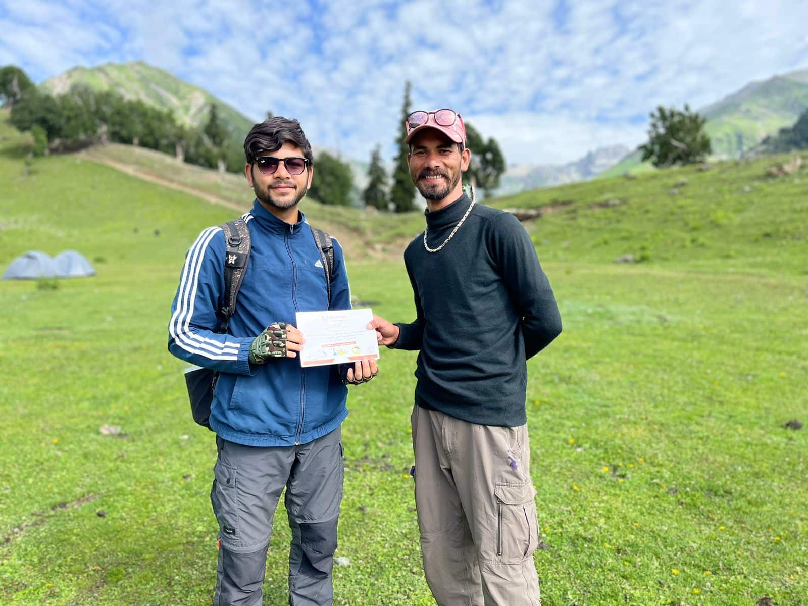
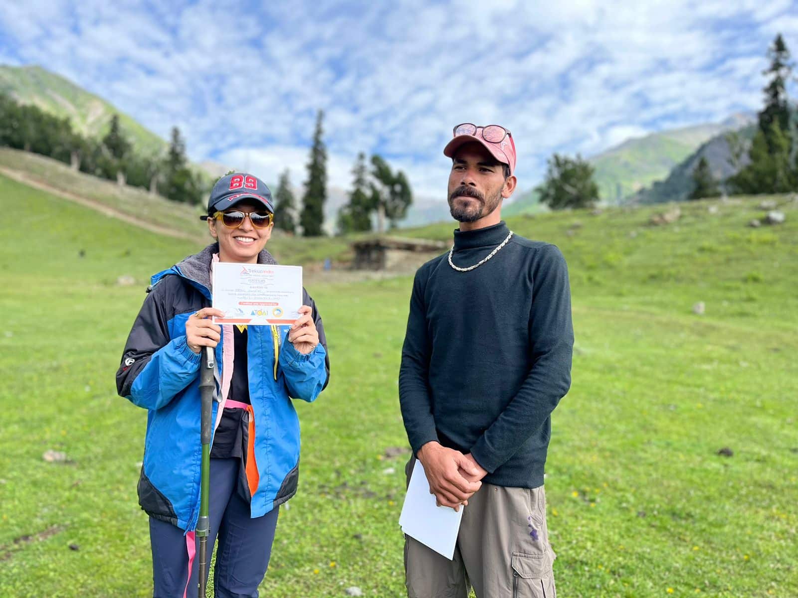
Our Trekkers Reviews And Expreinces
We provide only Indian vegetarian food, and your meal will mainly consist of Indian bread, vegetables, lentils, rice, and a delicious dessert. During your trek, we will serve three meals a day, including breakfast, lunch, and dinner. You will also be served tea, snacks, and lip-smacking soup in the evening before dinner. If it is a long day of trekking, you will be given a packed snack.
After extensive research on the trekkers’ nutritional requirements, we prepare the menu. Before putting all the meals together, we also consider the altitude and the weather.
The meal we serve during the trek is perfectly balanced with calories, carbohydrates, vitamins, protein, fibre, and minerals. You need to know that all our cooks have great expertise in cooking and have undergone thorough training. So, get ready to enjoy delectable and lip-smacking dishes during your trek. You will be served with lemon tea in the tent to start your day with a refreshed feeling. Before leaving the campsite for trekking, you will be given a hot finger-licking breakfast like upma, Aallu Prantha, Besan Chilla, Poha, Daliya, Corn flakes, and Maggie, along with tea or coffee.
If your trek is longer, we also offer some fresh local fruits such as apples and healthy drinks like Frootie or Maaza. In the afternoon, you will be served a simple & healthy lunch, while at around 04:00 pm, you will be given tea and a light evening breakfast. After you reach your campsite at night, you will be served a hot and delightful dinner.
After reading this, you must have understood the food we provided on the trek; you don’t need to worry about food. Many trekkers repeatedly trek with us because of the food we provide. Thus, we will give you unforgettable experiences.

Trekking with us for the Kashmir Great Lakes Trek is entirely safe because we have a team of trek leaders qualified in Wilderness first-aid and complete information about the high-altitude glitches. During the trek, we carry a full first-aid kit that contains all the essential medicines. Before trekking with us, you must ensure that you are medically fit for the trek; for us, your medical fitness is more important than anything else.
Right from our establishment, we at Trekup India have been continuously introducing new safety practices into Indian trekking to ensure the safety of voyagers. Trekup India introduced microspikes and made emergency bottled oxygen mandatory for all treks. Our trek leaders take your daily Pulse oximeter reading. We at Trekup India introduced the radio walkie-talkie as a safety communication device.
How can we ensure that your trek is safe with us?
We have noticed that most trek-organizing organizations do not follow these systems, but with time, they are following us; several competing companies are adopting these practices and organizing great, safe treks.
We ensure complete technical safety in the mountain. Our company has a vast team of more than 100 guides and trek leaders who serve on Himalayan treks. One of the best things about our team is that all the members are trained professionally by the Nehru Institute of Mountaineering, Indian Mountaineering Foundation Delhi, and Hanifle Center Outdoor Education Mussoorie.
Explore our New Safety Protocols
To ensure a perfect Trek, we have introduced some new safety checks to ensure excellent safety for our trekkers.
Our On-trek safety checks include:
- Daily oxygen saturation, along with pulse readings
- Stretchers team appointed on every trek
- Radios
- Trained mountain staff and complete safety
- Additional oxygen cylinders
- Special medical kit for high-altitude treks
- Microspikes on all types of snow treks
- Experienced Trek leaders, as well as safety
- Technical team on all snowy slopes
For Us, Your Safety Is the Top Priority
At Trekup India, you will find a team with local knowledge and fluency in English and Hindi. This helps ensure that you have a fantastic trek. Not only this, but we also pay attention to your health and safety because this is something we cannot ignore. All the team leaders involved in trekking have already undergone several professional courses in first aid, portable altitude chamber training, CPR, environmental awareness training, and advanced wilderness emergency medicine.
We also carry a complete first aid medical kit on every trek and trip we organize. Apart from the medical kit, we take a portable altitude chamber (if needed) and medical oxygen for all high-altitude treks. Our company has significant expertise in organizing all sorts of group adventure holidays for family groups, school and college groups, and friend groups. We have many travel options that suit different fitness levels and travelling styles.
Regardless of the group size, we value each and every member of our trekking groups. Our commitment to personal attention ensures that your needs and safety are always our top priority.
Who we are?
Trekup India has been a stalwart in the Adventure Tourism industry for 30 years. Since our inception, we have been dedicated to providing top-notch treks, voyages, trekking programs, and high-altitude expeditions. Our extensive experience is a testament to our commitment to your adventure and safety.
We organize treks in Uttarakhand, Kashmir, Sikkim, and Himachal while being part of the trekking community; we feature more than 75 documented Himalayan treks. In addition to other outdoor activities, our company also organizes trips for schools, colleges, and families.
Therefore, we maintain the quality of services offered to our valuable customers.
Must Read These Information Of Kashmir Great Lakes?
Why You Should Do Kashmir Great Lakes Trek?
1. Enjoy the stunning mountain scenery while on the trek
Many treks in the Himalayas offer breathtaking views. The Kashmir Great Lakes, however, is a different scale. The mountains of Kashmir look like this. You can feel their presence all around you. It is not exaggerated to say that a trek through Kashmir is like viewing IMAX on a TV while everything else is on a regular TV screen. Kashmir is a place you can feel it all
2.The diversity of the valleys, meadows
Seven trekking days are required for the Kashmir Great Lakes trek. You will also be trekking in seven different valleys. Each valley is spread out over the course of the trek. Each valley is a tough competitor to the one before it.
Six of the seven valleys that you can trek are distinct grasslands, or meadows. These meadows and grasslands at high altitude are linked by high passes. You would expect meadows to be the same on both sides of a pass. They aren’t. Each of them has its own world and charm.
You can start with the Shekdur meadows, also known as tabletop set among Maples and Birch trees. The Nichnai grasslands are a great example of how large and rugged meadows can get. Cross the Nichnai pass to enter a meadow you won’t want.
The Vishnusar grassland is a wide, grassland that descends gently, rich in wildflowers, and has a gentle stream running through it.
The Gadsar meadow has a more dramatic appearance. It is narrower and has more jagged mountains on its sides. The central landscape is dominated by a large Gadsar, but it leads to many smaller lakes. Wildflowers bloom throughout the valley.
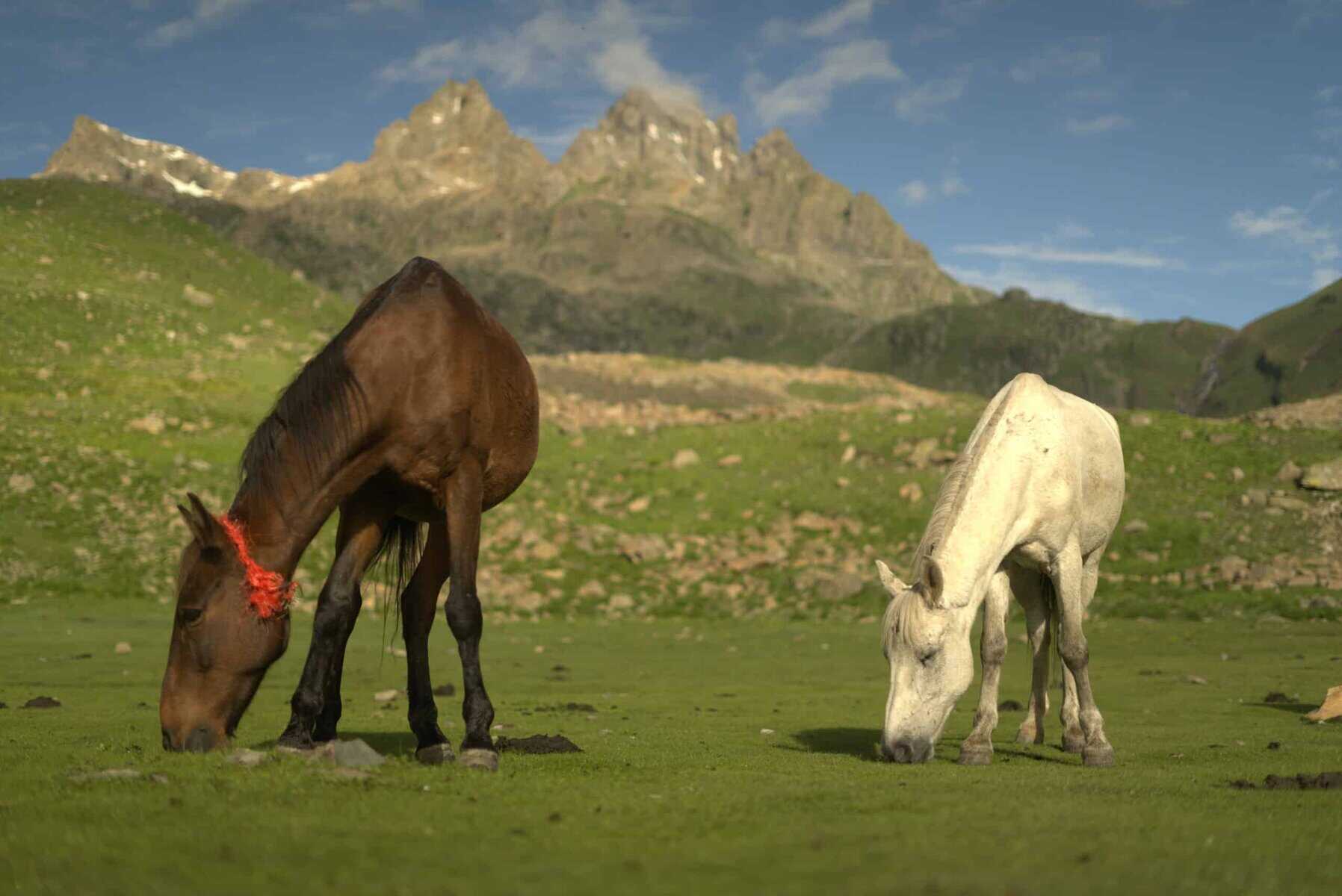
You will be transported to the top of the Gadsar valley by climbing up“Windows wall paper”Valley of Satsar. Satsar meadows are characterized by a smooth, manicured green lawn with a few maple trees and horses enjoying the graze. I have never seen greener grass elsewhere.
The Gangabal expanse is the last grassland. The valley below Zaj pass is almost like looking at the green world map. Gangabal in the blue looks just like Africa! Nandkol is on its side. The green landscape is also dotted by 4 lakes.
For me, the meadows at the trek are the best and most important reason to love KGL.
3. The lakes
The lakes are a must-see in any discussion about the Kashmir Great Lakes Trek. Before my exploration began, I only saw a few photos of the lakes and thought they were photoshopped images from a Scandinavian country. These lakes were not found in our mountains. These lakes at high altitude change color throughout the day.
Clear at dawn, sea green by afternoon, light blue by evening, and then inky blue by night. You will be amazed at the stunning lake scenery of Vishnusar, Kishansar, and the sea-green Gadsar with its ice floes.
4. The colors in Kashmir Great Lakes
KGL can be done best in July/August or early September. These months are monsoon in India, but the rains on the Pir Panjal side get much less. The mountains still get their summer rains, and the flowers explode into a rainbow of colors.
Different colors can be found in different valleys. There are pinks, purples and yellows as well as whites. The flowers change with the seasons. The colors of the sky and grass, rocks, water, and water all add to the beauty of the trek. It is not difficult to believe that Kashmir’s green is more vibrant than Kashmir’s blue. Each color is vividly saturated.
The vibrant colors of the Kashmir Great Lakes Trek will be a big hit with you.
Best time to do Kashmir Great Lakes Trek
To ensure a successful and enjoyable Kashmir Great Lakes trek, it’s crucial to timing your trek appropriately. The best time to embark on this Kashmir Great Lakes trek is during the monsoon season, specifically the months of July, August, and September. These months offer pleasant weather conditions and clear skies, allowing you to take in the stunning vistas of the surrounding mountains and lakes. However, it’s always important to check the weather forecast before embarking on your trek to ensure a safe and memorable experience.
How Difficult is the Kashmir Great Lakes Trek
The Kashmir Great Lakes trek is a moderately challenging ascent that reaches an elevation of 13,715 feet. Despite the tranquil and picturesque appearance of the trail in photos, it poses its share of challenges.
The trek spans 75 km over six days, averaging 12 km of trekking each day. You’ll need to ascend and descend 1500 feet daily. This trek has five tough segments that demand careful focus, such as the initial climb to Nichnai Campsite, the steady ascent from Nichnai Campsite to Nichnai Pass, the demanding climb to Gadsar Pass, the rocky stretch from Satsar to Gangabal, and the steep descent to Naranag.
The initial ascent to Nichnai Campsite presents a formidable challenge, as it demands a strenuous climb from Shitkadi (the starting point of the trek) to the Table Top (the first rest area). This grueling journey takes approximately 6-7 hours to complete and involves an altitude gain of 3,000 feet, which can be daunting and potentially lead to altitude sickness.
The journey on the second day of the trek presents another tough challenge with a 3-hour ascent to Nichnai Pass from the Nichnai Campsite. On the third day, you will encounter a 40-minute stretch with large rocks between Satsar and Gangbal. This part lacks a clearly marked path, requiring you to navigate by leaping and maneuvering around the boulders. It can be a difficult passage if you are not mentally and physically ready for it.
Mythological Stories About Kashmir Great Lakes Trek
The Harmukh mountain, rising more than 16,000 feet high, is revered in local lore as the abode of Lord Shiva. According to legend, a devout individual endeavored for twelve strenuous years to reach the mountain’s summit to meet the deity but was unsuccessful. Despite this, he achieved enlightenment during his quest and mysteriously disappeared from the hill. In tribute to Lord Shiva, a pilgrimage to Harmukh is undertaken, with devotees ascending to 14,000 feet to pay their respects to the god.
In 1856, Thomas Montgomerie led an expedition to Harmukh as part of the Great Trigonometric Survey, which resulted in the discovery of the renowned mountain K2. Prior to this, the mountain was unnamed and unknown to the surrounding villages due to its immense size. The survey team assigned the name K2, which has persisted as the mountain’s name despite the later adoption of a local name.
Frequently Asked Questions About Trek
What is the duration Of the Kashmir Great Lakes Trek?
The Kashmir Great Lakes Trek, a journey that spans a distance of 75 km over six days (including a day for travel to and from the trek starting point), is a challenge that requires thorough preparation. The elevation varies from 6,175 ft in Srinagar to 13,715 ft in Gadsar Pass. Each day, you can expect to trek an average of 10-11 km. Due to the demanding nature of the trek, it’s crucial to be well-prepared, both physically and mentally, to fully enjoy and conquer this adventure. The feeling of accomplishment and the breathtaking views you’ll witness at the end of each day will make every step worth it.
How difficult is the Kashmir Great Lakes Trek?
The Kashmir Great Lakes Trek is a popular hiking trail in India that spans over 70 kilometres through the Himalayas. This trek is famous for its breathtaking views of alpine lakes, snow-capped peaks, and lush meadows. The beauty of the surroundings will inspire you to keep going, even during the challenging parts of the trek. However, it’s important to note that the trek is quite challenging and requires good fitness and endurance. The route involves steep ascents and descents, rocky terrain, and high-altitude passes. The trek typically takes 7-8 days to complete, with an average walking time of 6-7 hours daily. Proper preparation and acclimatization are essential to ensure a safe and enjoyable experience on this trek.
How much is the Kashmir Great Lakes trek package?
If you are planning to trek to the Kashmir Great Lakes, you might be interested in the all-inclusive bundle that comes at a fixed price of 16500 per person. This bundle includes accommodation, meals, guide fees, and permits. However, it does not cover personal expenses, such as trekking gear, insurance, or any additional activities you might want to do during the trek. With the Kashmir Great Lakes Trek Bundle, you can have a hassle-free trekking experience without worrying about basic expenses.
Can beginners do Kashmir Great Lakes?
The KGL trek is an ideal adventure for those who are new to trekking as well as for experienced trekkers. However, it is crucial to be in good physical shape to enjoy the trek to the fullest. It is advised that individuals with certain medical conditions such as Bronchial Asthma, High Blood Pressure, Epilepsy, TB, Heart Problems, or a high BMI should refrain from participating in Himalayan treks for their safety. If you have any medical history, it is essential to inform us beforehand so that we can take the necessary precautions and make arrangements accordingly. Your safety is our top priority, and we have comprehensive safety measures in place to ensure a secure and confident trekking experience.


