
Trek Grade
Difficult
Highest Altitude
17,800 ft
Base Camp
Kathmandu
Best Time
Sept to Nov
Trek Distance
145 Km
Not sure which trek is right for you? Trekup India’s Mountain Experts have you covered.
Not sure which trek is right for you? Trekup India’s Mountain Experts have you covered. From figuring out if a trek matches your fitness level to knowing who you’ll be trekking with, we’re here to answer all your questions. Reach out to our Mountain Experts and plan your trek with confidence.
Annapurna Circuit Trek with Tilicho Lake
Annapurna Circuit, like The Great Gatsby in literature, is considered a timeless trekking classic. Since its launch in 1977, it has earned accolades as ‘the world’s greatest trek’ due to its diversity of landscapes from towering mountains to deep gorges, lush forests, and even desert-like regions. Beginning their trek from Kathmandu in Nepal’s capital city, Kathmandu, they will immediately experience the Himalayas with stunning rivers like the Marsyangdi River traversing two river valleys culminating at Thorang La Pass located 5,416 meters on the edge of the Tibetan Plateau. Annapurna Circuit Trek offers breathtaking corridors and towering mountain peaks that seem to reach toward the sky, making it difficult to distinguish between snow-covered summits and wispy white clouds. This trek’s stunning backdrop includes the Annapurna massif and other 8000-meter giants, as well as serene glacial lakes that add incredible diversity to this trek. From Manang village to the stunning Tilicho Lake at the heart of the Annapurna range, this trek offers an unforgettable journey full of breathtaking beauty and varied terrain. As one of Nepal’s most versatile treks, this journey showcases an astonishing tapestry of cultures and religions; lush Hindu villages in the foothills give way to Buddhist landscapes decorated with vibrant prayer flags for an extraordinary cultural immersion experience. Annapurna Circuit Trek is famed for its diverse landscapes rather than its level of difficulty, though there can be several difficult days and steep inclines as you gain altitude. Overall, though, the trek shouldn’t prove too taxing, but some challenging days might crop up once altitude gain has taken effect. Experience and physical fitness are invaluable assets in the Himalayas for two main reasons. Being fit helps adjust to thinner air at higher elevations; secondly, being prepared allows you to recognize signs of fatigue or difficulty more easily in the terrain. Annapurna Circuit Trek can be enjoyed throughout the year, except during monsoon season when heavy rainfall and snow can render certain sections impassable. Spring and autumn are generally considered ideal times to complete this trek – for more information regarding this trekking journey, continue reading here.
Trek Cost
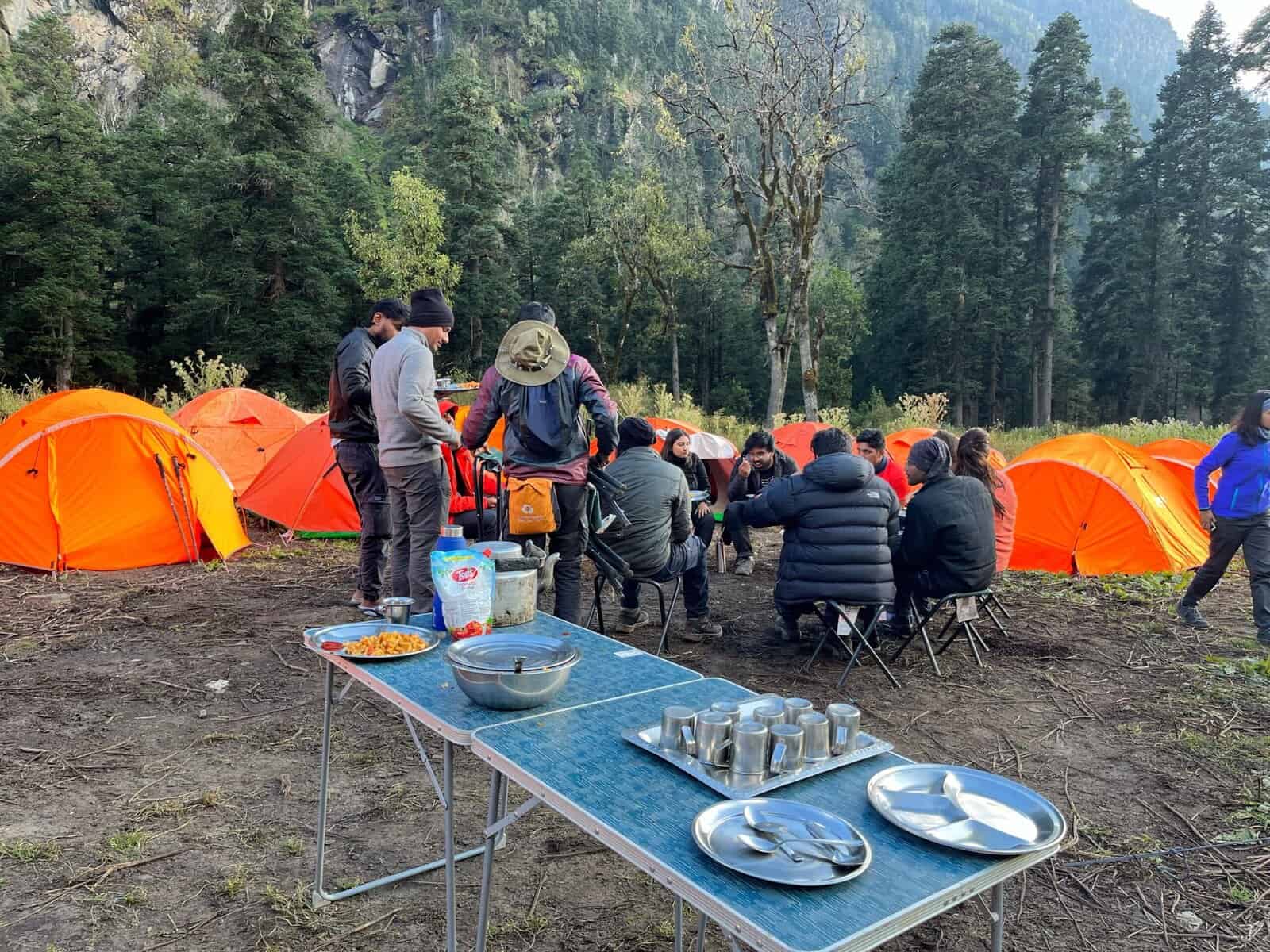
- Stay will be on a twin-sharing basis in tents
- +₹1800 Extra For Transport From Dehradun to Khanyasni and Return
- + 210 Trek Insurance (optional)
- Discount Policy
Pickup time 11.30 A.M from Manali.
Call Our Mountain Experts
Fix Departure Dates
Why Choose Trekup India?
Videos by experts watch these videos to prepare well for a Successful Trek

Want To Trek Like Pro?
Basically, watch these videos if you want to trek the same way professional trekkers do and make your skills better. These videos contain useful tips and techniques to further improve your trekking skills itself. These videos actually help both new and experienced trekkers improve their trekking skills. These videos definitely provide useful tips that make your trek better. We are seeing that these videos by Trekup India experts will only help you make your trekking skills better.


Know Everything About Acute Mountain Sickness
Acute Mountain Sickness occurs when people trek to high altitudes above 8,000 feet. This condition itself develops further due to reduced oxygen levels at such heights. Basically, as you go higher up, the air pressure and oxygen levels decrease, which causes the same problem. Acute Mountain Sickness surely causes headache, nausea, vomiting, and dizziness in affected persons. Moreover, peoples also experience difficulty in sleeping during this condition. To avoid mountain sickness, you should actually trek up slowly to higher altitudes. To learn further about this condition itself, watch the videos by Trekup India.


Day Wise Detailed Itinerary of Annapurna Circuit Trek with Tilicho Lake
Day 1
Arrive in Kathmandu (1,400M)
On day one, travellers will arrive in Kathmandu, Nepal’s vibrant capital city. Here, they’ll discover bustling streets filled with shops selling trekking and climbing equipment; towering mountains serve as a picturesque backdrop. Visitors from around the globe visit this vibrant metropolis to purchase high-quality gear for climbing expeditions; currency should be converted to Nepalese rupees as cash is the primary form of payment during treks. Taking this first day as an opportunity to acclimate to higher altitudes while meeting fellow trekkers as well as gathering essential details regarding an impending journey across Nepal’s breathtaking Himalayas.
Day 2
Kathmandu (1,400M) to Chame (2,550M) via Besisahar (760M)
At 06:00 AM, we embarked on our escape from Kathmandu by leaving our hotels early and traveling ten minutes to a bus stop before boarding a local minibus for our journey via the Dumre-Besisahar-Chame Highway to Chame. Travel time from Kathmandu to Besisahar takes about six hours, with the first hour spent navigating through Kathmandu city. Beyond this point, the highway to Dumre, which spans 148 km, is generally smooth and comfortable, providing scenic views of lush green mountains, valleys, and villages as we gradually descend toward warmer temperatures at 300 meters. Terraced farmlands laden with crops begin to appear along this journey towards our final destination. As we progress, our ascent begins, eventually leading us to Besisahar at 760 meters via cities, towns, and increasingly rural areas. Depending on road conditions (ie, construction debris, monsoon damage, or landslides), the final 30 kilometres between Dumre and Besisahar may be rough or even unpassable at times. At Besisahar, we will stop for lunch and a quick respite before transitioning from a minibus to a shared vehicle due to the narrow and rugged roads ahead. Determining whether we spend the night in Besisahar or press on to Chame depends on our arrival time and road conditions. However, we should travel straight to Chame on the same day, as it offers a more serene and less developed environment that’s conducive for exploration and acclimatization to higher altitudes. Doing this also saves travel time; though Chame is only 66 km away due to poor road conditions, nevertheless, arriving will reward us with a picturesque village in Manang district – one of Nepal’s least densely populated regions. Trekking along the western edge of the Marsyangdi River provides an aesthetically pleasing path leading to Chame from Besisahar. However, some trekkers opt to start in Besisahar and follow it until they reach Chame. Unfortunately, however, this option is marred by frequent dust clouds caused by passing vehicles as well as exhaust fumes from passing vehicles. Therefore, it would be more advantageous to take a vehicle directly to Chame, giving your body time to adjust before beginning trekking from this quieter town. After driving about fifteen minutes from Besisahar, we find ourselves on a road surrounded by dense forests and verdant mountains, where rice and millet are being farmed on terraced slopes. Dotted throughout this picturesque scene are colourful stone and mud houses typical of Nepalese settlements. On one side of a winding river flows mountains filled with homes, fields, and livestock lie below, while dense forests cover its higher slopes in an array of fifty shades of green. As villages become smaller and further apart until they eventually vanish altogether, suspension bridges span the river, providing convenient passage between mountains; along the route are numerous waterfalls cascading down their slopes, with at least one appearing every 20 meters or so. Mountains in this region tend to collapse. Due to ongoing construction work, we must consider both the time needed for operating heavy machinery like JCBs as well as potential delays that may occur as we plan for their use. Even though unpaved roads without barriers may seem hazardous, they are captivating. Without fencing to block out their views down into deep gorges that line these roadways. Waterfalls transform muddy roads into treacherous paths, adding an element of adventure. After driving for around three hours, the sight of Chamje waterfall will indicate its proximity. Here you can take a break from driving before continuing forward towards our goal – reaching an elevation of 2,550 meters at Chame Village, approximately three more hours later.
Day 3
Acclimatization at Chame (2,550M)
As the sun peeks out behind towering mountain peaks visible through your wooden window frame, Chame awakens as a charming town, providing welcome respite from driving on rough dirt roads. Lamjung Himal’s sublime presence shines especially brightly in this soft morning light. Rustic charm in the town is enhanced by stone houses, dirt roads, and the soothing sounds of a river. As evening approaches, sunsets become even more breathtaking with Manaslu North, Manaslu, and Phungi Himal peaks glowing brightly before dawn breaks. Chame’s well-stocked shops cater to your cravings with delicious snacks such as fried samosas and chips. Additionally, it’s recommended that you withdraw cash from Chame’s ATM as ATM options may become limited further along the trek. As an iconic stop along the Annapurna Circuit trek route, Chame boasts many lodges; however, food and drink prices have increased slightly relative to Besisahar (an increase that should continue throughout). At 9 AM, after enjoying a satisfying breakfast, we embarked on an excursion around our settlement to explore its surroundings and engage in some physical activity at higher elevations for optimal acclimatization. Chame View Point can be reached after a two-hour trek through dense pine forests with their steep terrain, where traversing it can be quite tricky. Beginning by passing through a village and fields of various crops, before reaching an increasing slope. No matter your approach, reaching the summit typically takes less than two hours. Chame View Point’s newly constructed platform affords breathtaking panoramic views of Lobuche Peak, Annapurna II, and Manaslu Mountains; these views can be enhanced further with prayer flags waving fluttering above towering trees that add visual beauty. A picturesque vista opens onto the tranquil village of Chame, nestled at its foot, flowing river and majestic mountains in the background, providing the setting for this picture-perfect landscape. Golden eagles soar overhead, adding another dimension of beauty. Ascending only takes 45 minutes; total distance walked is 6 kilometres, including ascent and descent. The village features two monasteries that add serenity, as dogs run freely, cows moo from houses nearby, firewood is neatly stacked in one corner, creaky wooden doors can be heard echoing around town as locals carry out daily tasks; taking a stroll through it reveals deep connections between Nepalese people and its towering mountains – relax for now because our real trek begins tomorrow – let it unfold before our real trek begins tomorrow, which promises exciting vistas all its own.
Day 4
Chame (2,550M) to Pisang (3,150M)
Today is sure to be an eventful journey, filled with new sights to take in and significant distance to travel. After spending the night relaxing at our cozy tea house in Chame, we fuel up early with breakfast at 0630 AM before setting out on our journey by 0700 AM. As we leave the village behind us, we leave behind its vibrant prayer flags, stupas, and chortens and let the Marsyangdi river guide us through the valley. Annapurna II towers majestically overhead – its silence providing a striking contrast against this busy landscape. Due to recent infrastructure development, a dirt road now connects Manang, and we must adapt our route accordingly. Some traditional trekking treks have been damaged by landslides, so for much of the day we will follow this vehicle route instead, diverting wherever possible to avoid it. The path begins against an idyllic background of alpine trees, winding its way upward with occasional short descents. Along its journey, you’ll come across an abundance of mani stones and chortens adorned with Buddhist prayers inscribed onto them and placed beside roads, rivers, or mounds as offerings to local spirits. According to tradition, travellers should pass these structures on the left side, symbolizing Buddhism’s belief in the clockwise rotation of the universe and the significance of circular patterns throughout religious practices. As we neared three hours, we reached a suspension bridge spanning the river. These are often seen throughout Nepal’s rural regions and feature metal cantilevers that sway gently when the wind blows across them. As soon as we cross, we turn off the main road and enter a dense pine forest where a well-worn trek winds its way amongst the trees. Bird calls, pine scent, and the sparkling turquoise river create an incredible atmosphere as we trek along this section of our journey. Today’s route involves an ascent of over 600 meters with gradual ascents interrupted by steeper sections, offering several opportunities for rest stops and replenishment along the way. After about an hour of trekking through forest paths, we rejoin the main road. Paungda Danda is one of the main highlights of today’s trek, dominating its scenery all along the trek. Situated southeast of Pisang Peak, this peak stands out for its unique western rock face that soars 1,500 meters above Marsyangdi River – this massive rock surface, known as Great Wall of Pisang can be seen visible on your right-hand side as part of this massive rock surface known as Swarga Dwar (doorway to heaven) where local belief holds that souls ascend this wall before reaching paradise. Today, you can visit an interesting location known locally as Dhukure Pokhari or “the dove pond.” Its shape reportedly resembles that of a dove, hence its moniker; this characteristic shape becomes most apparent when water levels drop significantly. Adjacent to it lies a small stone temple adorned with prayer flags. Nearby settlement shares its name with the nearby pond and stands at an elevation of approximately 3,185 meters. An hour’s walk away, there is a junction with signs pointing in both directions: Lower Pisang and Upper Pisang. Lower Pisang, located at 3,200 meters, boasts charming stone and wooden houses, flowering trees, prayer wheels, traditional Tibetan Buddhist symbols, as well as tranquil surroundings including yaks, firewood stacks, and stunning mountain views. Meanwhile, Upper Pisang, located on the mountainside below Pisang Peak, offers visitors the unique experience of an evening prayer service at its monastery – both offer memorable encounters between nature’s grandeur and spiritual tranquillity.
Day 5
Pisang (3,150M) to Manang (3,560M)
Today’s journey covers 16 kilometres and should take around five to six hours, starting off with breakfast at 6:30 AM. Tea houses along the Annapurna Circuit Trek offer comfortable accommodations and an assortment of food choices, providing travellers with an enjoyable travel experience. At 7 AM, after breakfast, our trek will start. Primarily following dirt roads towards Manang with occasional forays into trekking treks where available, the landscape shifts dramatically from lush alpine trees in Pisang to more rugged, earthy terrain in Manang. This region, nestled into the Himalayan rain shadow on the outskirts of Tibet’s plateau, boasts rugged cliffs, dusty treks, and unique vegetation that conjures images of Wild West-esque environments. There are two routes leading from Pisang to Manang; whichever trek follows through Humde is usually chosen as it takes you closer to town. As we explore Pisang village, passing stone houses and fields along a stone-paved path, we traverse its entirety. As we walk along the central walking path until reaching the village’s end, passing many prayer wheels placed along it, we then descend over a metal bridge over a river before ascending briefly back up again until reaching a chorten. Navigating through a wide track, making our way up what seems to be an endless climb, we make our way towards dense forest, veering off at any opportunity to take steeper routes to reduce road curvatures. At some point, the forest opens up into a suddenly different environment with dirt paths crisscrossing like river veins, towering rock faces, bushes dotting the landscape and scattered pine trees – an environment with the unmistakable sense that at any moment a ranger in cowboy boots on horseback might come trotting around a corner carrying his lasso! As we traverse more arid terrain now, we ascend gradually yet comfortably towards Bgoro Danda col (3,440m). Here, a spectacular panorama of Humde Valley with Chulu peaks as its backdrop will unfold before us. Ascending gradually towards Humde village with an airstrip that sees little use nowadays due to dirt roads being established through it, Humde marks our halfway point today’s trek and provides an excellent place for lunch breaks; there are restroom facilities within its walls as well. As the town dissipates, its scenery opens up to reveal a dramatic change in landscape – one where rugged, weathered spires rise from the earth like strange alien creatures, creating an otherworldly ambience. Terrain begins to transform into an earth-toned tapestry, with dry meadows’ rich hues of brown dominating the scene. Annapurna II, III, IV, and Gangapurna are majestic mountains that stand tall against the sun; Annapurna III and Gangapurna are particularly striking when seen from far away. When turning back around, Paungda Danda and Pisang Peak come into view once more. On the opposite side, an endless series of dry, jagged ridges seemingly sprawling endlessly under the sparkling snow-topped Chulu peaks are visible. Mungji (3,480M), an attractive village populated mostly by goats and suggesting its day’s destination may be within reach, is situated directly across from the river. Signposts here point towards Ice Lake and Milarepa Caves – two must-visit places to come back and explore on another day! From Mungji, it’s only a 30-minute stroll to Braka (3,500M). From there, it’s another journey through arid, open terrain where wild horses and yaks graze on any remaining greenery or just relax. This trek takes you past numerous chortens and mani walls before reaching a steep incline that leads you directly into Manang village – home of lodges, teahouses, and bakeries selling local bread! As you step through this sleepy village of roughly 200 residents, it feels like entering an alternate universe. Traditional stone and wooden houses, stone pathways, and rows of prayer wheels create an idyllic scene, drawing both locals and visitors alike to enjoy an idyllic afternoon reminiscent of indulging in an ice cream cone during a scorching city day. Manang is a charming village offering many amenities, from stores selling trekking equipment and services like visitor information centres and medical facilities, to tourist information services and medical facilities that may or may not always be staffed. Take advantage of any opportunities here to replenish funds or convert currency to NPR; exchange rates may not be as favourable. Make plans to arrive in Manang by afternoon; accommodations here are charming and welcoming, with delicious food offerings as well as charming cafes that specialize in top-quality coffee and desserts.
Day 6
Acclimatization at Manang (3,560M)
Manang is an ideal destination to help acclimatize to its high altitude, but with so much to explore in and around Manang, your day off might become as busy and exhausting as any trekking day.
Day 7
Manang (3,560M) to Shree Kharka (4,045M)
Today we will travel only 7-8 kilometers over an estimated 4-hour distance, so we can enjoy some extra rest after spending last night at Manang’s tea house, with its stunning view of Gangapurna and its glaciers right outside our window. At 08:30 AM, we will embark on our journey towards Shree Kharka, located at an elevation of 4,045 meters. Take five minutes to stroll through this charming medieval-style village for stunning scenery. Village dwellers lead visitors into expansive fields of crops where green blades dance in the breeze against a magnificent background of Gangapurna and Annapurna II-IV, with their snowcapped peaks shimmering brightly in sunlight. As we traverse further on our journey, a fork in the path presents us with two options – either an ascending road or steep, narrow treks, each offering stunning beauty and serenity. We opt for the latter route, a trekking path which leads us directly to a cable bridge spanning the river and then back onto a broad road, eventually arriving at Khangsar village and its marked metal gate entrance. Shortly afterwards, we arrive in a village, where numerous tea houses offer us warm hospitality and provide us with an opportunity to refuel. Nepal is well known for its archery tournaments, featuring locals clad in white robes showing their skills on an archery range, while football teams often compete against one another on wide open fields in friendly matches – both events drawing large crowds of locals, tourists, and trekkers alike. After 30 minutes since leaving Khangsar, we came upon another fork in our path with two options – a wide vehicle-friendly road and a steeper, narrower trek heading in opposite directions, each offering its benefits and challenges. After some thought and deliberation, we chose the latter, which, while more taxing for such a short stretch as 200 meters, proved a more direct and direct route. Notably, our chosen path eventually met up with the larger road, even though trek markers pointed in that direction. After an exhilarating 40-minute ascent, we eventually arrived at our day’s goal. The Shree Kharka trek was breathtaking, particularly after crossing a bridge, with majestic mountains looming ahead and creating the impression of walking into them directly. Along its narrow dirt path were vibrant wildflowers and bushes requiring careful foot placement on narrow dirt paths with careful foot placement needed. This leg of our journey was short and easy, with only moderately challenging terrain along its entirety. As evening temperatures dropped to around 6-7 degrees and lower at night, tea houses offered a cozy refuge complete with comfortable beds, nutritious meals, and thick blankets to help ease into their new environments and altitude. To ease into their surroundings and altitude, consider exploring nearby treks on dry brown mountains to help adjust.
Day 8
Shree Kharka (4,045M) to Tilicho Base Camp (4,110M)
Today might seem like an easy day compared to your recent activities, but be mindful on the trek through loose mountains. Blue sheep and mountain goats may make your trek hazardous with their playful antics that cause rocks of all sizes to come tumbling down at unpredictable speeds. While adorable animals like sheep and goats may seem harmless at first glance, their behaviour poses serious threats; their colour blends in well with barren brown mountains composed of loose rock and mud, so be cautious to stay alert of potential dangers!
Breakfast typically occurs around 07:30, and we start our trek shortly before 08:00 AM, following an identical path as before. First, we ascend a 100-meter incline before reaching undulating terrain that resembles camelback ridges with multiple ups and downs. After approximately 30 minutes on our trek, we crossed a river using a bridge spanning a deep gorge with stunning views of its bubbling river below. In the landscape are dry mountains with mud pillars resembling termite mounds, forming an incredible scene for our adventure. Once across the bridge, the trek becomes treacherous, winding around an unforgiving mountainside without much vegetation to cushion its surface and eventually leading down into the gorge below. This challenging section lasts approximately 50 meters before we reach a more secure path, which gradually ascends and offers secure footing.
Today’s journey involves traversing treacherous paths that ascend and descend along the side of a rapidly degrading mountain, along narrow treks with increasingly limited views of majestic peaks. Soon enough, however, we find ourselves transitioning into an environment characterized by barren, rocky and arid mountains, where various shades of brown offer no stable foothold. Soon enough we find ourselves among mysterious towering mud formations which were so captivating from a distance; now appearing even more mysterious and ancient as we pass through them.
Nepal is an eclectic blend of languages and cultures, creating an international atmosphere. When trekking unfamiliar treks, you’ll encounter individuals speaking different dialects from various regions who quickly become friends as you make progress toward Tilicho Base Camp at 11 AM – an impressive accomplishment as many trekkers reach this remote mountain campsite within one day! However, take some time out after trekking a significant elevation change (over 400 meters!) to explore these barren mountain treks to help acclimate yourself for future days that will take your journey even higher up into the altitudes.
Day 9
Tilicho Base Camp (4,110M) to Shree Kharka (4,045M) via Tilicho Lake (4,920M)
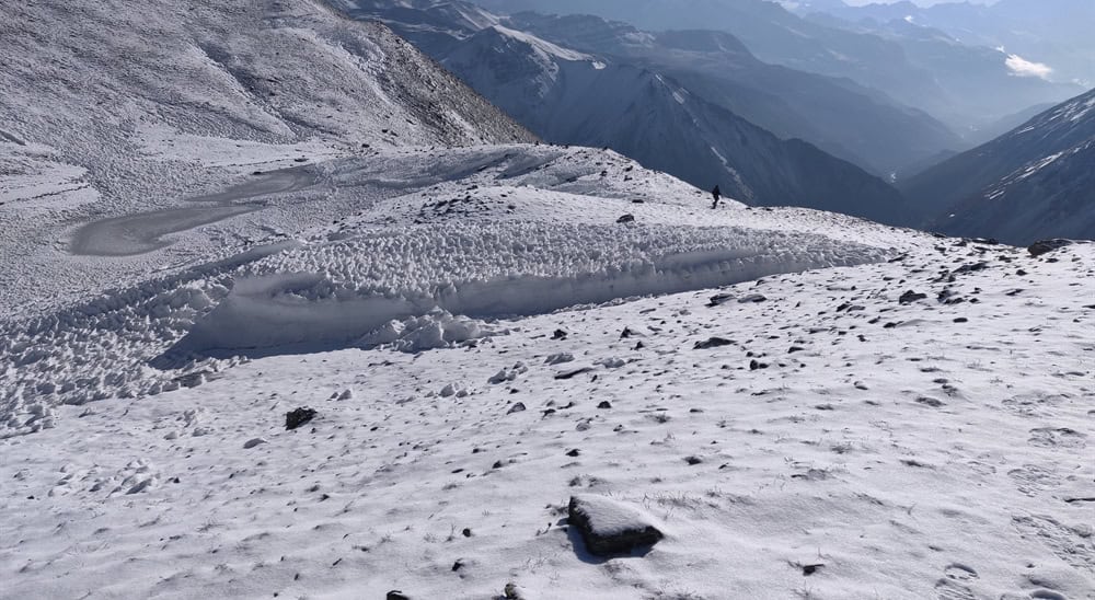
Day 9 will surely be exciting with an early 4:30 AM start and a packed breakfast in hand, setting off on our journey towards Tilicho Lake at an altitude of 4,920 m. As we trek, the trek winds its way upward through rugged, arid terrain characterized by loose moraine and steep inclines that require special consideration. As we ascend, breathtaking scenes reveal themselves beneath us: river valleys below and snowcapped mountains towering overhead. Morning air is crisp and dry, filled with the promise of magic as the sun begins its trek behind us to illuminate the landscape with warmth. But the terrain remains challenging, with landslides and stones making every step an endurance test. After 2.5 hours of navigating treacherous hairpin bends, we entered a snow-covered area where a steep and continuous climb began, ascending 800M in altitude. Finally, a signpost and a blue and white marker pole signalled our arrival near Tilicho Lake, filling us with excitement and anticipation!
But don’t be misled into thinking you are almost there; the lake remains hours away, its poles stretching out before you like an endless obstacle course. This landscape reveals itself as an expansive flat terrain covered by knee-deep snow that has been carved by fierce mountain winds into fascinating shapes. It resembles a frozen sea with waves suspended in time – an intoxicating sight. You see an endless sea of white spread out before you, only broken by vibrant colours from hundreds of prayer flags fluttering in the wind near a small temple, near a lake. Based on time of year and snowfall levels, Lake Titicaca can vary dramatically in appearance from year to year, from vibrant blue oasis to vast, glassy ice rink, obscuring its true beauty beneath a thick blanket of ice. While travelling from base camp to Lake Titicaca is no short journey, taking roughly 3-4 hours over its 6km distance, you will certainly be rewarded with breathtaking scenery!
After our brief excursion, we return to base camp, finding that the journey downhill was significantly faster. Within two hours we arrive back at base camp where we enjoy a welcome respite, refresh ourselves, enjoy lunch by the fire, and warm ourselves by it after our early morning adventure. While Tilicho Lake proved rewarding, now is the time to rejoin the main trek around Shree Kharka massif before setting out again towards Shree Kharka for the descent.
Shree Kharka, located 7 kilometres away, should take around two hours due to its familiar path and altitude decline. As we had to ascend and descend multiple times on Day 8, now is an opportune time to regain any lost altitude from previous descents. After exerting ourselves so much this morning, today might prove challenging, but still manageable. Our path to Shree Kharka narrows and becomes dusty again; be considerate to other trekkers by giving way, when necessary, as the trek only allows one trekker at a time. With towering mountains surrounding our trek routes looming large on all sides, it would be impossible to take it all in at once; hence, resting is highly advised as more long days lie ahead on our journey.
Day 10
Shree Kharka (4,045M) to Ledar (4,240M) via Yak Kharka (4,000M)
At this point in our trek, we have completed 10 kilometres. The total duration should range between 6 and 7 hours as we depart the comfortable days of initial trekking towards an elevation of 5,416 meters – today marks the beginning of a difficult but ultimately exhilarating journey! Setting goals may prove challenging at first glance; once they are accomplished, though, you may find yourself yearning for more excitement on this exciting adventure! Following our restful rest day that stretched into the afternoon on Wednesday, we set out for Ledar at 8:00 AM this morning. The journey from Yak Kharka spans 10 kilometres, with another 3 kilometres needed to reach Ledar. Although Yak Kharka offers various accommodation options, it would be more practical for us to push further today and establish ourselves in Ledar for easier traveling tomorrow. Yak Kharka and Ledar have grown increasingly popular as rest stops for trekkers heading toward Thorang Phedi, as more recognition has been brought to bear on their difficulties. Now these villages boast cozy lodges and welcoming cafes for trekkers passing through. Though not overly steep, the altitude makes the climb feel exhausting. After an exhausting 30-minute ascent of 120 meters, we reached what had once been an enchanting village; now reduced largely to rubble. However, from this vantage point, the landscape opens up to reveal lush valleys ahead. The mountainside has been terraced carefully for agricultural purposes while large herds of wild yaks, horses, and blue sheep roam freely throughout this vast region.
After about an hour and a half of trekking, we finally reach the summit of a hill and are met with stunning views over the valley below. A serpentine river winds its way across a landscape, passing by a village at the base of rolling hills amidst lush emerald-green fields and strange termite mound-like formations. At last, we reached our destination. Before us spreads an impressive landscape dominated by the Gangapurna, Annapurna II-IV mountains towering overhead. From our lofty perch, we start the treacherous descent, giving up any elevation we had gained along the way. Once at the bottom, we cross a long suspension bridge that spans a river with high swinging arms, offering stunning views. At its opposite side lies a terrain change and an uphill battle to gain back lost altitude; luckily, there are numerous tea stalls scattered along our journey providing us with welcome relief to replenish energy reserves and give us strength. After our ninety-minute ascent, we reach Yak Kharka – an easily identifiable landmark with vibrant markers adorning rocks along the trek, ensuring an easy journey. Here you can decide to stop for lunch or continue to Ledar, just an hour away, where you can settle in and dine – be quick though as darkness sets early at Yak Kharka, bringing a sudden chill with it! Ledar lies ahead: just an easy trek across flat terrain with roaming yaks and horses that roam freely across flat terrain; after crossing a metal bridge lies Ledar: an oasis-like village offering tranquillity, whatever season may bring with it!
Day 11
Ledar (4,240M) to High Camp (4,850M) via Thorang Phedi (4,540M)
This trek covers 6 kilometres and typically takes 4-5 hours to complete. Although its distance may seem short, arriving at High Camp with plenty of time in hand is important as accommodations (with only 110 rooms available) fill quickly during peak seasons; additionally, altitude sickness may slow our progress despite taking such a short route. At approximately 07:30 AM, our departure will commence. After ascending 150 meters, which typically takes 40 minutes to complete, a brief descent leads us onto a flat trek for approximately 10 minutes before we return downhill again. Take time to take in the sights, as failing to do so may mean missing an incredible panorama of Annapurna III and Gangapurna glistening with hues of red during a gorgeous Himalayan sunrise. At 50 minutes, we reached a fork in the road; here, there are two paths, with one leading straight ahead while the other deviates towards a suspension bridge. Both routes lead to the same destination, so choose the route based on your taste. If you enjoy crossing swinging metal bridges, the latter route might be best. After crossing the river, each path entails a steep incline of approximately 35 meters. Thorang Phedi is approximately 5 kilometres from Ledar and takes about two to 2.5 hours by bus or car to reach. Surrounding Thorang Phedi are rugged cliffs, crags, and ridges – hence its Nepali name of Phedi, which translates as ‘bottom of the pass’. Thorang Phedi offers accommodation options if needed; however, High Camp should be visited instead to reduce distance and altitude gain the following day and increase chances for successful acclimatization through gradual elevation gains on your journey towards Thorang La.
Accommodation and dining standards at both locations are comparable, so don’t let this influence your choice of where to stop for the day. Climbing High Pass involves an approximately 300-meter steep climb along a well-marked, rocky trek that should take no more than an hour if starting from Thorang Phedi at 10:30 AM and arriving by 10:30 AM; with ample time on this scenic trek home to blue sheep providing pleasant company along the way! However, any decision about proceeding directly to High Pass should be made collectively after taking into account each group member’s comfort with altitude adjustment and confidence when taking on the higher elevation challenge.
High Pass Lodge features 110 rooms that can comfortably house two to three guests each, along with four shared bathrooms and a large dining area that’s divided into multiple sections for easy navigation. Guests can dine on pancakes, pasta, pizza, and beer from their cozy interior while experiencing mountain breezes at this altitude. A brief acclimatization walk may help guests prepare for the pass ascent while enjoying mountain breezes at this altitude; visitors from different tea houses often gather in this dining area, where visitors gather together, socialize, read cards, or swap stories while having fun activities to keep guests busy for days.
Day 12
High Camp (4,850M) to Muktinath (3,765M) via Thorang La Pass (5,416M)
Distance covered: 15.5 kilometres, total duration: 6.5 hours. On the previous night, everyone inquired about departure times, stops, weather forecasts, clothing layers needed, and dining preferences in a lively dining area from which all small groups and individuals moving towards a mountain pass congregated. By 4 AM this morning, all were up early enough to gather in their dining rooms with sleepy yawns and lively chatter filling the air, like one big happy family.
As soon as breakfast has finished at approximately 5 AM, our ascent begins. Since it’s still dark out there, we will climb using torchlight and should exercise extra caution on this narrow trek that may become treacherous due to ice or moraine formation. Assure your head-torch has enough battery power for at least several hours of travel ahead. If you stayed at Thorang Phedi, early departure may be required and more elevation gained; plan your supplies accordingly. As this climb can be strenuous and air dry, carrying at least two liters of water may help ease discomfort by keeping your throat hydrated. An hour of climbing through an unlit gully in darkness may be tiring, but as dawn arrives and unveils breathtaking views, energy returns in spades. Beholding the majestic mountains at first light can inspire awe, with Gangapurna and Annapurna III sparkling under the sun’s light. However, given that this climb is continuous and steep, finding a comfortable pace and rhythm may prove helpful for ensuring success.
The trek winds through soft, dusty mountains that seem almost delicate. As you progress, snow gradually appears in various shapes and forms – inspiring perseverance through colder temperatures. However, the final stretch to the pass may prove challenging due to deceptive false peaks; taking around three hours to cover this last four kilometre stretch. Pay attention to your body’s signals to ensure an enjoyable journey.
At Thorang La Pass, look out for rocks covered in prayer flags that mark your arrival. Once you reach that point and feel the strong wind pushing from all directions, you will know you have arrived at this well-known pass. Given its cold and harsh winds, it is wise to snap some photos, briefly celebrate, and enjoy some hot tea at the small tea house located there before beginning your descent back towards Muktinath, though remember this journey may take many hours.
Consider stopping to appreciate the breathtaking views along Kali Gandaki Valley’s winding trek, with its dramatic backdrop of mountain ridges and moraines. While there are countless mountains to see and identify, one of the main highlights is seeing Dhaulagiri Peak. Parts of the trek may become soft due to landslides; therefore, it is wise to keep an eye out for red and white markers on your way. As we transition from dusty mountains to verdant lands and rugged rocks, the scenery progressively transforms with each step we take downhill. At the end of a challenging descent with trembling knees comes an incredible sense of accomplishment; at which time hot showers await, as do delicious meals, plus Wi-Fi connectivity will soon return.
Day 13
Muktinath (3,765M) to Jomsom (2,880M) via Lubra (2,990M)
Tomorrow we will complete 19 kilometres over 5 to 6 hours as the Annapurna Circuit Trek comes to a close, and tomorrow we board a bus back to Pokhara. Even if you think you have seen all its breathtaking sites along the way, be prepared for an incredible experience as every day of Annapurna Circuit Trek offers something different and stunning – we have selected Lubra as an idyllic route from Muktinath to Jomsom for this leg of our trek.
Today we won’t need to rush as our primary objective is Jomsom, a larger city located at lower altitude. In the morning we explore Muktinath – an acclaimed pilgrimage destination with sacred sites for both Hindus and Buddhists that holds plenty of surprises for visitors! There’s plenty to see and experience around Muktinath!
As we leave Muktinath for Lubra, the goal is to reach Lubra by lunchtime – an approximate journey time of 3.5 hours. As we leave town, we navigate our way through its bustling streets lined with cafes and tourists before taking an under-explored trek leading into the desert landscape on our left. As we pass towering mountains to our left and a valley to our right dotted with small villages, apple orchards, and livestock on either side, the scenery becomes increasingly stunning. Less travelled by trekkers than other paths, this trek may even remain completely alone until reaching Lubra village approximately halfway to Jomsom. This day’s trek features several steep ascents, but the amazing views of Dhaulagiri, the peaceful atmosphere, and the stunning landscape all combine for an enlightening and pleasurable experience. As we descend towards Kali Gandaki Valley, the scenery shifts into dry, rocky, and windswept terrain – quite the opposite view from lush surroundings!
Lubra stands out among other high-altitude villages for its breathtaking landscape and unique geography, making it truly unforgettable. Situated atop a rugged mountain slope, this small high-altitude village provides the ideal place to take a break, recharge your energy reserves, and avoid harsh winds. The main village can be reached via a long suspension bridge spanning the river to its left. A charming tea house can be found within this village, offering delicious homemade cuisine as well as providing insight into traditional village life. Be sure to experience their cuisine and their way of life; the valley is famous for its strong gusts that make each step an adventure! Once our lunch break has passed, we’ll cross the river and tackle its windy terrain, winding our way down Panda Khola before joining the main trek to Jomsom, where vehicles provide welcome relief from solitude in the mountains. By late afternoon, we should arrive in Jomsom’s bustling trading hub, where lodges are conveniently situated near its airport on its outskirts.
Day 14
Jomsom (2,880M) to Pokhara (820M)
Journeying from Kathmandu to Pokhara by bus takes approximately 160 kilometres over narrow mountain roads. Beginning at 9:00 AM, local buses gradually traverse rugged terrain with views of lush valleys below; as we descend lower lands the temperature increases and surroundings become more crowded; landscape transitioning between larger villages and lush green mountainsides as the journey proceeds; expected arrival is around evening time so it is recommended to plan further travel for tomorrow.
We’ve prepared a comprehensive Trek Route Map for your upcoming adventure to Annapurna Circuit Trek with Tilicho Lake, which outlines the entire journey including all stops and trails. This map provides detailed information on the terrain, distance between points of interest, and estimated travel time to help ensure a safe and enjoyable trek. We’ve carefully curated the map to ensure that you have all the necessary information at your fingertips. Please take a moment to review it thoroughly, and don’t hesitate to reach out if you have any questions or concerns.
The Trek Altitude Chart is a useful tool for Trekkers to monitor their altitude changes during their rides, allowing them to plan their routes more efficiently and track their progress over time. This Annapurna Circuit Trek with Tilicho Lake chart is beneficial for both casual and experienced Trekkers, helping them make the most out of their Trek experience.
Trek Cost Inclusions
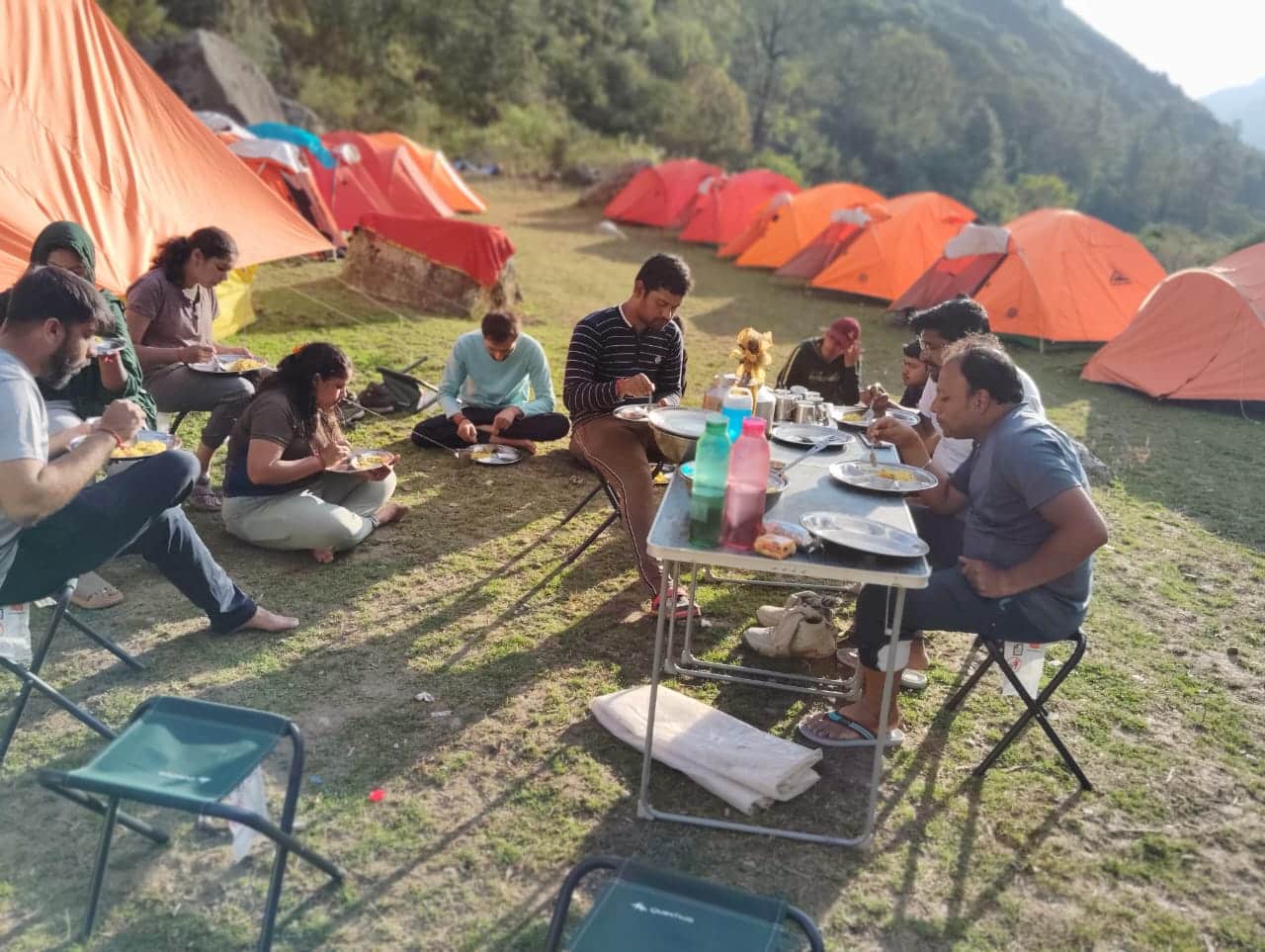
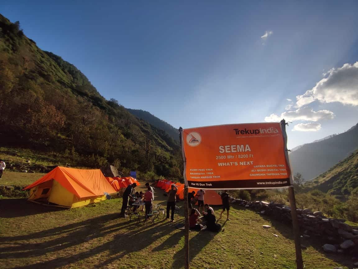
- Stay: 13 Nights of tented accommodation at individual campsites of Trekup India on twin sharing.
- Meals: Trekup India will provide freshly cooked meals during the trek starting with Lunch on Day 1 to Lunch on day 14 (Meals are simple, nutritious, and vegetarian)
- Trek Insurance (Optional): Trekup India recommends that all trekkers consider getting trek insurance. This is optional, but highly recommended. Trek insurance covers unexpected events that may occur during your trek. The cost of the insurance starts from INR 210. Please read more about what is included in the coverage and why it is mandatory on treks.
- Trek Equipment: Sleeping bag, Sleeping tents, Kitchen tent, Dining tent, Toilet Tent.
- Amenities: All utensils, sleeping mattresses (Black foam mats), Crampons, and Gaiters for snow.
- Health & Safety: First Aid Box, Oxygen Cylinders, Stretchers, Oxi meters, BP Machines, health.
- Permits: Forest Permits and Camping Permission Fee
- Trek Crew: High Altitude Chef, Helpers, Trek Leader & Guides, and other support teams.
- Potters & Mules: Potters and Mules are to carry all trekking equipment, ration, and vegetables.
Trek Cost Exclusions
- GST 5% (it is Mandatory)
- Any Meals/accommodation beside the itinerary or not mentioned in the program.
- Any Bus / Airfare to/from trek start/end point
- Personal Medical expenses do carry your medication.
- Any personal services such as Laundry, phone calls, liquors, mineral water, etc.
- Any still / video camera fee
- Any Entrance fee Monuments, Monasteries, Museums, Temples – Pay directly on the spot.
- Backpack Offloading (Mule/Porter Charges)
- Offload Charges: ₹ per bag for the full trek if paid online in advance.
- On-spot Payment: Charges may increase by up to 30% if paid at the base camp.
- Weight Limit: Each bag must not exceed 10 kg.
- Note: Offloading is optional and is recommended for those who prefer to trek with a lighter daypack.
- Any emergency evacuation charges
- Any services that are not mentioned in the cost inclusion section.
What should you pack for the Annapurna Circuit Trek with Tilicho Lake
Annapurna Circuit Trek with Tilicho Lake is a high-altitude trek. The trekking gear you have to have for this particular trek differs from normal treks. Thus, read this whole segment. There is an important question that the trekker who is doing trek asks, like what all things to carry while trekking. Below, we have provided the details on everything you should take; an easy way to remember is by Head to foot or foot to head. We have prepared from Head to foot.

Head Gears
When trekking it's important to carry headgear to protect your head and face.
Heading out for a trek? Don’t forget to carry headgear to protect your beautiful face and head from the sun, wind, and dust! It’s an essential accessory that keeps you safe and comfortable throughout your adventurous journey. So, make sure you pack it before you step out into nature!
- Head Lamps – When trekking at night, headlamps are essential to illuminate your path while keeping your hands free. Headlamps come in different sizes and lumens, so it is essential to choose one that suits your needs.
- Hats or Cap – Caps or hats are also necessary when trekking in different weather conditions. Caps protect your head from the wind and freezing temperatures at night, while hats provide shade and protection from the sun during the day. It’s essential to ensure that your hat has a strap to prevent it from being blown away by the wind.
- Sunglasses – Sunglasses are also essential for trekking. Your sunglasses should protect your eyes from harmful UV rays and fit your face perfectly to avoid falling off while climbing, jumping, or crossing obstacles. The glass of your sunglasses should also be designed for different weather conditions to provide optimal visibility.
- Buff / Balaclava – Lastly, a buff or balaclava is a must-have to protect your mouth or neck from extreme temperatures and keep them warm. Buffs and balaclavas come in different materials, thicknesses, and designs, so it’s important to choose one that suits your needs and preferences. Depending on the weather conditions and your activities, you can wear them as neck warmers, face masks, or headbands.
Clothes
When trekking in high altitudes, prepare for cold weather by wearing layers. Layering traps heat, keeps you warm, and allows you to easily adjust your clothing as temperatures fluctuate.
Layering is important for different seasons when trekking. When planning a high-altitude trek, it is important to prepare for the cold weather. Wearing layers is the best approach as it provides both protection and flexibility when the weather changes frequently in the mountains. Layering helps to trap heat and keep your body warm, while at the same time allowing you to easily adjust your clothing as the temperature fluctuates. By wearing layers, you can enjoy your trek comfortably and stay safe in the unpredictable mountain weather
- For spring, summer, and monsoon treks, consider wearing three layers: a woollen sweater, a fleece, and a padded jacket.
- For autumn treks, add one more fleece layer to make it four layers.
- For winter treks, you may need five layers with thermals, a woollen sweater, two fleeces, and a padded jacket.
- T-shirt/sleeve shirt– Bring three T-shirts and two quick-dry trek pants, wearing one and carrying the others. Long sleeve shirts help to protect from sun UV rays. We recommend synthetic T-shirts as they get dry quickly when they get wet.
- Hiking / Trekking Jacket– down jackets (-5 to-10 C) or two-three-layer jackets.
- Thermals– at least two pairs of thermals help keep the body warm during cold weather.
- Undergarments– you can carry them according to your habitual and hygiene requirements.
- Gloves– 1 pair of gloves will keep your hand warm and nice.
- Trek Pants– Bring 2 to 3 comfortable trekking pants. Trekking pants play a significant role, as they are designed for comfort and mobility, making trekking easier. It should be Synthetic so that it gets dry quickly when wet.
- Rain Wear– you can carry a raincoat or Poncho. During long rains and snowfalls, the waterproof jackets start leaking. Still, the Poncho and raincoats keep you dry, so choose accordingly.
Tip: If you choose a raincoat on your trek, carry a small waterproof cover so things inside your backpack can’t get wet. If you carry a Poncho, you don’t need to worry. It protects both you and your backpack.
Foot Gears
When it comes to planning a trek, one of the most important aspects is to ensure that you have the right kind of foot gear.
- Trekking shoes which are waterproof and have ankle support. Walking / Hiking sandals which can be used off the trek, i.e., in the morning and evening hours when you reach the campsite, basically to get your feet rest from heavy boots, sometimes used for crossing streams and rivers, it’s more comfortable and safer than crossing barefoot or wetting your shoes. Sneakers (Optional) can be worn for normal driving days or used around the camp.
- Socks– you should at least carry 3 to 4 pairs.
- Microspikes & Gaitorswill be provided by Trekup India when required. You don’t have to carry them.
Personal First Aid Kit
Don't forget to pack your personal first aid kit! It's always better to be safe. So, make sure you're prepared for any unforeseen circumstances.
Below are some common medicines generally required/used during your adventure trip; however, please consult your doctors prior.
- Antiseptic towel or water syringe (to clean the wound)
- Butterfly bandage for a small cut
- Cotton and elastic bandages and sterile gauze pad for larger wounds
- Latex gloves are used when the wound bleeds.
- Medicine for Diarrhea (Upset stomach)
- Medicine for cold, flue/fever, headache
- Some pain killers
- ORS pouches
- Quick pain relief spray (External use)
- Any personal medicine prescribed by your doctor
- Dimox / Similar for high altitude sickness
- Bug Repellent
- Carry some nutria/energy bars and drinks (non-alcoholic)
- Note: Kindly consult your doctor before purchasing or taking any medicine.
Gadgets and Other Items
You might also consider bringing a camera, binoculars, portable charger, and snacks. Be well-prepared and tackle any trail with confidence.
- Trekking Poles
- Mobile phone
- Camera
- Spare batteries for phone and camera, power bank
- Lightweight flashlight or headlight
- A waterproof bag made of plastic is used for the camera.
- Plug/converter for electrical items
- 1-litre water bottle
- A journal with a pen would be a good idea to keep your notes.
- Some book of your interest for the ideal time
- Get into the habit of maintaining a Map and guidebook of the region.
Hygiene & Personal toiletry
Remember to pack hygiene and personal toiletry items such as soap, shampoo, toothbrush, toothpaste, deodorant, and toilet paper.
- Sunscreen with UV protection to shield your skin from harmful rays
- 1 or 2 small quick-drying towels to help you dry off quickly in case of rain or sweat
- Toilet paper, tissues or wet wipes for maintaining hygiene while on the trek
- Toothbrush, toothpaste, and mouth freshener to keep your mouth clean and fresh throughout the journey
- Deodorant or talcum powder to help you stay fresh and odor-free, especially during hot and humid climates
- Shampoo to keep your hair clean and healthy
- Sanitary pads or tampons (for female trekkers) to manage menstrual cycles
- Lip-gloss or salve to protect your lips from dryness and chapping
- Bio-degradable soap to keep yourself clean and hygienic while on the trek
- Nail clipper and other personal items that you use daily
Compulsory Documents to Carry
There are certain documents that you should always carry with you. These documents are not only necessary for your safety and security, but they may also be required by local authorities.
These files must be submitted to the Forest Department before your trek. With none of these, you will not be permitted to trek—original and photocopy of government photo identity card. Carry IDs like Aadhaar, voter ID, etc.
How To Plan Your Trek & Reach Kathmandu, Nepal?
The Start Point for the Annapurna Circuit is Besisahar; the end point will be Jomsom/ Pokhara.
By Road: By Jeep or bus from Kathmandu to Besisahar will take approximately eight to ten hours.
Pokhara to Kathmandu by road takes 6-8 hours, or you can take the 30-minute flight.
By Air (return): From Jomsom in Nepal to Pokhara takes only 20 minutes via flight.
Fitness Required & Preparation Guide For Annapurna Circuit Trek with Tilicho Lake
If you’re preparing for a Annapurna Circuit Trek with Tilicho Lake, Trekup India recommends jogging as part of your fitness routine. Jogging helps work out the same muscle groups that you’ll use during trekking and can help you build endurance. You don’t need any special equipment to get started.

Fitness Target
Trekup India has put the Annapurna Circuit Trek with Tilicho Lake into an easy-to-moderate-grade-level trek.
For Easy – Moderate Treks – In order to be well-prepared for your upcoming trek, it is recommended that you focus on building your endurance by aiming to cover a distance of 4.5 kilometers in less than 45 minutes. This will help you to develop the necessary stamina and strength required to successfully complete your journey.
How to Achieve This Fitness Target?
To start preparing for your trek:
- Try jogging for at least five days every week.
- If you find 4.5 km too difficult at first, begin with 2 km and gradually increase over 2-3 weeks.
- Once you feel more comfortable running 4.5 km, focus on improving your speed gradually on a daily basis.
It is important to ensure that you can consistently complete 4.5 km in under 45 minutes for at least two weeks before your planned trek. Allow yourself 6-8 weeks to prepare physically for the journey.
Strength Training exercises that benefit Trekking
Trekking is an activity that demands a good level of strength.

Trekking is a demanding activity that requires good cardiovascular endurance, muscular strength, and overall fitness. To help you prepare for your trek, incorporating bodyweight exercises into your training routine can be an effective way to build strength, improve stability, and enhance endurance, all of which are crucial for a successful trek. In this regard, here’s a breakdown of body weight exercises categorized by the specific body parts they target and the benefits they offer during trekking.
1. Lower Body Exercises
Lower body exercises like squats and lunges are great for building lower body strength, essential for trekking.
a. Squats
Squats are an excellent exercise for building lower body strength, essential for trekking. They target the quadriceps, hamstrings, glutes, and calves. Solid quadriceps and glutes provide power for ascending and tackling uphill climbs, while vital hamstrings aid stability during descents. This is particularly helpful in navigating uneven terrain during trekking.
How to perform Squats Exercises:
- Stand with feet shoulder-width apart, toes pointing slightly outward.
- Lower your body by bending your knees and hips, keeping your back straight.
- Lower until your thighs are parallel to the ground or as low as comfortable.
- Push through your heels to return to the starting position.
b. Lunges
Lunges target the quadriceps, hamstrings, glutes, and calves. They improve lower body strength, balance, and stability, crucial for maintaining control on rocky trails and steep slopes. Additionally, they enhance flexibility, reducing the risk of injury while trekking.
How to Perform Lunge Exercises:
- Stand with feet hip-width apart, hands on hips or sides.
- Take a step forward with one foot, lowering your body until both knees are bent at 90-degree angles.
- Push through the heel of your front foot to return to the starting position.
- Repeat on the other side, alternating legs.
2. Upper Body Exercises
Upper body exercises such as push-ups and pull-ups effectively strengthen the upper body, especially the chest and shoulders, which are essential for carrying a backpack during treks.
a. Push-Ups
Targets: Chest, shoulders, triceps, and core.
Benefits for Trekking: Push-ups are an effective exercise to strengthen the upper body, especially the chest and shoulders, essential for carrying a backpack during treks. Improved upper body strength will also help maintain posture and stability while traversing challenging terrain.
How to Perform Push-Ups Exercises:
- Start in a plank position with hands shoulder-width apart and body in a straight line from head to heels.
- Lower your body by bending your elbows until your chest nearly touches the ground.
- Push through your palms to return to the starting position.
- Keep your core engaged throughout the movement.
b. Pull-Ups/Bodyweight Rows:
Targeting the back, biceps, and shoulders can significantly benefit trekking. You can strengthen these muscle groups by performing pull-ups or bodyweight rows and improve your posture and balance while carrying a backpack. Additionally, more muscular back muscles can help reduce the risk of back strain and fatigue during long treks, making your journey safer and more comfortable.
3. Core Exercises
Core exercises like planks and Russian twists can help strengthen the core muscles, which are crucial for maintaining stability and balance while trekking on uneven terrain.
a. Planks
Targets: Abdominals, obliques, and lower back.
Benefits for Trekking: Planks are an effective exercise that helps strengthen the core muscles. These muscles are crucial for maintaining stability and balance while trekking on uneven terrain. A strong core also helps improve posture, reducing the risk of back pain and fatigue during extended hikes.
How to Perform Planks Exercises:
- Start in a plank position with elbows directly under shoulders and body in a straight line from head to heels.
- Engage your core and hold the position, avoiding sagging or arching the back.
- Keep breathing steadily and hold for the desired duration.
b. Russian Twists
Targets: Obliques, abdominals, and lower back.
Benefits for Trekking: Russian twists engage the core muscles, particularly the obliques, improving rotational stability and balance. Enhanced core strength helps prevent injuries and improves overall performance during trekking.
How to Perform Russian Twist Exercises:
- Sit on the ground with knees bent and feet flat, leaning back slightly to engage the core.
- Clasp hands together and twist the torso to one side, bringing the hands towards the ground beside the hip.
- Return to the centre, then twist to the other side.
- Continue alternating sides for the desired number of repetitions.
4. Full Body/Cardiovascular Exercises
Full-body/cardiovascular exercises like burpees and mountain climbers are excellent for improving cardiovascular endurance, strength, and agility.
a.Burpees
Burpees are an excellent full-body exercise that targets your legs, chest, arms, and core. This exercise dramatically benefits trekking enthusiasts, improving cardiovascular endurance, strength, and agility. Regularly incorporating burpees into your workout routine can enhance your overall fitness level, which can help you endure long hikes and rugged terrains with ease.
How to Perform Burpees Exercises:
- Start in a standing position.
- Squat down and place hands on the ground.
- Jump feet back into a plank position.
- Perform a push-up.
- Jump feet back to the squat position.
- Explosively jump up into the air, reaching overhead.
- Land softly and repeat the sequence.
b. Mountain Climbers
Mountain climbers target the core, shoulders, chest, and legs. This dynamic, full-body exercise can significantly improve cardiovascular endurance and agility. It is an excellent functional workout for trekking preparation as it engages both the upper and lower body muscles while strengthening the core muscles.
How to Perform Mountain Climbers Exercises:
- Start in a plank position with hands shoulder-width apart and body in a straight line from head to heels.
- Drive one knee towards the chest, then quickly switch legs, alternating in a running motion.
- Keep the core engaged and the hips stable throughout the movement.
- Continue at a moderate to fast pace for the desired duration.
Incorporating bodyweight exercises into your training routine can help you build strength and endurance and prepare your body for the physical demands of trekking. Consistency and proper form are crucial to maximizing the benefits of these exercises and ensuring a safe and enjoyable trekking experience. Engaging your core muscles, including obliques, abdominals, and lower back, with Russian twists can improve your rotational stability and balance, preventing injuries and enhancing overall performance during trekking.
When incorporating strength training exercises into your workout routine, it’s essential to maintain proper form and technique to avoid injury. Start with lighter weights and gradually increase the intensity as you progress, focusing on compound exercises targeting multiple muscle groups simultaneously. Some examples of practical strength training exercises for trekking include squats, lunges, deadlifts, and pull-ups.
Remember to give your muscles time to recover between workouts, and remember to stretch before and after your workouts to prevent injury and improve flexibility. Combining strength training with jogging and proper stretching allows you to take your fitness to the next level and confidently tackle even the most challenging treks.
Our Trekkers Reviews And Expriences
Posted onTrustindex verifies that the original source of the review is Google. Food is amazing, really supportive guidePosted onTrustindex verifies that the original source of the review is Google. This was my first trek with Trekup India, and it was an amazing experience. Our trek leader Aditya supported us from the very beginning till the end of the trek. He helped us like a brother, always caring and motivating everyone. The food was surprisingly very good, especially considering how remote the area was. Hot water was also served whenever needed, which was a big relief in such cold conditions. Along with that, Aditya shared stories and gave motivation throughout the trek, which made the journey even more interesting and enjoyable. Loved the entire experience.Posted onTrustindex verifies that the original source of the review is Google. Very Good Trekking ExperiencePosted onTrustindex verifies that the original source of the review is Google. Extremely Good experience with Trekupindia. I went on the Kedarkantha trek with them and it was really a once in a lifetime experience. Our trek leader, Kapil Sharma Sir, was really encouraging and supportive. The other staff members were also really friendly and helpful. Special thanks to the kitchen staff for providing us with such delicious food on the mountains. During the final stretch of the trek, I was completely burnt out mentally. Kapil Sir really helped me push through my mental barrier and complete the trek. Note: One problem that I personally faced was during the journey from dehradun to sankri. The traveller bus provided by them had really small seats for a 6ft guy like me. Except this there was literally no issue. And this issue is easily solvable with a bit of communication with your co-passengers. Also, proper safety measures were also taken each day before beginning the trek. 10/10. Would recommend that you give it a try. I am sure you will get hooked on the beauty of the mountains and the people.Posted onTrustindex verifies that the original source of the review is Google. What an incredible trekking experience on our Sandakphu-Falut Trek with Trekup India from 20-26Dec! Huge thanks to our amazing guides Pranay and Tshiring for their knowledge, care, and constant support of our 16-member group. Lovely tea house stays, great food, and unforgettable evenings with guitar night by Mr. Rupesh on Samanden Village and fun singing & dancing by Tshiring. Truly special memories with wonderful co-trekkers. Highly recommended! 🏔️✨Posted onTrustindex verifies that the original source of the review is Google. I had a very good experience with Trekup India on my 3rd trek to Kauri Pass on 27th to 31st Dec' 25 . I am a female solo trekker and we did this trek with only 10 people which was just so amazing. The people around me were so helpful and cooperative and everything was organised so well. The food was delicious throughout the trek. Everyday starts with whole body stretching exercises by our trek lead which was just relaxing. We had our best dinner at Gulling Campsite 😍. Our trek leader Gaurav Rawat and Gopi bhaiya was so cooperative and experienced. He guided us in every way possible on and off the trek. He took us on a warm up Evening walk on Day 2 of our trek after we reached Tali forest. And I had the best sunset experience in my life. What a feeling it was. We did our Kauri Pass summit way ahead of the stimulated time and we decided to go even more to touch the snowline till Pangarchulla peak. Gopi bhai has gone all the way with us. It was a cheery on the top. It was a perfect ending to the year. Best thing that I have experienced in 2025. Looking forward to have more treks this year♥️ Cheers 👍🏼👋🏼 Trekup India Keep Growing 🫡Posted onTrustindex verifies that the original source of the review is Google. Crazy trek and even crazier trek guide , shoutout to aman bhai trek guide . Best experience 💪💪⛰️⛰️🍻🍻Posted onTrustindex verifies that the original source of the review is Google. Hi this veda Somashekar from Karnataka in the month of December 25th i went to kedarkanth trek with trekup india, that was my first solo to narth india, I'm so excited, they organisation where well, and good team, every step I'm satisfied with them, lead's they are very supportive and knowledgeable lead's # kapil Sharma # Rahul # jayarama sir they're very good lead's like to Thank for trekup india team, and also i like to Thank # pooja and Adithya also they also supported, I was very good and memorable trek, thank you team trekup india🔥❣️❤️
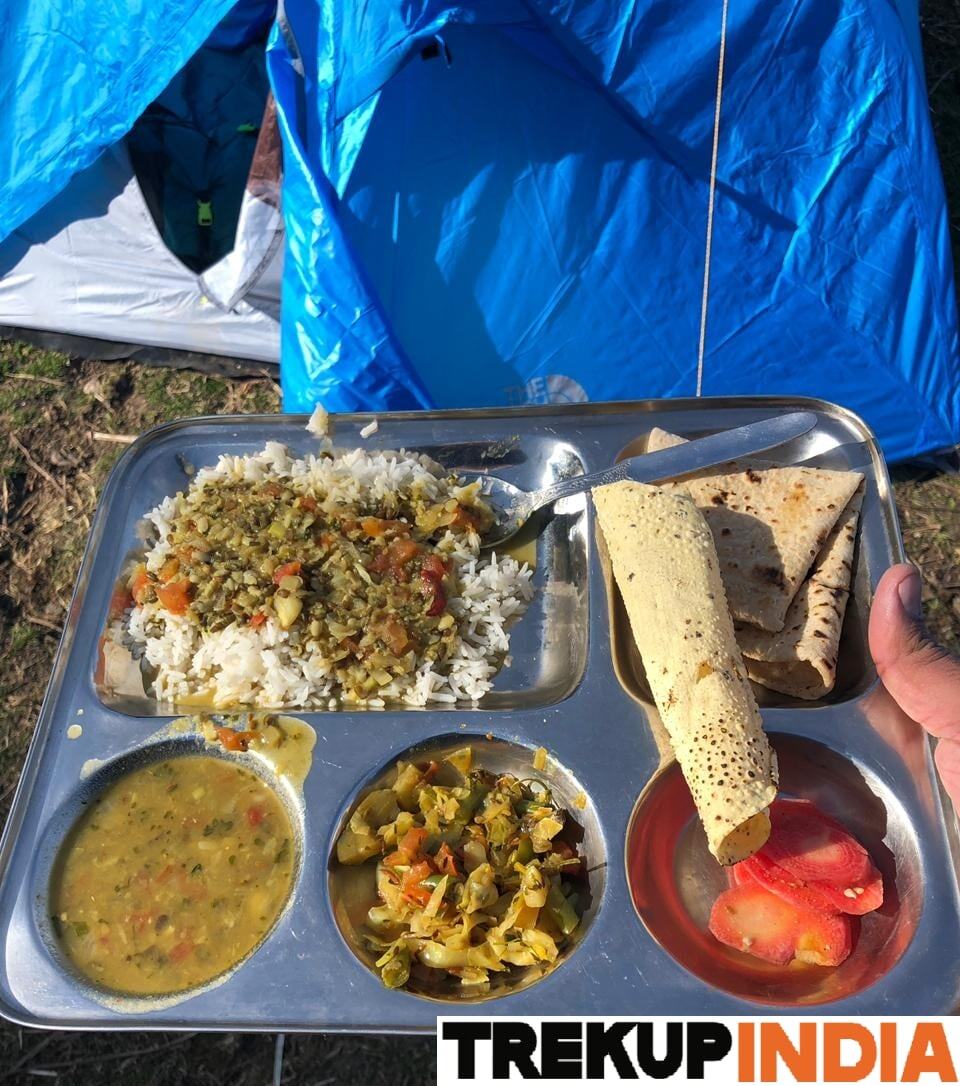
We provide only Indian vegetarian food, and your meal will mainly consist of Indian bread, vegetables, lentils, rice, and a delicious dessert. During your trek, we will serve three meals a day, including breakfast, lunch, and dinner. You will also be served tea, snacks, and lip-smacking soup in the evening before dinner. If it is a long day of trekking, you will be given a packed snack.
After extensive research on the trekkers’ nutritional requirements, we prepare the menu. Before putting all the meals together, we also consider the altitude and the weather.
The meal we serve during the trek is perfectly balanced with calories, carbohydrates, vitamins, protein, fibre, and minerals. You need to know that all our cooks have great expertise in cooking and have undergone thorough training. So, get ready to enjoy delectable and lip-smacking dishes during your trek. You will be served with lemon tea in the tent to start your day with a refreshed feeling. Before leaving the campsite for trekking, you will be given a hot finger-licking breakfast like upma, Aallu Prantha, Besan Chilla, Poha, Daliya, Corn flakes, and Maggie, along with tea or coffee.
If your trek is longer, we also offer some fresh local fruits such as apples and healthy drinks like Frootie or Maaza. In the afternoon, you will be served a simple & healthy lunch, while at around 04:00 pm, you will be given tea and a light evening breakfast. After you reach your campsite at night, you will be served a hot and delightful dinner.
After reading this, you must have understood the food we provided on the trek; you don’t need to worry about food. Many trekkers repeatedly trek with us because of the food we provide. Thus, we will give you unforgettable experiences.

Trekking with us for the Annapurna Circuit Trek with Tilicho Lake is entirely safe because we have a team of trek leaders qualified in Wilderness first-aid and complete information about the high-altitude glitches. During the trek, we carry a full first-aid kit that contains all the essential medicines. Before trekking with us, you must ensure that you are medically fit for the trek; for us, your medical fitness is more important than anything else.
Right from our establishment, we at Trekup India have been continuously introducing new safety practices into Indian trekking to ensure the safety of voyagers. Trekup India introduced microspikes and made emergency bottled oxygen mandatory for all treks. Our trek leaders take your daily Pulse oximeter reading. We at Trekup India introduced the radio walkie-talkie as a safety communication device.
How can we ensure that your trek is safe with us?
We have noticed that most trek-organizing organizations do not follow these systems, but with time, they are following us; several competing companies are adopting these practices and organizing great, safe treks.
We ensure complete technical safety in the mountain. Our company has a vast team of more than 100 guides and trek leaders who serve on Himalayan treks. One of the best things about our team is that all the members are trained professionally by the Nehru Institute of Mountaineering, Indian Mountaineering Foundation Delhi, and Hanifle Center Outdoor Education Mussoorie.
Explore our New Safety Protocols
To ensure a perfect Trek, we have introduced some new safety checks to ensure excellent safety for our trekkers.
Our On-trek safety checks include:
- Daily oxygen saturation, along with pulse readings
- Stretchers team appointed on every trek
- Radios
- Trained mountain staff and complete safety
- Additional oxygen cylinders
- Special medical kit for high-altitude treks
- Microspikes on all types of snow treks
- Experienced Trek leaders, as well as safety
- Technical team on all snowy slopes
For Us, Your Safety Is the Top Priority
At Trekup India, you will find a team with local knowledge and fluency in English and Hindi. This helps ensure that you have a fantastic trek. Not only this, but we also pay attention to your health and safety because this is something we cannot ignore. All the team leaders involved in trekking have already undergone several professional courses in first aid, portable altitude chamber training, CPR, environmental awareness training, and advanced wilderness emergency medicine.
We also carry a complete first aid medical kit on every trek and trip we organize. Apart from the medical kit, we take a portable altitude chamber (if needed) and medical oxygen for all high-altitude treks. Our company has significant expertise in organizing all sorts of group adventure holidays for family groups, school and college groups, and friend groups. We have many travel options that suit different fitness levels and travelling styles.
Regardless of the group size, we value each and every member of our trekking groups. Our commitment to personal attention ensures that your needs and safety are always our top priority.
Who we are?
Trekup India has been a stalwart in the Adventure Tourism industry for 30 years. Since our inception, we have been dedicated to providing top-notch treks, voyages, trekking programs, and high-altitude expeditions. Our extensive experience is a testament to our commitment to your adventure and safety.
We organize treks in Uttarakhand, Kashmir, Sikkim, and Himachal while being part of the trekking community; we feature more than 75 documented Himalayan treks. In addition to other outdoor activities, our company also organizes trips for schools, colleges, and families.
Therefore, we maintain the quality of services offered to our valuable customers.
Must Read These Information Of Annapurna Circuit Trek with Tilicho Lake
What are the Highlights of Annapurna Circuit Trek with Tilicho Lake?
- Trek up to the Tilicho Lake for an amazing trek up one of the world’s tallest glacial lakes and experience its turquoise water.
- Thorong La Pass (5,416 meters).
- Incredible views of Annapurna I, II, III, and IV, as well as Gangapurna, Dhaulagiri, and Tilicho Peak, can be enjoyed from here.
- Discover diverse landscapes spanning lush valleys to the barren trans-Himalayan deserts.
- Explore ancient monasteries and experience the vibrant Gurung and Manangi cultures.
- Explore Muktinath and unwind in its hot springs.
- Kali Gandaki Gorge is the deepest canyon in the world.
Frequently Asked Questions About Annapurna Circuit Trek with Tilicho Lake
How to Reach Annapurna Circuit Trek with Tilicho Lake?
The Start Point for the Annapurna Circuit is Besisahar; the end point will be Jomsom/ Pokhara.
By Road: By Jeep or bus from Kathmandu to Besisahar will take approximately eight to ten hours.
Pokhara to Kathmandu by road takes 6-8 hours, or you can take the 30-minute flight.
By Air (return): From Jomsom in Nepal to Pokhara takes only 20 minutes via flight.
What is the Best Time to visit Annapurna Circuit Trek with Tilicho Lake?
The Start Point for the Annapurna Circuit is Besisahar; the end point will be Jomsom/ Pokhara.
By Road: By Jeep or bus from Kathmandu to Besisahar will take approximately eight to ten hours.
Pokhara to Kathmandu by road takes 6-8 hours, or you can take the 30-minute flight.
By Air (return): From Jomsom in Nepal to Pokhara takes only 20 minutes via flight.


