Halu Chilume Gange Trek
Halu Chilume Gange Trek
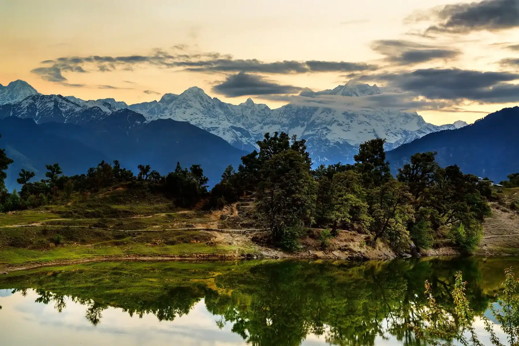
The Halu Chilume Gange Trek is an exciting hiking route situated in Doddaballapur, a mere 60 kilometers away from Bangalore. A verdant tapestry envelops the path, the fragrance of lemongrass mingling with the earthy scent of the post-monsoon season. At the same time, the vibrant greenery transforms into a warm golden hue during the winter and summer months. From the open areas that provide wide views of the countryside and neighboring settlements, visitors the Makalidurga Hill, another popular hill trek in Doddaballapur. Residents often visit the trail because there is a small temple constructed from rocks with a carved idol on a rock.
The temple is thought to possess the power to grant wishes, attracting visitors from surrounding areas, particularly women, who seek to have their desires fulfilled through prayer. Every Monday, a unique ceremony takes place at this location, noting that the temple’s priest travels from the nearby village of Ujjani on a daily basis, which is approximately 3.5 kilometers away from the trek’s starting point. The trail appeals to your sense of adventure with its expansive and uncharted terrain, offering an ideal escape for those seeking a thrilling hike on a weekend.
Best Time for Halu Chilume Gange Trek
The Halu Chilume Gange trek offers a unique experience throughout the year, with lush vegetation providing shade during the summer months and protection from the elements during the monsoon season. While it’s recommended to carry a poncho or raincoat and a rain cover for your backpack during the monsoons, the trail’s boulder sections can be particularly slippery, so caution is advised when navigating these areas.
Highlights of Halu Chilume Gange Trek
The hill is enveloped by dense foliage, with overgrown shrubs and trees creating the feeling of hiking through a forest. This unique experience sets this trek apart from others near Bangalore. The presence of bells attached to rocks in clusters around the place of worship adds to the mystery of the area. This distinctive feature is a highlight not commonly found on other treks in the region. Similar to the Makalidurga trek, Gundamagere Lake can be seen from Halu Chilume Gange, and the viewpoint at the summit offers a panoramic view of Makalidurga Hill.
Halu Chilume Gange Trek Detailed Trail Information
Downhill Journey
The descent to Thaaniparai is usually less challenging than the climb, with some significant exceptions, such as Kona Thalai Vasal and Sangili Parai. While the threat of mishaps is lower, exercise care is still essential, especially when navigating rocky locations that might increase the likelihood of ankle twists if appropriate care isn’t taken.
The Halu Chilume Gange Trek commences on an unpaved path until you arrive at the base. From there, the route to the Gange temple is clearly marked and easy to follow. However, identifying the correct trail from the base can be challenging, as several paths ascend the hill, but not all of them lead to the temple. It’s important to note that the main trail to the temple may not be immediately apparent, and it may require some exploration to find the correct route. (According to the documentation team, they had to explore the trail three times before discovering the main path that leads to the temple.)
A challenging part of the trek comes after the temple, where you must navigate through dense jungle and climb over rocks to reach the summit. The Halu Chilume Gange trail offers opportunities for extended exploration up to the peak. It is advised to bring essential gear for this journey.
From Mallasandra Road, follow the dirt path to your left for about 2 kilometers. Keep an eye out for an electricity pole with a small board that reads “Way To Halu Chilume Gangamma Temple” in Kannada, as the trail can be easily missed. The path meanders through picturesque farmland and grasslands, where you’ll see coconut trees, paddy fields, and grape vines. Continue on the trail until you reach a hill on your left. Turn left at the junction and follow the trail through more farmland. Eventually, you’ll come across a small stream flowing between rocks, which is more prominent during monsoons. Cross the rocks carefully to avoid slipping or spraining your ankle. Follow the trail until you reach the base of the hill. If the trail becomes too muddy, look for alternative routes that cut through nearby farms while keeping the hill in view.
An alternative path includes scaling a mud mound to access a farm and follow the path to the starting point. After some exploration and navigating through different trails, you have arrived at the starting point of the journey near the foothills, with a clear path leading to the temple visible. Follow the well-defined trail from the starting point. The initial climb is moderately steep and becomes steeper as you near the temple.
The path offers a sense of journeying through a wooded area. The scenery becomes exceptionally beautiful from this spot. You will come across a variety of plants, insects, and various creatures. Be sure to stay vigilant. With luck, you may even catch sight of some snakes. In approximately 20 minutes, you will come across an abandoned stone shelter on your right. In ancient times, worshippers engaged in rituals at the temple that lasted for several days. They utilized this location to rest overnight. Near the temple, you will also find iron grater blades secured to the rocks. The worshippers prepare a feast to fulfill their desires and offer it to Halu Chilume Gange, the deity revered by the locals. Proceed for about 100 meters to arrive at Halu Chilume Gange temple. It is a distinctive temple featuring bells hanging from a rock and a stone idol at the rock’s base. From this juncture, the previously clear trail begins to diminish.
As you proceed along the trail, you’ll encounter several boulders with markers that guide your way. However, the path soon becomes obscured by dense foliage, and you’ll need to push through the thick vegetation to continue. Don’t forget to pause and take in the breathtaking views of the surrounding area as you make your way to the View Point. Once you reach the clearing, you’ll be rewarded with a stunning panorama. Since there isn’t a clear path beyond this Point, it’s best to enjoy the views and savor the experience rather than attempting to explore further. The trek offers plenty of excitement and beauty up to View Point, making it a satisfying journey.
Take a moment to appreciate your surroundings and soak up the ambiance. Close your eyes and reflect on the journey that brought you to this Point. Listen to the silence and the sounds of nature, and allow yourself to unwind. Before beginning your descent, take a moment to relax your muscles and recharge your energy. As you make your way back down, be mindful of the tricky sections and take your time. Avoid taking any unnecessary risks and move slowly and steadily to ensure your safety.
How to Reach For Halu Chilume Gange Trek
To get to Halu Chilume Gange from Bangalore, you can use your vehicle and follow these directions:
1. First, open Google Maps on your device and enter “Halu Chilume Gange, Doddaballapur” as your destination.
2. Click on the “Get Directions” button to see the recommended route.
3. You can choose the mode of transportation you prefer, such as driving, and Google Maps will provide you with step-by-step directions to reach Halu Chilume Gange.
Alternatively, you can copy and paste the following link into your browser to open the directions in Google Maps:
https://www.google.com/maps/dir/Bangalore,+Halu+Chilume+Gange,+Doddaballapur
This link will take you directly to the directions page for the route from Bangalore to Halu Chilume Gange.
Directions to Halu Chilume Gange without Google Maps
- From the National Highway 44, turn left towards Yelahanka New Town and proceed along State Highway 9 towards Doddaballapur.
- In approximately 21 miles, turn left at the Gundamagere Cross junction. You’ll notice an Indian Oil Petrol Pump located on the right-hand side of the road. This is your final opportunity to refuel before embarking on the trek, so be sure to fill up your tank if you’re running low.
- In approximately 2.8 miles, make a slight right turn to remain on the current road, which will lead you toward Green Valley Resort. Continue for an additional 4 miles.
- Turn left at the intersection with Hosahalli Bus Stand on your right.
- Proceed directly for 3 kilometers until you see a dirt path on your left off Mallasandra Road.
To get to Halu Chilume Gange using public transportation
- Start from Majestic Bus Station and take a bus to Doddaballapur Bus Station. Then, transfer to a private bus going to Goravanahalli or a shared auto bound for the village of Hosahalli. Alight at Hosahalli and continue on foot for 3 kilometers along Mallasandra Road.
- To reach Doddaballapur and return, you can avail of BMTC buses that operate every 15 minutes from Majestic Bus Station in Bangalore. The buses that ply this route include 285M, 285MA, 285MC, 285MF, 285MG, 285MK, 285MP, Volvo-285M, and JPV-285M.
- Buses traveling from Doddaballapur to Bangalore are also subject to the same rules and regulations.
Dates For Upcoming Treks
Want To Trek Like Pro?
Basically, watch these videos if you want to trek the same way professional trekkers do and make your skills better. These videos contain useful tips and techniques to further improve your trekking skills itself. These videos actually help both new and experienced trekkers improve their trekking skills. These videos definitely provide useful tips that make your trek better. We are seeing that these videos by Trekup India experts will only help you make your trekking skills better.


Know Everything About Acute Mountain Sickness
Acute Mountain Sickness occurs when people trek to high altitudes above 8,000 feet. This condition itself develops further due to reduced oxygen levels at such heights. Basically, as you go higher up, the air pressure and oxygen levels decrease, which causes the same problem. Acute Mountain Sickness surely causes headache, nausea, vomiting, and dizziness in affected persons. Moreover, peoples also experience difficulty in sleeping during this condition. To avoid mountain sickness, you should actually trek up slowly to higher altitudes. To learn further about this condition itself, watch the videos by Trekup India.
